At The Midnight Hour, Severe Threat is Winding Down
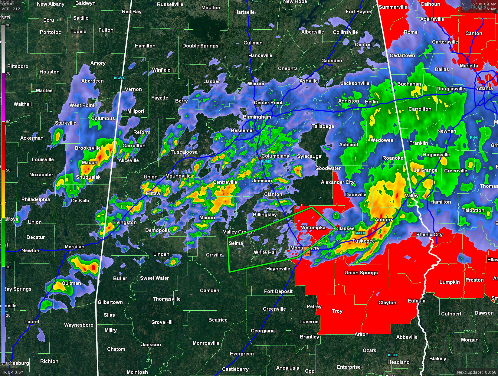
Counties remaining in Tornado Watch are displayed in red.
A Tornado Watch is currently in effect for Tallapoosa, Chambers, Elmore, Lee, Montgomery, Macon, Bullock, Russell, Pike, and Barbour counties until 4 AM CDT.
A Flash Flood Warning continues for Autauga, Dallas, Elmore, Lowndes, and Montgomery counties until 1:45 AM CDT.
The severe weather threat has ended for areas north of a line from Carrollton in Pickens County, Tuscaloosa, Columbiana in Shelby County, Ashland in Clay County, and Wedowee in Randolph County.
Most of the heavier rain activity has made its way south of the I-59 corridor in east Alabama, and along and south of the I-20 corridor in west Alabama. The heaviest storm in the state is affecting west and central Macon, western Lee, and extreme eastern Montgomery counties.
More showers and thunderstorms will push into Pickens, Sumter, Greene, and Choctaw counties within the hour. These storms are well below severe limits and are not expected to become severe. They will mostly be noise makers from the thunder.
Category: Alabama's Weather, Severe Weather
About the Author (Author Profile)
Bill Murray is the President of The Weather Factory. He is the site's official weather historian and a weekend forecaster. He also anchors the site's severe weather coverage. Bill Murray is the proud holder of National Weather Association Digital Seal #0001 @wxhistorianSubscribe
If you enjoyed this article, subscribe to receive more just like it.


