An Encore Performance
Storms are making an encore appearance tonight across Central Alabama ahead of an approaching cold front.
There is just enough instability left in the atmosphere to fuel the storms. They are being enhanced by a low level southwesterly jet that has formed over Alabama. We also find ourselves under an increasing upper level jet that is encroaching from the west.
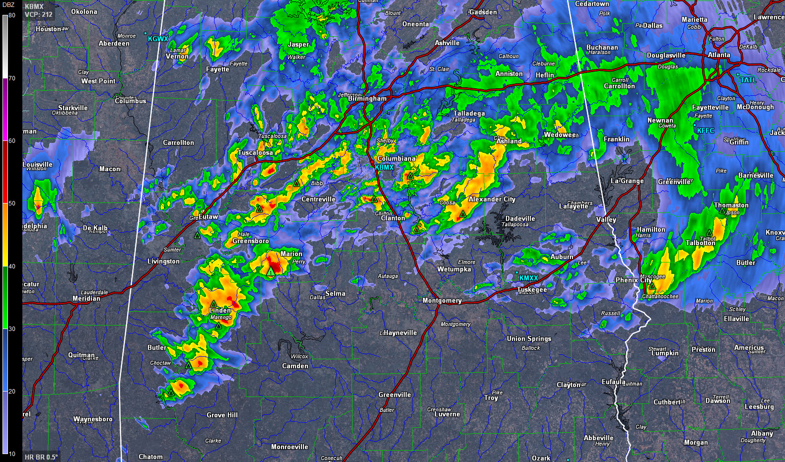
The storms are not severe, and are not expected to become severe, but they are causing lots of lightning and thunder from Greene County up through Tuscaloosa, Jefferson, Shelby, Talladega and Coosa Counties.
Stronger storms are over Sumter, Marengo and Hale Counties. There could be some small hail with these storms, especially near Uniontown.
They are moving northeast in the faster flow, at forward speeds of over 50 mph.
A general weakening trend has been noted in the past ten minutes and they should continue to go downhill. Our aging rockers will fall slowly asleep after their frenetic encore plays out.
The tornado watch continues for Barbour, Bullock, Macon, Pike and Russell Counties till 4:00 AM. All other counties have expired or been canceled.
A flash flood warning continues for parts of Lowndes, Elmore, Autauga, Montgomery and Dallas Counties. FLooding was reported on AL-143 southeast of Millbrook, with the southbound lanes closed.
Category: Alabama's Weather, Severe Weather
About the Author (Author Profile)
Bill Murray is the President of The Weather Factory. He is the site's official weather historian and a weekend forecaster. He also anchors the site's severe weather coverage. Bill Murray is the proud holder of National Weather Association Digital Seal #0001 @wxhistorianSubscribe
If you enjoyed this article, subscribe to receive more just like it.


