Latest Severe Weather Thoughts
As the first wave of storms have pushed through the state and have made their way into Georgia, we can now focus all of our attention to the second and third waves.
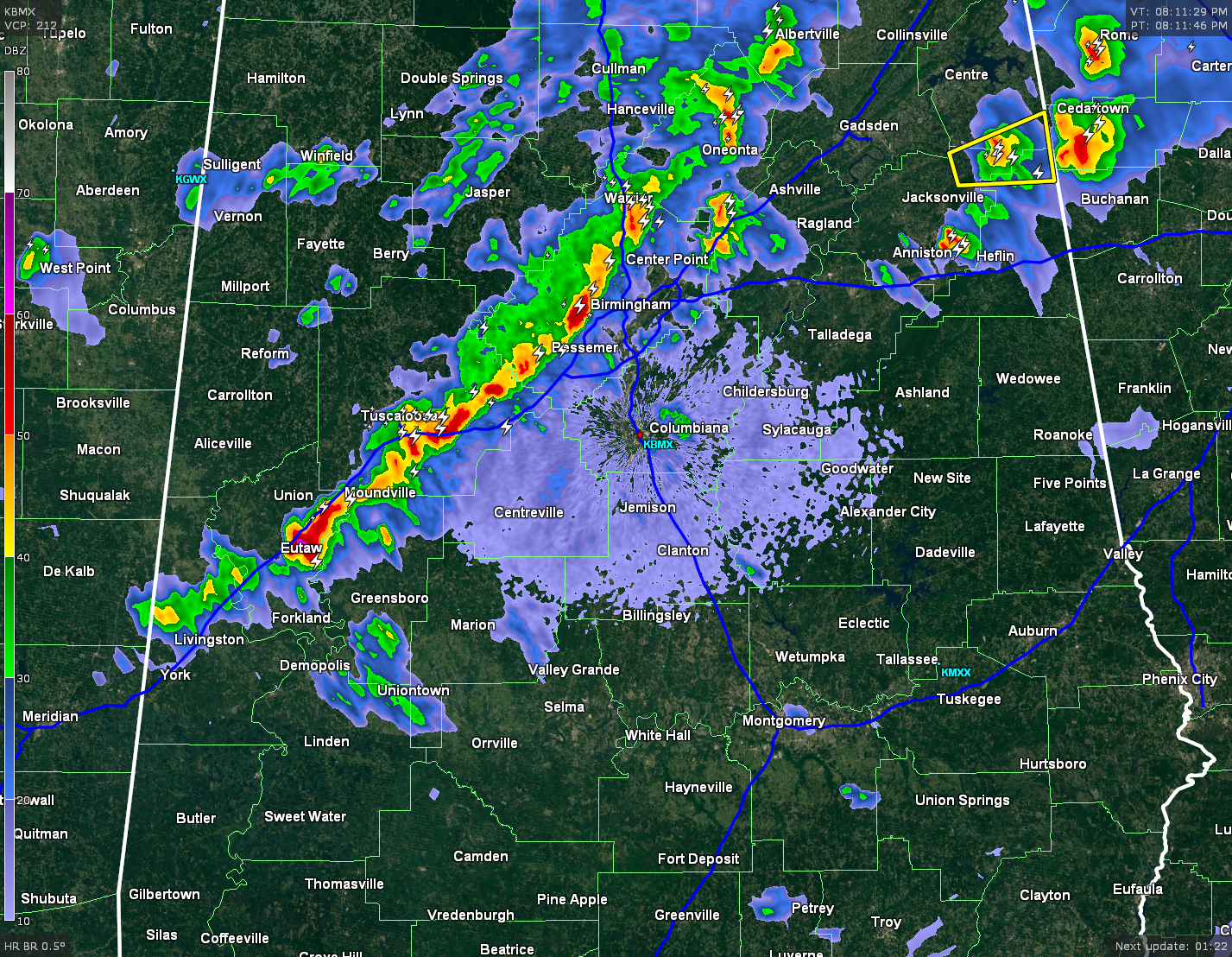
The line that is affecting the I-20 and I-59 corridors presently, is associated with a pre-frontal trough. There is a small severe threat with this feature as it pushes across the state into a more moist and unstable environment in central and eastern Alabama.
The broken line of storms, that is still located back in eastern Mississippi, is associated with the cold front. These storms will have an even lesser chance of becoming severe, as they move into an atmosphere that has been already worked over and is more stable. These storms are currently moving to the southeast and could actually fall apart before reaching the I-65 corridor.
The low-level jet really starts to slow down around 10 PM, as wind speeds at 5,000 feet slow to 30-40 MPH. Surface-based CAPE numbers fall rapidly to almost none as soon as this current line moves through. STP numbers are non-existent west of the line of storms, and less than one near the line.
The main threat from these storms will continue to be heavy rainfall, frequent lightning, strong gusty winds, and some hail. There may be a severe storm pop in this line before it exits the state, and I believe it will probably be near the southern end of it.
As I type this, a Significant Weather Advisory was just issued for the storm located just northeast of Greensboro. It is moving to the east at 50 MPH. Towns in the path of this storm include:
Brent, Marion, Greensboro, Moundville, Heiberger, Talladega National Forest, Greensboro Municipal Airport, Lawley, Sawyerville, Mertz, Ellerds, Wateroak, Sprott, Havana, Oakmulgee, Moundville Airport, Folsom, Morgan Springs, Phipps, and Harper Hill.
Category: Alabama's Weather, Severe Weather
About the Author (Author Profile)
Bill Murray is the President of The Weather Factory. He is the site's official weather historian and a weekend forecaster. He also anchors the site's severe weather coverage. Bill Murray is the proud holder of National Weather Association Digital Seal #0001 @wxhistorianSubscribe
If you enjoyed this article, subscribe to receive more just like it.


