Tuesday Midday Nowcast for Central Alabama
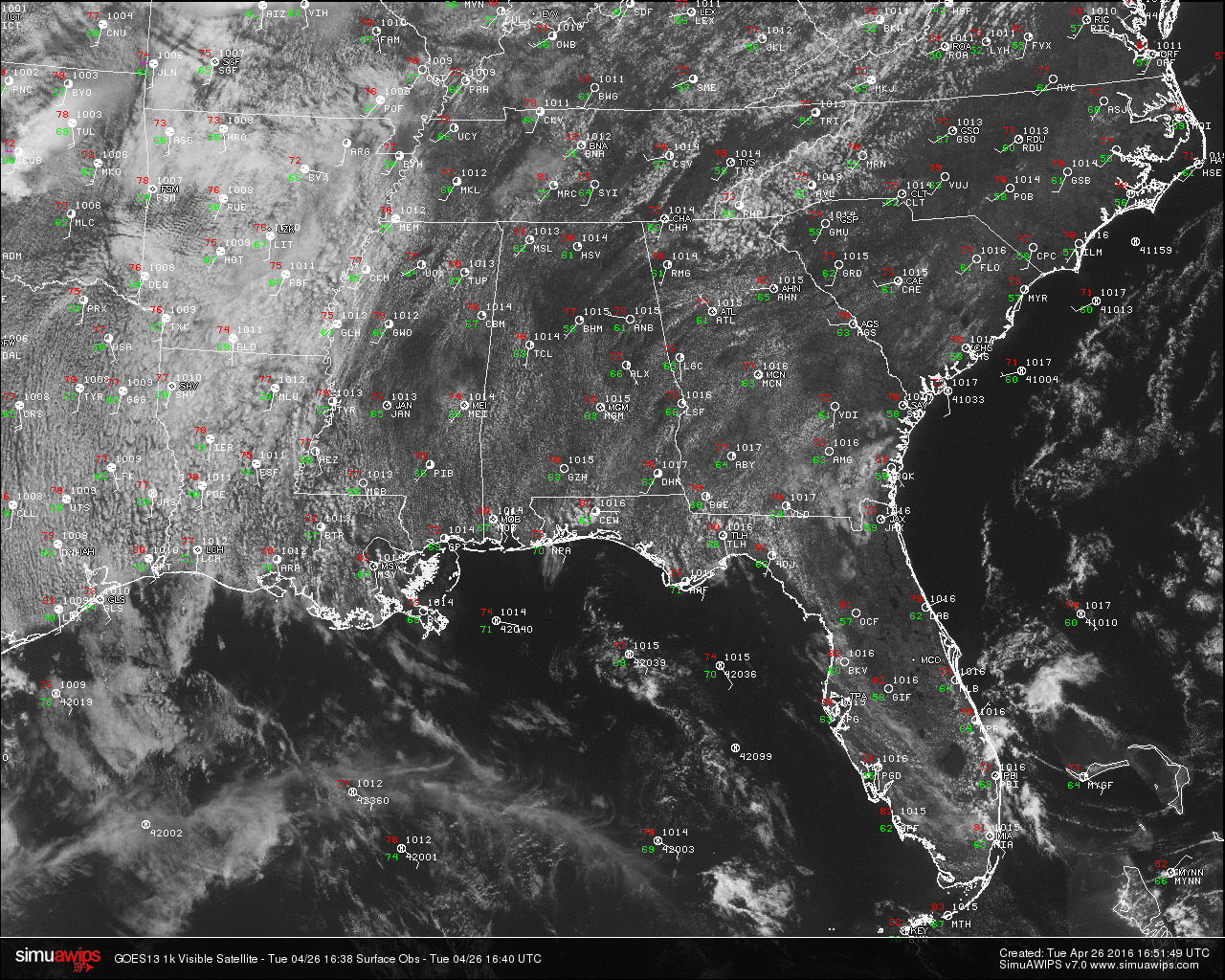
Mostly sunny to partly cloudy skies are across the state at this hour. This is allowing temperatures to rise nicely in the area, making it a really nice day outside. Here are temperature readings from across the state at this hour:
Birmingham 77
Tuscaloosa 76
Muscle Shoals 81
Huntsville 80
Anniston 76
Montgomery 81
Dothan 75
Mobile 80
TO THE WEST: A major severe weather situation develops from southern Nebraska down into Texas; a “moderate risk” is defined for this zone, where storms late today and tonight could produce large hail, damaging winds, and tornadoes. A few violent, long track tornadoes are not out of the question based on the projected combination of instability and shear.
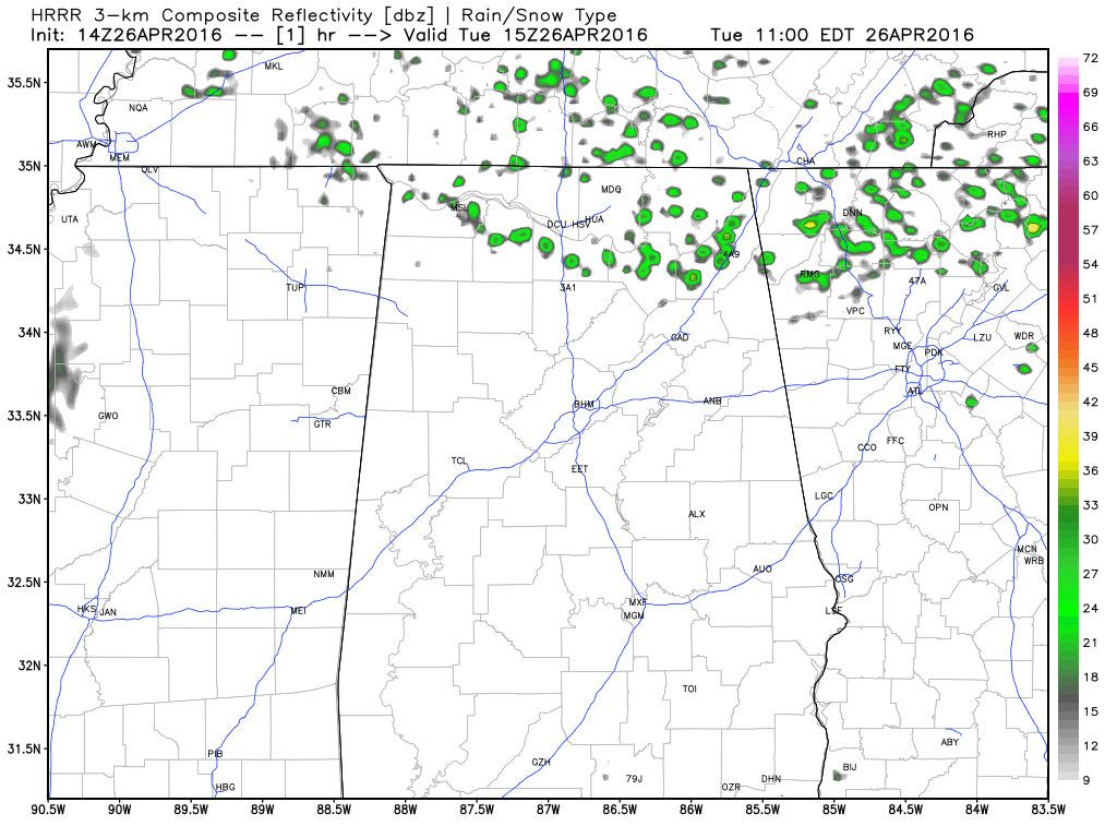
HRRR Model Run for later today and tonight.
REST OF TODAY: Moisture levels will start to increase today, and there could be a risk for a few showers this afternoon and into the evening hours. The latest HRRR model run has widely scattered showers developing over much north and western parts of the state. Otherwise, skies will remain partly sunny with highs reaching the mid 80s.
TONIGHT: A thunderstorm complex (MCS) will approach Alabama from the north, we will insert a risk of showers and storms for late tonight, mainly over the northern third of the state. These storms should be weakening and severe weather is not expected. The sky will be mostly fair for the southern two-thirds of the state tonight.
TOMORROW: A decent part of the day should remain dry and warm, with temperatures reaching the 80s by afternoon. A big weather system currently located over the central U.S. will get closer, and showers and thunderstorms will become likely late tomorrow night and into Thursday. The SPC has placed the northwest corner of the state in a “Slight” risk for severe weather, with a “marginal” risk along and west of a line from Scottsboro to Clanton to Jackson.
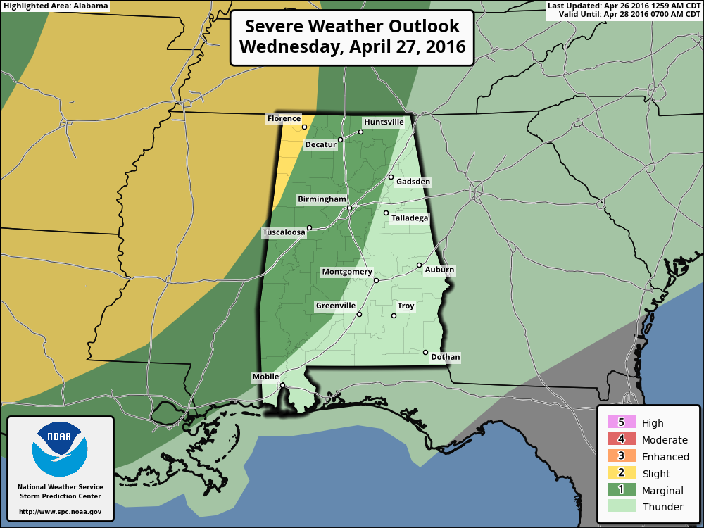
A weakening trend should be occurring as these storms move into the state, but some hail and gusty winds will be possible from tomorrow night into early Thursday. Main window for these storms will be a 12 hour period from midnight tomorrow night through noon on Thursday.
APRIL 27, 2011 ANNIVERSARY SPECIAL: Join us this evening at 6:00 on ABC 33/40 for a one hour special as we look back at the generational tornado outbreak of April 27, 2011 that killed 252 people in Alabama. You will see some very powerful stories.
WEATHER BRAINS: Don’t forget you can listen to our weekly 90 minute netcast anytime on the web, or on iTunes. This is the show all about weather featuring many familiar voices, including our meteorologists here at ABC 33/40. You can find it here. Scroll down for the show notes on the new episode we recorded last night.
Category: Alabama's Weather
About the Author (Author Profile)
Scott Martin is an operational meteorologist, professional graphic artist, musician, husband, and father. Not only is Scott a member of the National Weather Association, but he is also the Central Alabama Chapter of the NWA president. Scott is also the co-founder of Racecast Weather, which provides forecasts for many racing series across the USA. He also supplies forecasts for the BassMaster Elite Series events including the BassMaster Classic.Subscribe
If you enjoyed this article, subscribe to receive more just like it.


