Tuesday Midday Nowcast for North/Central Alabama
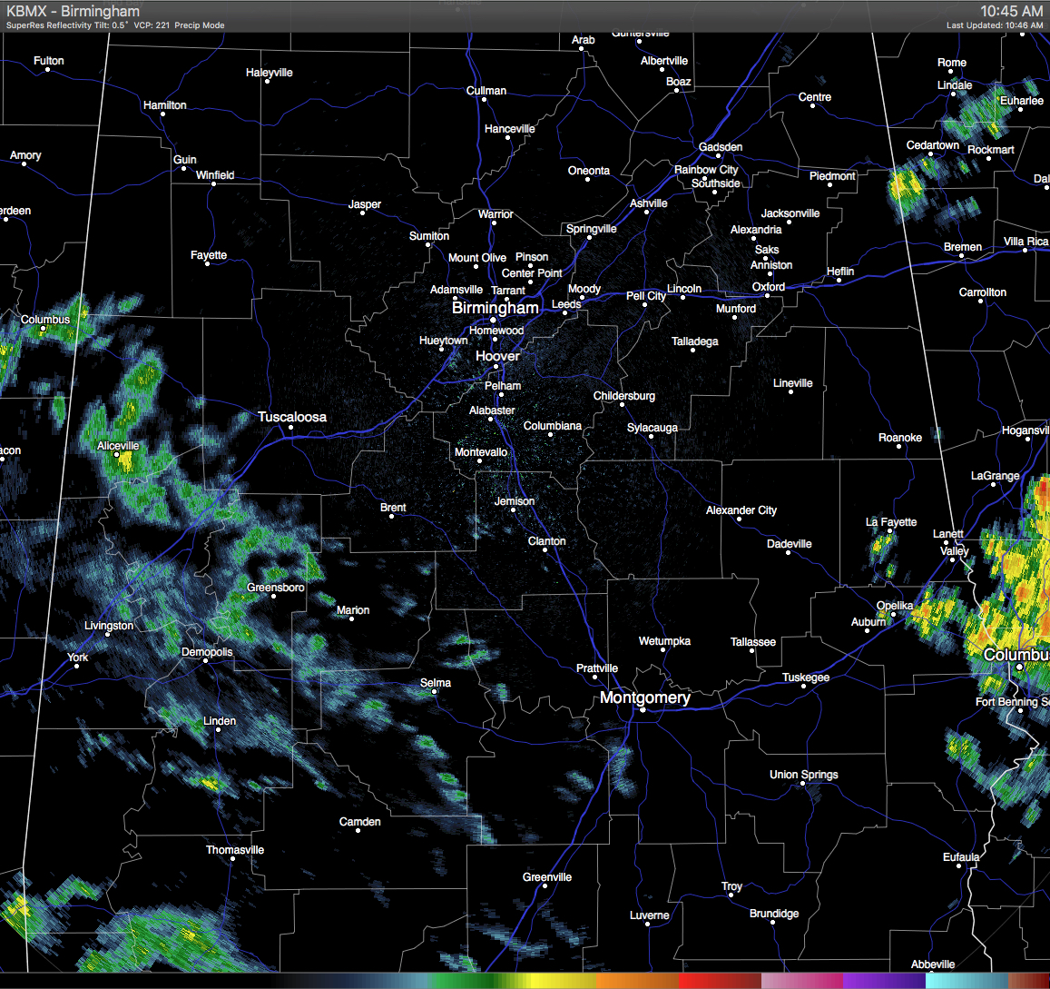
RADAR CHECK: Light rain is pushing across the west/central parts of the area, with more shower activity in the southwestern part of the state. There is a decent shower located in Northeastern Cleburne County. It is moving to the northeast, and will soon push over into Georgia. Radar across the Southeastern U.S. is quite active, especially in Central Georgia and up into the Carolinas and Virginia. Good news is that there are no severe warnings at this time in the southeast.
QUICK LOOK AT TEMPERATURES: Most communities are into the upper 60s to 70s, with the warm spot in the state being Dothan at 77. Here is a list of temperature readings from across the state at this time:
Birmingham 69
Tuscaloosa 75
Muscle Shoals 68
Huntsville 70
Anniston 68
Alexander City 73
Montgomery 76
Dothan 77
Mobile 75
REST OF TODAY: Skies will be mostly cloudy throughout the area, with a few breaks to allow some sunshine through. Afternoon highs will be in the low to mid 80s for much of North/Central Alabama. Looking at the latest HRRR run, showers will continue to push across the area during the afternoon. Showers will start to diminish during the late afternoon and early evening hours. Looks like most places in the area will be dry after 10PM tonight, especially areas along and north of the I-20 corridor.
CLIMATOLOGY FOR BIRMINGHAM: The normal high temperature for May 17th in Birmingham is 81, while the normal low is 58. The record high of 95 was reached in 1962. The record low of 43 was set back in 1956.
WEDNESDAY: Warm and muggy conditions tomorrow, with a mix of sun and clouds. A risk of isolated showers or thunderstorms, especially during the afternoon and evening hours. Afternoon highs will mostly be in the low 80s.
HEADED TO THE BEACH: Today will be mostly cloudy with a good chance of showers and storms on the coast from Panama City Beach over to Gulf Shores; then about 4 to 6 hours of sunshine tomorrow and Thursday with scattered storms. Then, after relatively wet day Friday, the weekend will trend drier with increasing amounts of sunshine and fewer showers. Highs will be around 80 degrees. See a very detailed beach forecast here.
THE REGIONS TRADITION: The Regions Tradition will be held this year at the Greystone Golf and Country Club Wednesday through the weekend… A shower is possible tomorrow and Thursday, but most of those two days should be dry. The best chance of showers and storms will come on Friday, but I still expect them to get some golf in, especially during the morning. Then, the weather trends drier for the weekend; only a small risk of a shower Saturday, followed by a sunny sky Sunday. Highs will generally be in the low 80s, although upper 70s are expected Friday due to clouds and showers. Find out more information and purchase your tickets here.
SEC BASEBALL TOURNAMENT: Coming up at the Hoover Met May 24-29… too early for a specific forecast, but in late May in Alabama average highs are in the 80s, and many days are pretty humid like summer. Find out more information and purchase your tickets here.
WEATHERBRAINS: Don’t forget you can listen to our weekly 90 minute netcast anytime on the web, or on iTunes. This is the show all about weather featuring many familiar voices, including our meteorologists here at ABC 33/40. You can find it here.
Category: Alabama's Weather
About the Author (Author Profile)
Scott Martin is an operational meteorologist, professional graphic artist, musician, husband, and father. Not only is Scott a member of the National Weather Association, but he is also the Central Alabama Chapter of the NWA president. Scott is also the co-founder of Racecast Weather, which provides forecasts for many racing series across the USA. He also supplies forecasts for the BassMaster Elite Series events including the BassMaster Classic.Subscribe
If you enjoyed this article, subscribe to receive more just like it.


