Significant Weather Advisory – Cherokee, Northeastern Cleburne, & Northeastern Calhoun Counties Until 3:15 PM CDT
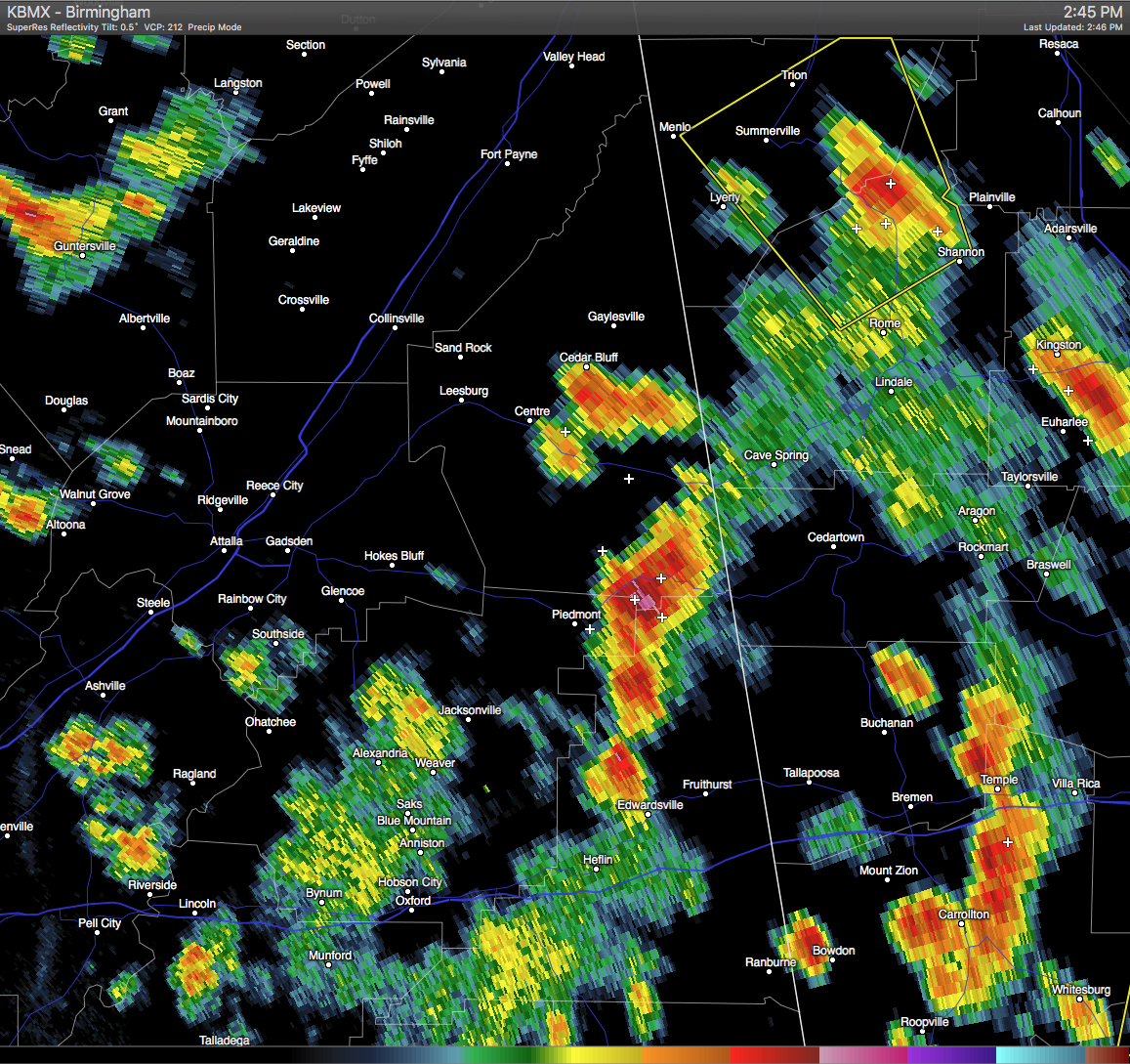
A Significant Weather Advisory has been issued for Cherokee, Northeastern Cleburne, & Northeastern Calhoun Counties until 3:15 PM CDT. A strong thunderstorm was located near Eastern Weiss Lake and Mars Hill, and was moving northeast at 15 MPH. Pea size hail and wind gusts in excess of 40 MPH will be possible with this storm. If you are in the path of this storm, seek safe shelter until it has passed. Locations in the path are listed below.
ALZ019>021-012015-
CALHOUN AL-CHEROKEE AL-CLEBURNE AL-
244 PM CDT WED JUN 1 2016
…SIGNIFICANT WEATHER ADVISORY FOR CHEROKEE…NORTHEASTERN CLEBURNE
AND NORTHEASTERN CALHOUN COUNTIES UNTIL 315 PM CDT…
AT 244 PM CDT…DOPPLER RADAR WAS TRACKING STRONG THUNDERSTORMS ALONG
A LINE EXTENDING FROM NEAR EASTERN WEISS LAKE TO 6 MILES WEST OF MARS
HILLS. MOVEMENT WAS NORTHEAST AT 15 MPH.
PEA SIZE HAIL AND WINDS IN EXCESS OF 40 MPH WILL BE POSSIBLE WITH
THESE STORMS.
LOCATIONS IMPACTED INCLUDE…
PIEDMONT…CENTRE…CEDAR BLUFF…FORNEY…
CENTRE MUNICIPAL AIRPORT…EDWARDSVILLE…GAYLESVILLE…MARS HILLS…
CORNWALL FURNACE PARK…PLEASANT GAP…EASTERN WEISS LAKE…MOSHAT…
WESTERN WEISS LAKE…SWEETWATER LAKE…BROOMTOWN…
HOWELLS CROSSROADS…OAK LEVEL…NEW MOON…
COLEMAN LAKE AND CAMPGROUND AND SPRING GARDEN.
Category: Alabama's Weather, Severe Weather
About the Author (Author Profile)
Scott Martin is an operational meteorologist, professional graphic artist, musician, husband, and father. Not only is Scott a member of the National Weather Association, but he is also the Central Alabama Chapter of the NWA president. Scott is also the co-founder of Racecast Weather, which provides forecasts for many racing series across the USA. He also supplies forecasts for the BassMaster Elite Series events including the BassMaster Classic.Subscribe
If you enjoyed this article, subscribe to receive more just like it.


