Significant Weather Advisory – Central Randolph County Until 3:45 PM CDT
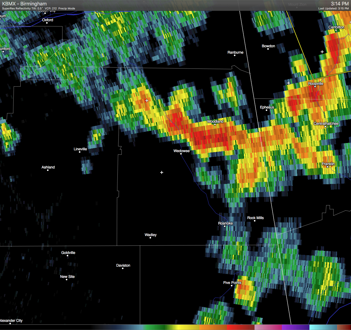
A Significant Weather Advisory has been issued for Central Randolph County until 3:45 PM CDT. A strong thunderstorm was located near Wedowee, and was moving east-northeast at 10 MPH. Pea size hail and wind gusts in excess of 40 MPH will be possible with this storm. If you are in the path of this storm, seek safe shelter until it has passed. Locations in the path are listed below.
ALZ029-012045-
RANDOLPH AL-
315 PM CDT WED JUN 1 2016
…SIGNIFICANT WEATHER ADVISORY FOR CENTRAL RANDOLPH COUNTY UNTIL 345
PM CDT…
AT 314 PM CDT…DOPPLER RADAR WAS TRACKING A STRONG THUNDERSTORM NEAR
WEDOWEE…MOVING EAST-NORTHEAST AT 10 MPH.
PEA SIZE HAIL AND WINDS IN EXCESS OF 40 MPH WILL BE POSSIBLE WITH
THIS STORM.
LOCATIONS IMPACTED INCLUDE…
WEDOWEE…WOODLAND…BIG SPRINGS…NAPOLEON AND TENNANT.
PRECAUTIONARY/PREPAREDNESS ACTIONS…
FREQUENT CLOUD TO GROUND LIGHTNING IS OCCURRING WITH THIS STORM.
LIGHTNING CAN STRIKE 10 MILES AWAY FROM A THUNDERSTORM. SEEK A SAFE
SHELTER INSIDE A BUILDING OR VEHICLE.
Category: Alabama's Weather, Severe Weather
About the Author (Author Profile)
Scott Martin is an operational meteorologist, professional graphic artist, musician, husband, and father. Not only is Scott a member of the National Weather Association, but he is also the Central Alabama Chapter of the NWA president. Scott is also the co-founder of Racecast Weather, which provides forecasts for many racing series across the USA. He also supplies forecasts for the BassMaster Elite Series events including the BassMaster Classic.Subscribe
If you enjoyed this article, subscribe to receive more just like it.


