

Storms Pushing Into North Alabama
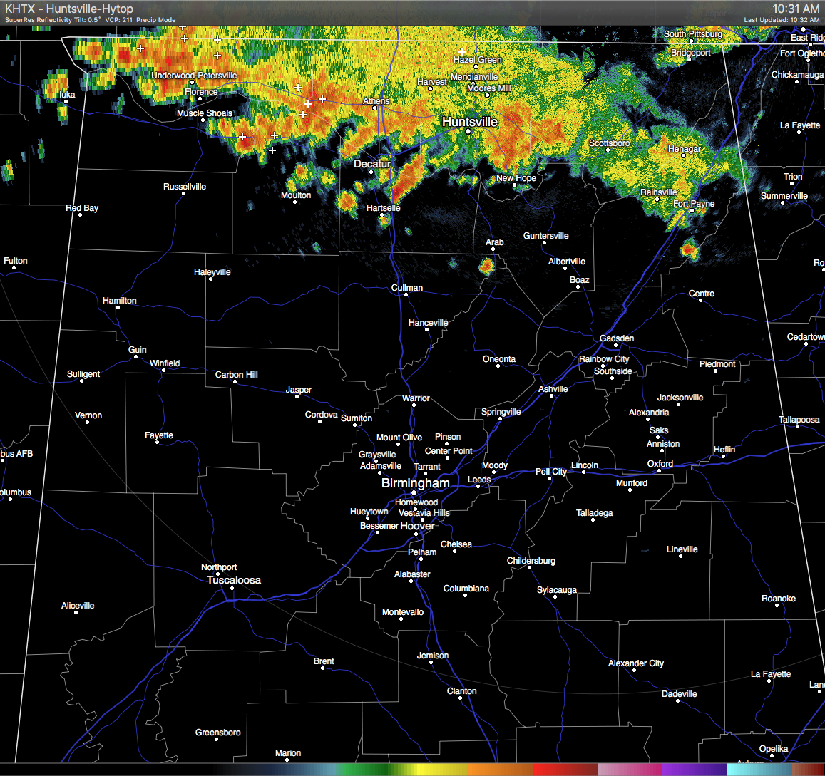
Even though skies are mostly clear for all of Central Alabama at this time, we have some thunderstorms making their way into the state from Tennessee. These storms are pushing mainly to the south-southeast around 25 MPH, with development spreading to the south. Some of these storms could pack a punch as CAPE values are already in the 2000-2500 J/kg, and rainfall could be heavy as precipitable water values are above 2 inches in some spots. Localized flash flooding could be a slight possibility if large amounts fall in a short amount of time. It is possible that a few of these could have wind gusts up to 40 MPH. No matter the strength of these, cloud-to-ground lightning will probably be an issue, so please stay indoors until this line passes.
Looking at times of arrival at this current point, it should make Cullman by 11:00-12:30, Gadsden and Rainbow City by 11:30-1:30, and to Birmingham by 1:00-3:00… all of these contingent if it holds together. There may be more showers and storms that form during the afternoon that you would typically expect, but these are a welcome surprise for those who need the water.
Category: Uncategorized
About the Author (Author Profile)
Scott Martin is an operational meteorologist, professional graphic artist, musician, husband, and father. Not only is Scott a member of the National Weather Association, but he is also the Central Alabama Chapter of the NWA president. Scott is also the co-founder of Racecast Weather, which provides forecasts for many racing series across the USA. He also supplies forecasts for the BassMaster Elite Series events including the BassMaster Classic.Subscribe
If you enjoyed this article, subscribe to receive more just like it.


