Midday Nowcast: Hot & Humid With Showers Already Popping Up
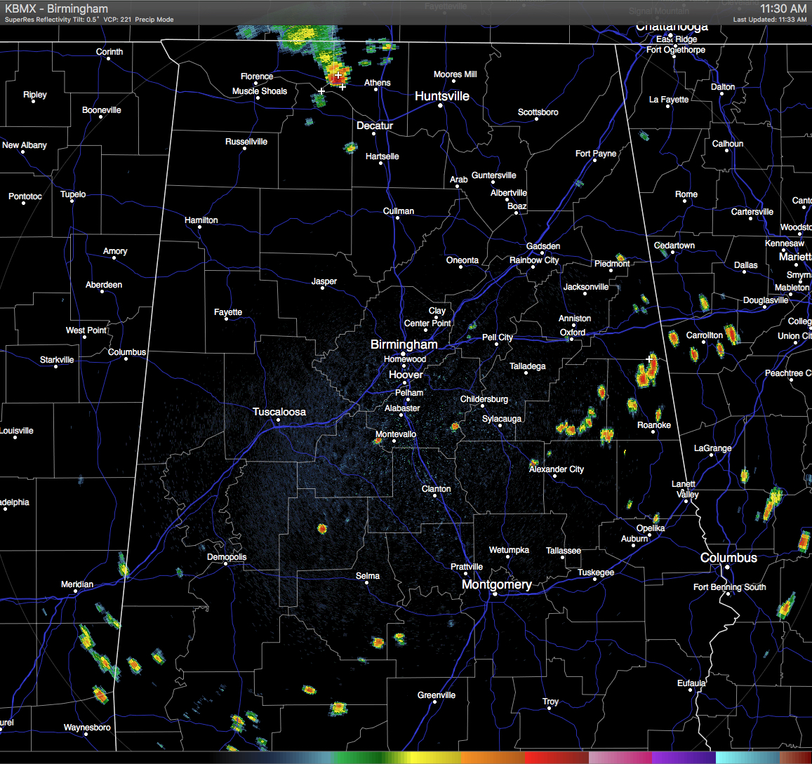
Across Central Alabama at this hour, skies are mostly clear and temperatures are already getting pretty warm out there. A few isolated showers have already popped up in the eastern part of the area in Southeastern Clay, extreme Southeastern Cleburne, and north and central Randolph counties. A few more have popped south of US-80 and west of I-65.
There are also storms pushing into extreme North Alabama in Lauderdale and Limestone Counties. These appear to be associated with a surface boundary pushing southward and more convective showers and thunderstorms could fire along and ahead of it in the next few hours. We’ll keep an eye on it.
HEAT ADVISORY: The main issue for Central Alabama today is that most of the area is under a Heat Advisory until 9PM tonight, with heat index values reaching 105 degrees and possibly higher, due to highs reaching the mid 90s and dew points in the low 70s.
TEMPERATURES AT THIS HOUR: With the skies being mostly clear out there for the most part, the temperatures are climbing. Here is a list of temperature observations from across the area:
Birmingham 91
Tuscaloosa 90
Gadsden 89
Anniston 91
Cullman 88
Hamilton 91
Clanton 90
Alexander City 89
Montgomery 91
WHAT TO EXPECT FOR TODAY: Skies will remain partly to mostly clear for the remainder of the day with a few scattered showers and thunderstorms possible mainly during the late morning to the early evening hours. Odds of any one spot getting rain today is one in three. Chance of showers and storms could increase if we have more convective formation along the boundary moving in from Tennessee that I mentioned earlier. Afternoon highs will be in the mid 90s for the most part, with a few upper 90s out there today. Once again, a Heat Advisory is in effect for much of the area until 9PM tonight. Please use common sense while outside today. Showers should be gone by 10PM tonight and lows will be in the 70s.
CODE YELLOW AIR QUALITY: The Air Quality Index for the Birmingham Metropolitan Area will be in the “Code Yellow” for particulate matter 2.5. Unusually sensitive people should consider limiting prolonged outdoor exertion.
TODAY’S CLIMATOLOGY FOR BIRMINGHAM: The normal high for August 4th is 91, while the normal low is 70. The record high for today was set back in 1947 at 103. The record low was set back in 1950 at 56.
THURSDAY’S OUTLOOK: Hot and humid once again tomorrow, with a good supply of sunshine. Afternoon highs will be in the mid to upper 90s. Models are suggesting that the air will be a little bit drier tomorrow, so the the risk for showers and storms will be a little lower, with odds at one in four for any one spot getting rain.
HEADED TO THE BEACH: The general idea is for about 6 to 8 hours of sunshine daily through the weekend from Panama City Beach over to Gulf Shores, and of course, an occasional passing thunderstorm is likely this time of the year. Highs will be in the upper 80s on the immediate coast, with mid 90s inland. The sea water temperature early this morning at the Dauphin Island Sea Lab is 87 degrees. See a very detailed Gulf Coast forecast here.
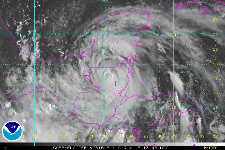
THE TROPICS: At 10AM this morning, Tropical Storm Earl was rapidly weakening over the high terrain of northern Guatemala about 115 miles west of Belize City. Maximum sustained winds have dropped to 50 MPH with higher gusts. Even though Earl is expected to weaken to a tropical depression by sometime tonight, up to 8 to 12 inches of rain could fall over portions of eastern Mexico, which could lead to life-threatening floods and landslides.
THE BLOG IS ON TWITTER: Be sure to follow the Alabama Wx Weather Blog on Twitter. Just click here to start following our feed.
WEATHERBRAINS: This week, the panel entertained Charlie Woodrum, who is the Warnings Coordination Meteorologist for the NWA Central Pacific Region. This is the show all about weather featuring many familiar voices, including our meteorologists at ABC 33/40. You can listen anytime on the web, or on iTunes. You can find it here.
ADVERTISE WITH US: Deliver your message to a highly engaged audience by advertising on the AlabamaWX.com website. The site enjoyed 10.2 MILLION pageviews in the past 12 months. Don’t miss out! We can customize a creative, flexible and affordable package that will suit your organization’s needs. Contact Bill Murray at (205) 687-0782.
Category: Uncategorized
About the Author (Author Profile)
Scott Martin is an operational meteorologist, professional graphic artist, musician, husband, and father. Not only is Scott a member of the National Weather Association, but he is also the Central Alabama Chapter of the NWA president. Scott is also the co-founder of Racecast Weather, which provides forecasts for many racing series across the USA. He also supplies forecasts for the BassMaster Elite Series events including the BassMaster Classic.Subscribe
If you enjoyed this article, subscribe to receive more just like it.


