

Warm, Wet, Unsettled
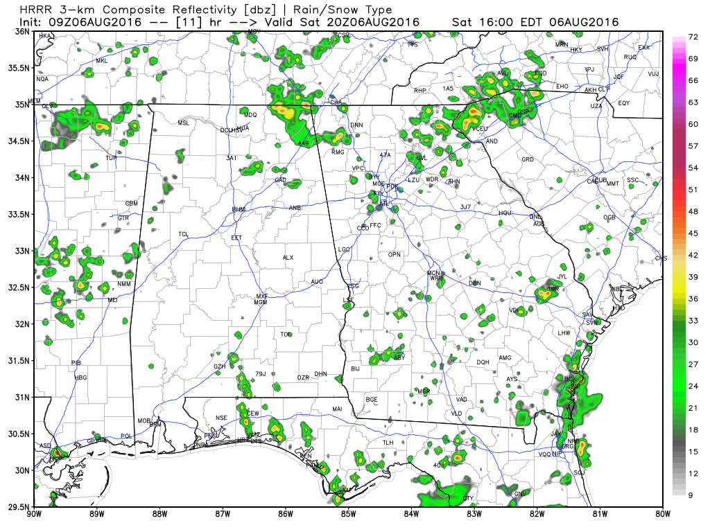
Alabama waking up to some clouds across the northern and southwestern sections of the state this morning. Temperatures fell back into the 70s overnight even after the highs yesterday reached the middle and upper 90s across Central Alabama. There is some potential for storms today, but even with a weak front in the neighborhood, it looks like we won’t see anything especially widespread. A heat advisory is again in effect from 9 am to 9 pm today as heat indices climb into the 105 to 108 range. The area affected is west of a line from Florence to Birmingham to Columbus, GA.
About 6 hours of sunshine today along the Gulf Coast today with 4 to 6 hours daily from Sunday through much of next week. There will be some passing thunderstorms today, and thunderstorms will become likely from Sunday through much of next week. Highs will be around 90 today and in the upper 80s the rest of the week. While there will be better than average rain chances this next week, but there will still be periods of sun. Rip currents could be an issue as well, so make sure you pay attention to the flags posted along the beaches. See a very detailed Gulf Coast forecast here.
SPC has no specific slight risk areas for the next several days, but there are a couple of areas of marginal. Today the marginal risk includes parts of Northwest Mississippi, Arkansas and East Oklahoma.
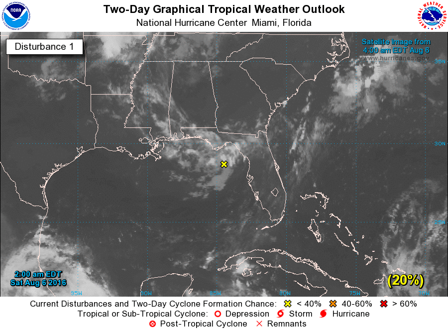
In the tropical Atlantic, Earl is raining out over southern Mexico and should dissipate later today. A weakness in the upper air pattern over the Northeast Gulf of Mexico will meander along the coast of the Florida Panhandle for the next week. NHC places a 30 percent chance of further development if it stays over the water. It will help lead to some unsettled weather for the Southeast over the week ahead.
Looking at the upper air pattern, Central Alabama will remain under an upper ridge for the week ahead. But there is a fly in that ointment. The fly is this upper weakness that appears this morning over the extreme Northeast Gulf of Mexico. The GFS maintains this weakness through next weekend as it meanders from the Northeast Gulf to the mouth of the Mississippi River. After today, this feature should help to keep shower and thunderstorm chances fairly high – in the 60 to 80 percent range – through the week. So this should mean more coverage of showers and storms with perhaps some influence on the drought conditions affecting the northern two-thirds of Alabama.
With the presence of more clouds and the greater coverage of showers, high temperatures should be held in the upper 80s. Some spots could hit 90 or 91 depending on how much sunshine they see before showers get started. Morning lows will not change much with values in the lower 70s.
Looking into voodoo country, the GFS is still presenting the idea of a fairly strong trough coming across the Central US around August 17th. This still looks potent enough to bring that first front along with a short spell of drier air to the Southeast US. But, as we’ve seen over the last week, the GFS brings the heat back after that with a sizable ridge around the 21st of August. But hey, a short spell of cooler, drier air is better than no spell of cooler, drier air!
I expect to have the next Weather Xtreme Video posted around 7 or so on Sunday morning. I’m heading up to Gadsden this morning to participate in the “Kids Town Alive.” After that I’ll be filling in for Meaghan on ABC 3340 News at 6 and 10 pm. Stay cool today and Godspeed.
-Brian-
Category: Alabama's Weather
About the Author (Author Profile)
Brian Peters is one of the television meteorologists at ABC3340 in Birmingham and a retired NWS Warning Coordination Meteorologist. He handles the weekend Weather Xtreme Videos and forecast discussion and is the Webmaster for the popular WeatherBrains podcast.Subscribe
If you enjoyed this article, subscribe to receive more just like it.


