Wet/Unsettled Weather To Continue
RADAR CHECK: As expected, it has been an active day for showers and thunderstorms across the great state of Alabama. Storms are moving slowly to the southwest, and due to the very high precipitable water values, we have seen some flooding in spots, including downtown Birmingham…
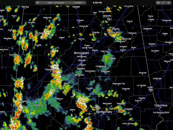
Showers and storms will slowly die down tonight across the state, but showers could linger into the late night hours.
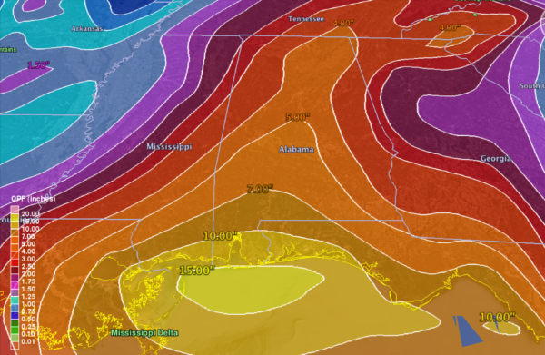
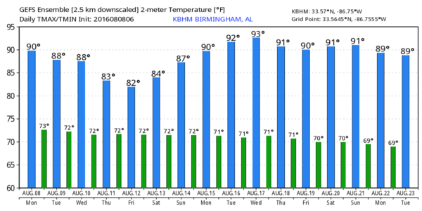
REST OF THE WEEK: An upper low now over Georgia will continue to meander across the Southeast U.S., and with broad low pressure at the surface we expect scattered to numerous showers and thunderstorms on a daily basis through Friday. The sky will feature more clouds than sun each day, and highs will be mostly in the 86-89 degree range. In fact, the GEFS ensemble is printing a high of only 82 in Birmingham for Friday due to clouds and showers. While rain distribution won’t be even, many Alabama communities will see beneficial amounts of rain this week…
THE ALABAMA WEEKEND: No real change; a blanket of very moist air will cover the state, and we will have a number of showers and storms over the weekend. Both days will feature a mix of sun and clouds away from the storms with highs in the 87-90 degree range.
NEXT WEEK: We expect a slow trend toward more “average” weather for mid-August; highs back in the low 90s, a bit more sunshine each day, and fewer showers and storms. But still, every afternoon and evening we will deal with the usual array of scattered thunderstorms. See the Weather Xtreme video for maps, graphics, and more details.
AT THE BEACH: Just a limited amount of sunshine each day (1-3 hours) through the weekend from Gulf Shores to Panama City Beach; showers and storms are likely each day through Friday with potential for heavy rain at times. Showers and storms should be fewer in number on the coast over the upcoming weekend. Highs generally in the mid to upper 80s… See a very detailed Gulf Coast forecast here.
TROPICS: Tropical storm formation is not expected across the Atlantic basin through the weekend.
WEATHER BRAINS: Don’t forget you can listen to our weekly 90 minute netcast anytime on the web, or on iTunes. This is the show all about weather featuring many familiar voices, including our meteorologists here at ABC 33/40. We will produce this week’s show tonight at 8:30 CT… you can watch it live here.
CONNECT: You can find me on all of the major social networks…
Facebook
Twitter
Google Plus
Instagram
Look for the next Weather Xtreme video here by 7:00 a.m. tomorrow…
Category: Alabama's Weather
About the Author (Author Profile)
James Spann is one of the most recognized and trusted television meteorologists in the industry. He holds the AMS CCM designation and television seals from the AMS and NWA. He is a past winner of the Broadcast Meteorologist of the Year from both professional organizations.Subscribe
If you enjoyed this article, subscribe to receive more just like it.


