Looking a Little Tropical
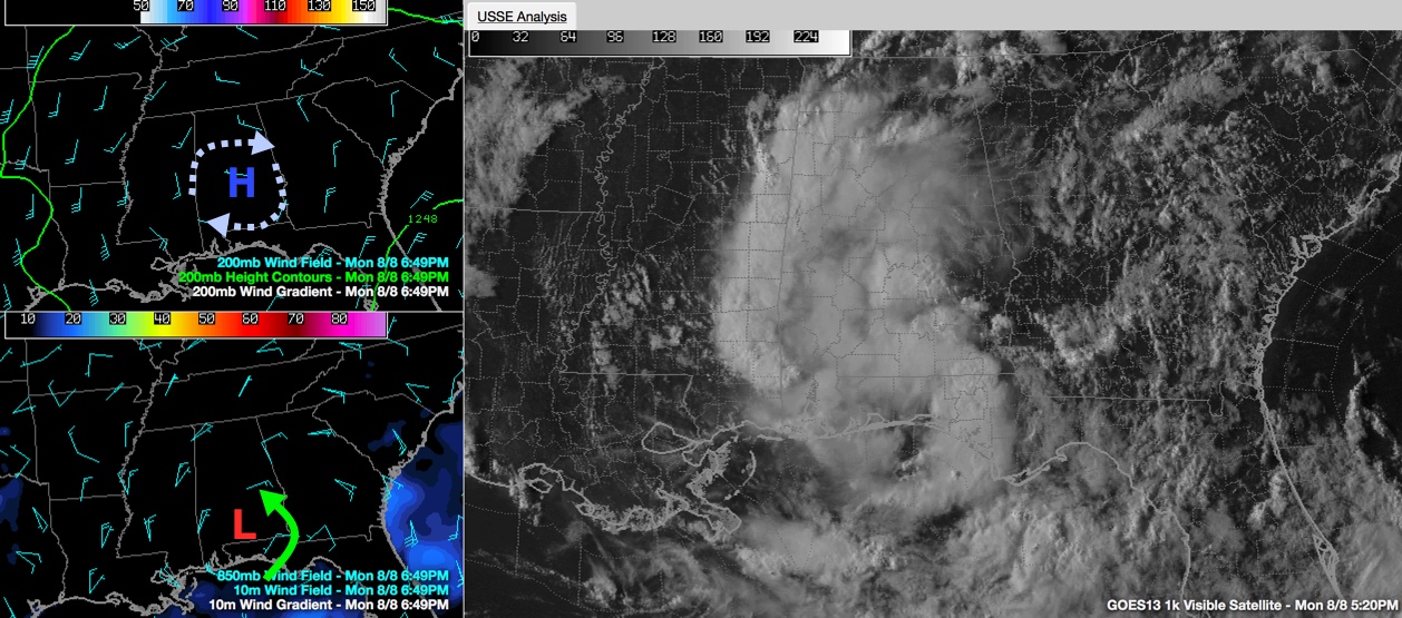
The weather system over the Deep South was once thought to have a chance to become a tropical depression or tropical storm.
That hasn’t happened, since the system is over land, and there isn’t any chance of that happening while it is inland.
But the combination of high pressure in the upper atmosphere and the lower level circulation over South Alabama has resulted in a late afternoon visible satellite picture that is a little reminiscent of a tropical cyclone, which good inflow from the Gulf of Mexico thanks to the low and good outflow aloft from the anticyclone.
If you use a little imagination, maybe you can see it too in the visible satellite image in the right panel.
Category: Alabama's Weather
About the Author (Author Profile)
Bill Murray is the President of The Weather Factory. He is the site's official weather historian and a weekend forecaster. He also anchors the site's severe weather coverage. Bill Murray is the proud holder of National Weather Association Digital Seal #0001 @wxhistorianSubscribe
If you enjoyed this article, subscribe to receive more just like it.


