Yes, It’s Going to Rain. But There is a Severe Weather Risk, Too.
Clouds have thickened over much of the northern two thirds of Alabama on this final November Sunday. Our next storm system, or answer to drought prayers, is taking shape to the west of us. The big upper trough is moving into the Four Corners region of the Southwest U.S. with a strengthening jet stream progressing into the Plains. A deepening surface low is along the Kansas/Nebraska border. Showers and storms are along the warm front over Nebraska and much of Iowa.
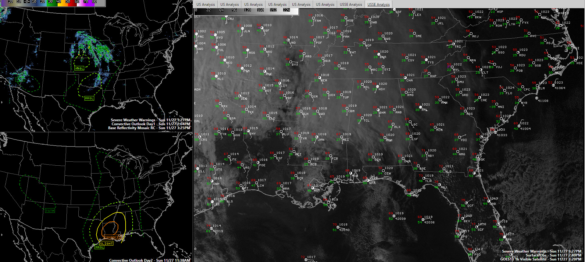
Storms will fire over the next few hours over Kansas, Oklahoma and North Texas. You can see the marginal severe weather risk areas posted by the SPC for today and tonight in the top left panel of the graphic. The main event will come tomorrow for us though as this system intensifies and pushes east.
By tomorrow morning, a powerful low level jet will develop northward out of the Gulf of Mexico right into the heart of Alabama. This will transport lots of moisture northward. Precipitable water values will be soaring through the morning and by tomorrow evening, they will be over 1.5 inches across Central Alabama, which is in the top ten percent of historical values. This is always a recipe for heavy rains.
You can see the Day Two severe weather outlook in the lower right hand panel of the graphic. This shows the area that will experience an enhanced risk of severe weather, including the risk of a couple of strong tornadoes over eastern Texas, much of Louisiana and western Mississippi. There is a marginal risk of severe weather through the overnight hours for areas west of I-65 here in Alabama. The main risk will be damaging winds, but we can’t rule out a couple of spin up tornadoes with all the shear that will be in place.
Winds will be breezy on Monday, averaging 15-25 mph out of the south. You will definitely notice the wind, and it will give a stormy feel to the day.
Rainfall amounts tomorrow night and early Tuesday should be between 0.75 and 1.5 inches as the line of showers and storms pushes slowly across the state. It should clear the I-59 Corridor by 6 a.m. and be out of East Alabama by late morning. There will e some sunshine Tuesday afternoon and temperatures will soar into the upper 70s, setting the stage for more severe weather Tuesday night into Wednesday as round two sets up.
Showers and thunderstorms will quickly break out again Tuesday night just to the west of I-59 from New Orleans into North Alabama. A very diffluent pattern aloft will enhance the environment for severe weather. Instability values will be running 500-1,000 joules/kg late Monday night and into early Wednesday morning as dewpoints surge into the middle 60s as far north as I-20. Shear values will be on the increase as well late Tuesday night and early Wednesday morning.
The result will be a more significant severe weather threat for Central Alabama during the overnight hours. That is a recipe for trouble with most of the population sleeping and unaware. It is important for you as Alabama Weather Ambassadors to alert your network to this threat for tomorrow night and way more importantly Tuesday night. Review weather plans and have a way to get warnings just in case.
We still appear to be on track to receive around 1-1.5 inches of rain from both systems this week. The WPC is calling for 3-4 inches of rain across our area, with 4-5 inches in spots. This will make a dent in the drought.
Category: Alabama's Weather
About the Author (Author Profile)
Bill Murray is the President of The Weather Factory. He is the site's official weather historian and a weekend forecaster. He also anchors the site's severe weather coverage. Bill Murray is the proud holder of National Weather Association Digital Seal #0001 @wxhistorianSubscribe
If you enjoyed this article, subscribe to receive more just like it.


