

Clouds Are Starting To Move In At Midday, Storms Arrive Later

NICE AT MIDDAY, BUT ROUND 2 OF SEVERE WEATHER ARRIVES TONIGHT
Across the northern half of Central Alabama at the noon hour, skies are mostly clear to sunny. While in the southern half of the area, skies are partly to mostly cloudy as the frontal boundary has stalled out over the southern part of the state. A few widely scattered showers are out there around the Auburn and Alexander City areas and a few down in the southeastern corner of the state.

Temperatures at this time across Central Alabama at noon range in the mid and upper 60s to the low 70s. The warm spot in the area is Troy at 73 degrees, while the cool spot is at Haleyville and Auburn at 66 degrees.
Across the southeastern United States, showers and thunderstorms can be found back to our west in northwestern Louisiana and back into eastern Texas. Showers and a few storms are also located along the cold front stretching from southwestern Georgia, through west-central parts of South Carolina, and up into central parts of North Carolina. No convective watches or warning are in effect across the southeast at this moment, but I’m pretty sure that will change later today.
BIRMINGHAM’S CLIMATOLOGY AND RECORDS
The normal high for November 29th is 60, while the normal low is 39. The record high for today was set back in 1991 at 76. The record low was set back in 1955 at 19.
FOR THE REST OF TODAY AND WEDNESDAY
For the rest of this afternoon, clouds will start to move in from the south as the stalled boundary heads back to the north as a warm front. Afternoon highs will be in the mid to upper 70s, with a few places topping out in at or just over 80 degrees. Some spots could be close to record highs today.

The guys at the SPC has much of the state in the “slight risk” for severe storms throughout the remainder of the day and into the morning on Wednesday, while the northwestern parts of the state are in the “enhanced risk” for severe storms.
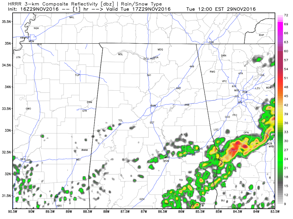
HRRR Radar Model Run valid from 11AM today to 4AM tomorrow morning.
Click image to animate.

HRRR Forecasted Dewpoints at 10PM

HRRR CAPE (Instability) Values at 10PM

HRRR Significant Tornado Parameter at 10PM
As the warm front moves north, it will bring with it much higher dewpoints, greater instability levels, and warm temperatures. Looking at the latest run of the HRRR (16z), a few isolated storms could develop along the front as it moves into the area, and those could pack a punch. CAPE values (instability) will be in the 900-1500 J/kg for much of Central Alabama at 4pm and rising afterword, shear values will be rising, and the Significant Tornado Parameter values will be approaching the 1-2 range and rising. Strong winds, large hail, and an isolated tornado or two could be possible with these storms. The higher risk for significant tornadoes could be in the northwestern parts of the area and on up into the northwest corner of the state.
A short wave impulse will then bring a squall line into the western parts of the area sometime in the 11PM to 1AM time frame. As it does, the individual storms out ahead of the line will merge with the squall line. As this happens and as it progresses across the state, the main threats will then be from damaging winds and a brief tornado or two. The wave should move completely out of the area by the noon hours on Wednesday. Skies will start to clear out pretty rapidly throughout the remainder of the day, and highs will be in the mid to upper 60s for most, with a few 70s in the southeastern parts of the area.
CALL TO ACTION
We haven’t had active weather in a long time. Be sure you can hear severe weather watches and warnings if they are needed. And, since this active weather will come during the late night/pre-dawn hours, be sure you have a NOAA Weather Radio properly programmed with a battery backup. A good warning app needs to be on your phone as well, like WeatherRadio by WDT. And, you might want to review your “action plan” with the family just in case. Your safest place is a small room on the lowest floor, near the center of the house, and away from windows. You don’t have to be underground. And, if you live in a mobile home you have to get out, and into a safe place in a site built structure.
ON THIS DAY IN 1896
The mercury plunged to 51 degrees below zero at Havre, MT. It marked the culmination of a two week long cold wave caused by a stagnate high pressure area similar to those over Siberia during the winter. During the month of November temperatures across Montana and the Dakotas averaged 15 to 25 degrees below normal.
NUMBER OF THE DAY: 1.17
The amount of rain that fell at the Birmingham International Airport during last night’s storms was 1.17 inches. This is the first time that Birmingham received over 1 inch of rain in a 24 hour period since July 30th.
FOLLOW THE BLOG ON TWITTER
Be sure to follow the Alabama Wx Weather Blog on Twitter. Just click here to start following our feed.
WEATHERBRAINS
This is the weekly netcast that’s all about weather featuring many familiar voices, including our meteorologists at ABC 33/40. This week, the “Brains” chatted with Mike Wolfinbarger, from RadarScope. You can listen anytime on the web, or on iTunes. You can find it here.
Forecaster: Scott Martin (Twitter: @scottmartinwx)
Category: Alabama's Weather, Severe Weather
About the Author (Author Profile)
Scott Martin is an operational meteorologist, professional graphic artist, musician, husband, and father. Not only is Scott a member of the National Weather Association, but he is also the Central Alabama Chapter of the NWA president. Scott is also the co-founder of Racecast Weather, which provides forecasts for many racing series across the USA. He also supplies forecasts for the BassMaster Elite Series events including the BassMaster Classic.Subscribe
If you enjoyed this article, subscribe to receive more just like it.


