

Tornado Watch Issued for Parts of Louisiana, Arkansas and Mississippi
Here is an update on the Alabama weather situation at 2:30 p.m.
A tornado watch has been issued for extreme southeastern Arkansas, northeastern Louisiana and much of Central Mississippi. It will be in effect until 9 p.m. CST.
Storms are firing this afternoon over SE Arkansas and NE Louisiana. One storm approaching Port Gibson in western Mississippi has had a severe thunderstorm warning on it for nearly an hour. Hail to 1.75 inches is possible with this storm as well as a tornado. It will pass near or just west of Jackson within a couple of hours.
A tornado warning was just issued on the storm southwest of Tullos, LA for radar indicated rotation.
Storms are expected to grow in intensity and organization through the afternoon hours in the tornado watch area and the eventual supercell storms will produce tornadoes, including some significant ones. The SPC says there is a moderate risk of EF2 and greater tornadoes in this watch area.
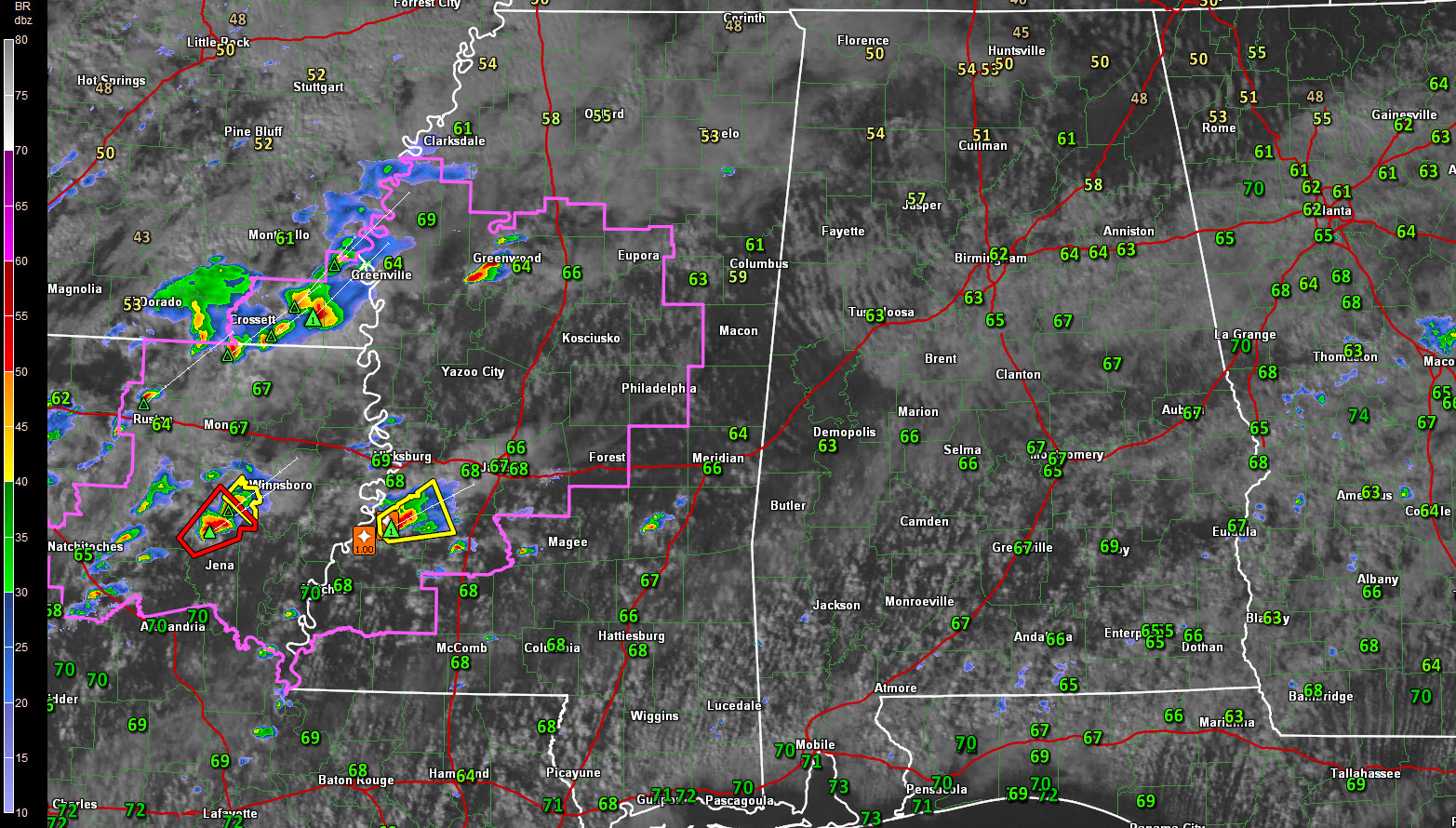
A warm front is currently lifting northward across the I-20 corridor. The graphic shows the dewpoints, which makes it easy to find the warm front. You see the warnings and the watch in purple. There hasn’t been any convective development with very little CAPE and a good supply on convective inhibition. South of US-82, the instabilities are increasing and this airmass will be moving northward behind the warm front.
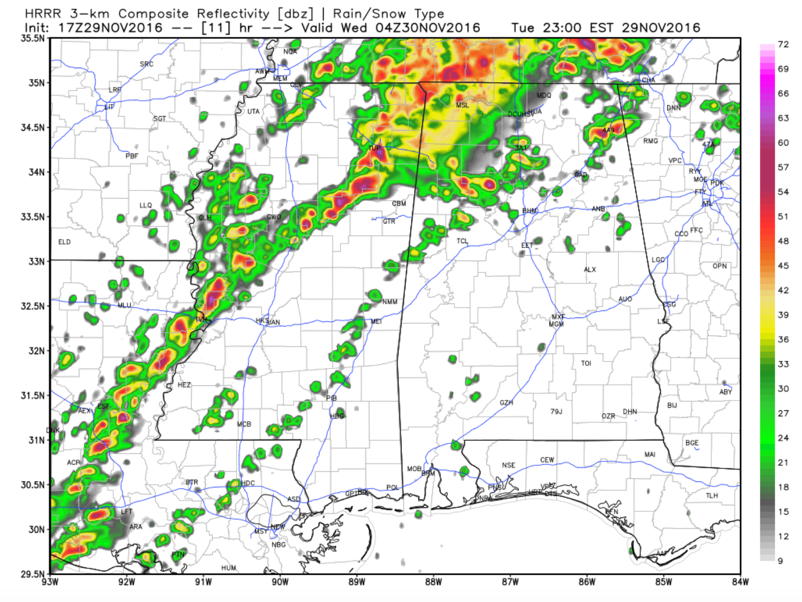
HRRR model simulated radar for 10 p.m. CST tonight.
According to the HRRR model, showers and storms will start developing by 6-7 p.m. CST over Central Alabama but I doubt they will be severe until they lift into the Tennessee Valley around 9 p.m.
Meanwhile, the storms over western Mississippi should explode around 6 p.m. These storms will lift into Northwest Alabama by 9 p.m. Storms will be intensifying from Jasper to Cullman in the 9-10 p.m. time frame, expanding into a line from Pickens County through Walker, Fayette, Morgan and Jackson Counties. These storms look cellular in nature and have a high probability of being severe until the main line enters West Alabama and overtakes them around 1-2 a.m.
This big line of storms will push southeastward through the early morning hours, reaching the I-59 Corridor around 4-5 a.m. The main threat by then should be damaging winds and embedded tornadoes.
But all modes of severe weather will be possible tonight across Alabama, including damaging winds, large hail and tornadoes.
The SPC just upgraded the severe weather outlook to include a moderate risk over North Central Mississippi. Areas from Pickens through Lamar, Fayette, Marion, Franklin, Colbert and Lauderdale Counties are in the enhanced risk area. The slight risk extends as far east as Anniston, Montgomery and Mobile.
Review your severe weather safety plans and make sure that you have a reliable way of receiving weather warnings through the overnight hours tonight. Scott Martin and I will have the latest information throughout the night.
Category: Severe Weather
About the Author (Author Profile)
Bill Murray is the President of The Weather Factory. He is the site's official weather historian and a weekend forecaster. He also anchors the site's severe weather coverage. Bill Murray is the proud holder of National Weather Association Digital Seal #0001 @wxhistorianSubscribe
If you enjoyed this article, subscribe to receive more just like it.


