

Here Is An Update On The Alabama Weather Situation at 4:30 PM CST
The good news is that conditions across the state of Alabama is quiet as of now, but it is pretty active back into Mississippi and Louisiana.
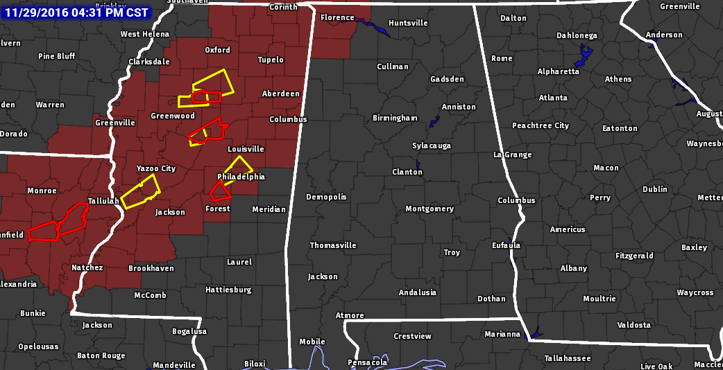
The Tornado Watch that was issued earlier for parts of Southeastern Arkansas, Northeastern Louisiana, and much of Central Mississippi continues in effect until 9:00 PM tonight, but a new Tornado Watch has been issued for almost all of Northern Mississippi, parts of Southwestern Tennessee, and extreme Northwest Alabama until 11:00 PM tonight.
A few tornadoes will be likely with a couple intense tornadoes possible, along with possible scattered damaging wind gusts up to 70 MPH, and isolated large hail up to 1.5 inches will be possible.

Multiple tornado warnings have been issued across Mississippi and Louisiana since the last update. One is currently in effect for Scott County, Mississipi, for a confirmed tornado located near Forkfille and near Harperville, and moving to the northeast at 40 MPH. Places in the path of this storm are Walnut Grove, Standing Pine, Sebastopol, Pearl River, and Philadelphia.
Several severe thunderstorm warnings are in effect for multiple locations in Mississippi at this moment, and all of the individual storms are pushing to the northeast. These supercells will spread northeastward through the evening and will likely affect the northwest corner of Alabama around the 6-7PM time frame. As the environment becomes more favorable for rotating updrafts, a couple strong tornadoes will be possible, as well as large hail and damaging wind gusts through early tonight.
Category: Alabama's Weather, Severe Weather
About the Author (Author Profile)
Scott Martin is an operational meteorologist, professional graphic artist, musician, husband, and father. Not only is Scott a member of the National Weather Association, but he is also the Central Alabama Chapter of the NWA president. Scott is also the co-founder of Racecast Weather, which provides forecasts for many racing series across the USA. He also supplies forecasts for the BassMaster Elite Series events including the BassMaster Classic.Subscribe
If you enjoyed this article, subscribe to receive more just like it.


