Rainy and Chilly Weekend Weather
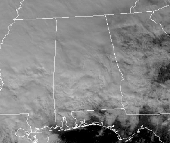
Clouds are here, and if you look at the radar, it looks like the rain is falling across much of the state, but that is not the case.
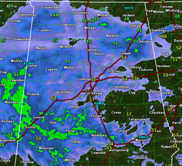
The lower levels of the atmosphere are very dry, and the rain is evaporating before it reaches the surface, but as the rain falls through these dry layers, it is moistening those layers of the atmosphere. That means, if you haven’t seen the rain yet, you are going it before the long. The rain is reaching the surface mainly west of Interstate 65 but will continue to spread east today. It is a rather cool Saturday afternoon with temperatures in the 50s.
Looking towards the west, there is a lot of rain heading our way, and we are in store for a rainy night across North/Central Alabama. It is going to be a nice steady soaking rain through out the night; temperatures will hold in the mid 40s all night, and certainly no threat of severe weather, just some great sleeping weather.
You’ll certainly want the umbrellas and rain gear close to hand heading out the door tomorrow. Our Sunday will feature clouds, periods of rain, and chilly temperatures. Thankfully no severe weather is expected, and I doubt we will hear much thunder in North/Central Alabama, but there could be some across southern portions of the state. Thunder or not, it will be a rather wet day. Temperatures tomorrow afternoon will hold in the lower 50s much of the day, and some spots may sit in the 40s all day.
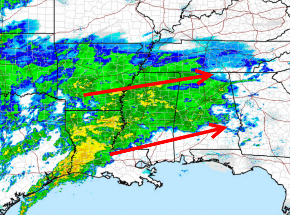
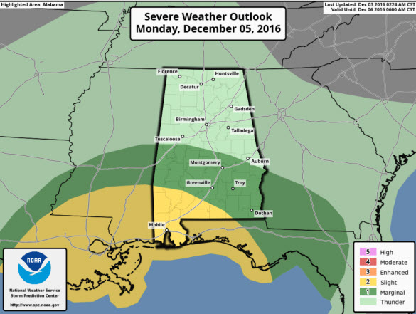
MORE RAIN AND STORMS: A low pressure system will develop off the Texas coast and will lift north across the southeastern United States, bringing with it another round of strong storms late Monday and into early Tuesday. Now the latest GFS has the low lifting right across Central Alabama, which is not ideal for severe weather for us, but that track of the low, will allow a warm sector to surge north across the state and that will allow for those storms across the state, with the best chance for severe storms over South Alabama. Currently, on their day three convective outlook, the SPC has locations along and south of the U.S. 82 corridor from Tuscaloosa, to Montgomery, to Phenix City in a “marginal risk for severe storms, while the standard “slight risk” covers locations across Southwest Alabama such as Mobile, Gulf Shores, Monroeville, and Evergreen.
The exact northward extent of the severe weather will depend on how far north the warm, moist air mass makes it inland. The best chance of storms will come Monday night and early Tuesday. We will start to dry out by the time Tuesday evening arrives as the low lifts northeast of the area, and behind it, dry air will be pulled south. Highs will be in the upper 50s and lower 60s across the area on Monday, and back up into the lower to mid 60s for Tuesday.
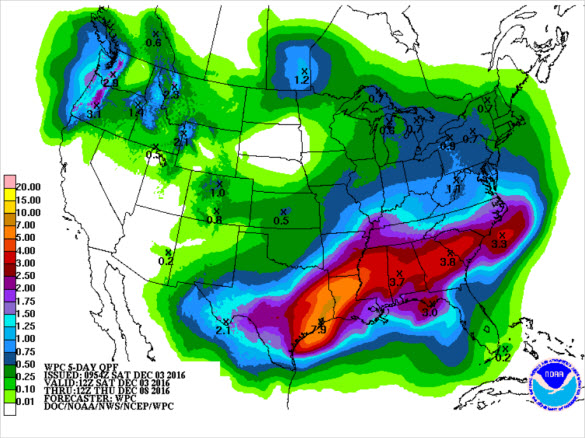
For much of Alabama, by the time the rain is finished Tuesday evening, rainfall totals for much of the area will range from 2-4 inches, with a few spots perhaps getting more. We need every drop, but unfortunately some flash flooding could be possible with all of the heavy rainfall, but overall, these soaking rains will not end the drought, but should hopefully put a nice dent in the conditions.
Category: Alabama's Weather
About the Author (Author Profile)
Macon, Georgia Television Chief Meteorologist, Birmingham native, and long time Contributor on AlabamaWX. Stormchaser. I did not choose Weather, it chose Me. College Football Fanatic. @Ryan_StinnetSubscribe
If you enjoyed this article, subscribe to receive more just like it.


