

A Brief Update On Tonight’s Weather
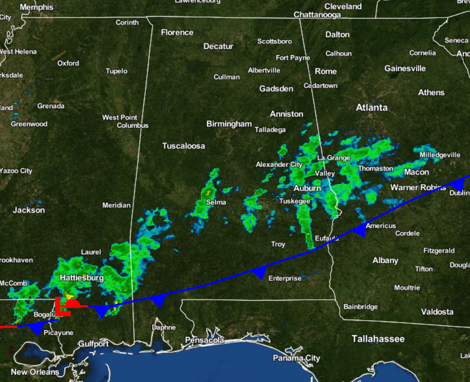
The cold front has reached the southern parts of the state, currently located from just north of Mobile, over to just south of Eufaula. The short wave trough that was associated with this system has now moved out of the area. This has allowed some clearing to occur north of the front, especially north of the I-20 corridor. This clearing has allowed temperatures to drop down into the 40s in spots, and as this continues for the next several hours, the temperatures will equal the dewpoint values and fog will form. Use extra caution if you will be out driving later tonight, as visibilities will drop down below 1 mile, even down to 1/2 mile in some spots.
Closer to the front, clouds and rain will continue during the remainder of the evening and overnight hours, as another short wave trough moving from Texas will cause a wave to develop along the front. This will bring an increase to the chance of rain later tonight for areas along and south of the I-20 corridor, and bring a return of cloud cover to the rest of the area. When the clouds move in, temperatures will stop decreasing and bring a little relief to the lowest fog visibility areas.
Category: Alabama's Weather
About the Author (Author Profile)
Scott Martin is an operational meteorologist, professional graphic artist, musician, husband, and father. Not only is Scott a member of the National Weather Association, but he is also the Central Alabama Chapter of the NWA president. Scott is also the co-founder of Racecast Weather, which provides forecasts for many racing series across the USA. He also supplies forecasts for the BassMaster Elite Series events including the BassMaster Classic.Subscribe
If you enjoyed this article, subscribe to receive more just like it.


