Skies Are Clearing At Midday, But Colder Temperatures Are On The Way
Sun Is Out At Midday For The Northern Half Of The Area
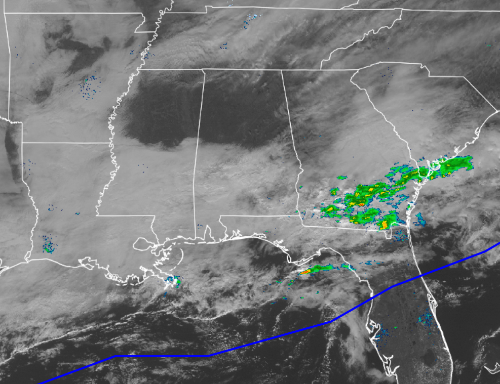
As you can see in the latest visible satellite image for the southeastern United States, skies are clearing in the northern parts of Central Alabama, with clouds still blanketing the southern half. All shower activity has now completely pushed out of the state and is currently located in Southern Georgia and the extreme southern tip of South Carolina. The cold front has now pushed its way south of the state and over the Gulf of Mexico.
Skies should continue to clear out for the remainder of the afternoon and evening hours, with afternoon highs in the 50s for most of the area, with a few 60s in the southern locations in the area. Overnight lows tonight will be colder, as 20s and 30s will be felt throughout the area.
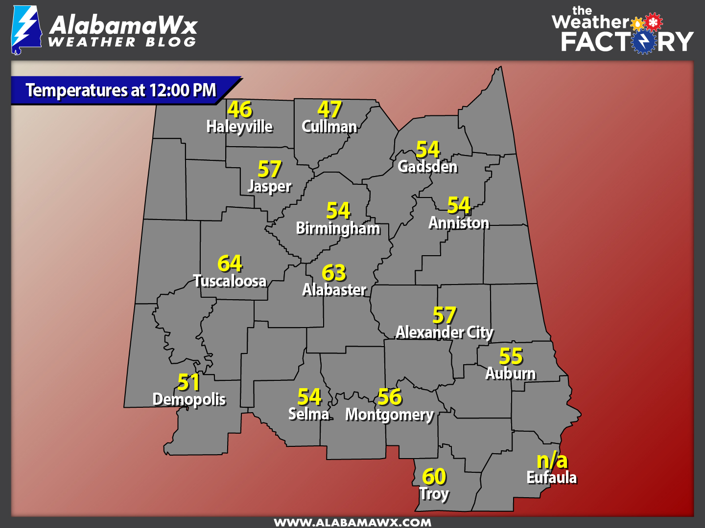
Current Temperatures Across Central Alabama
At this time, temperatures are currently ranging from the mid 40s in the extreme northern parts of the area to right at 60 degrees in the southern part of the area. Warm spot is currently Troy at 60 degrees, while Haleyville is currently the cool spot at 46 degrees.
Birmingham’s Climatology And Records
The normal high for December 14th is 56, while the normal low is 35. The record high for today was set back in 1971 at 77 degrees. The record low was set back in 1917 at 14 degrees.
A Much Colder Day For Thursday
The sun will be shining to the max tomorrow, but winds averaging 5-10 MPH out of the north will not help it to do much warming. Clear skies throughout the daytime hours, with highs only reaching the 40s throughout much of the area, with a few 50 in the southern locations of the area. Mostly clear skies and cold temperatures will greet you if you’re heading out to look at Christmas lights. Temperatures will mainly be in the 30s by 6PM, and overnight lows will be in the 20s across the area. I wouldn’t be surprised if the colder spots hit the teens.
National Extremes
Both Opa-locka and West Kendall Florida recorded the warmest high temperature for Tuesday at 86 degrees. The coldest low temperature for last night into the early morning hours today was recorded at Cut Bank Montana at -18 degrees.
On This Day In Weather History: 1924
The temperature at Helena, MT, plunged 79 degrees in 24 hours, and 88 degrees in 34 hours. The mercury plummeted from 63 above to 25 below zero. At Fairfield MT the temperature plunged 84 degrees in just 12 hours, from 63 at Noon to 21 below zero at midnight.
Follow The Blog On Social Media
The blog is now on Facebook, so be sure to head over there, click the like and follow buttons to stay up-to-date with the latest info from your favorite meteorologists. Also, be sure to follow the Alabama Wx Weather Blog on Twitter. Just click here to start following our feed.
WeatherBrains
This is the weekly netcast that’s all about weather featuring many familiar voices, including our meteorologists at ABC 33/40. You can listen anytime on the web, or on iTunes. You can find it here.
Forecaster: Scott Martin (Twitter: @scottmartinwx)
Category: Alabama's Weather
About the Author (Author Profile)
Scott Martin is an operational meteorologist, professional graphic artist, musician, husband, and father. Not only is Scott a member of the National Weather Association, but he is also the Central Alabama Chapter of the NWA president. Scott is also the co-founder of Racecast Weather, which provides forecasts for many racing series across the USA. He also supplies forecasts for the BassMaster Elite Series events including the BassMaster Classic.Subscribe
If you enjoyed this article, subscribe to receive more just like it.


