Central Alabama Weather Update at 3:00 AM
The cold front has now entered into the extreme northwestern parts of Central Alabama, and you can see the temperatures fall just behind it. When the front passed through Muscle Shoals, the temperature went from 74 degrees at 12:30 AM, to 40 degrees just a little over an hour later at 1:38 AM.
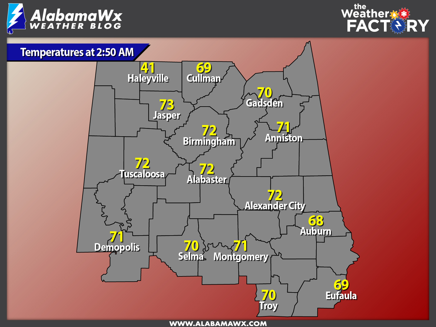
Current temperatures across the area show that most everyone is still in the 70s ahead of the front, but just behind it, the temperature has already dropped to 41 degrees in Haleyville. Now that’s a big temperature contrast in a short distance.
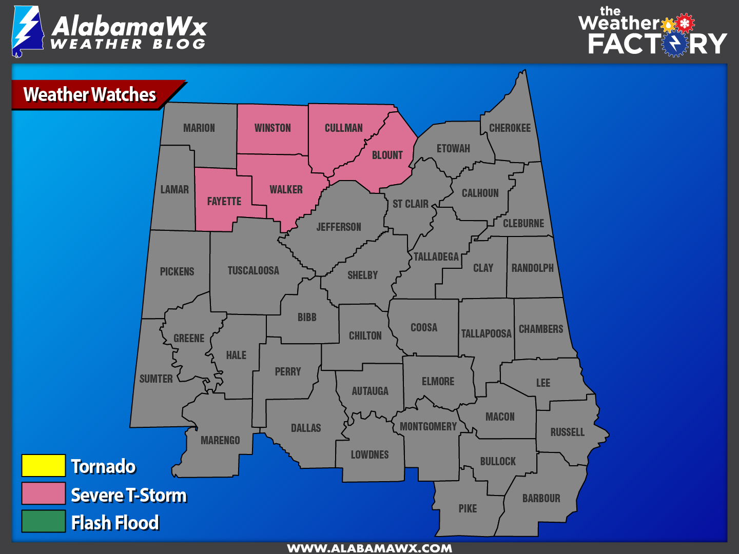
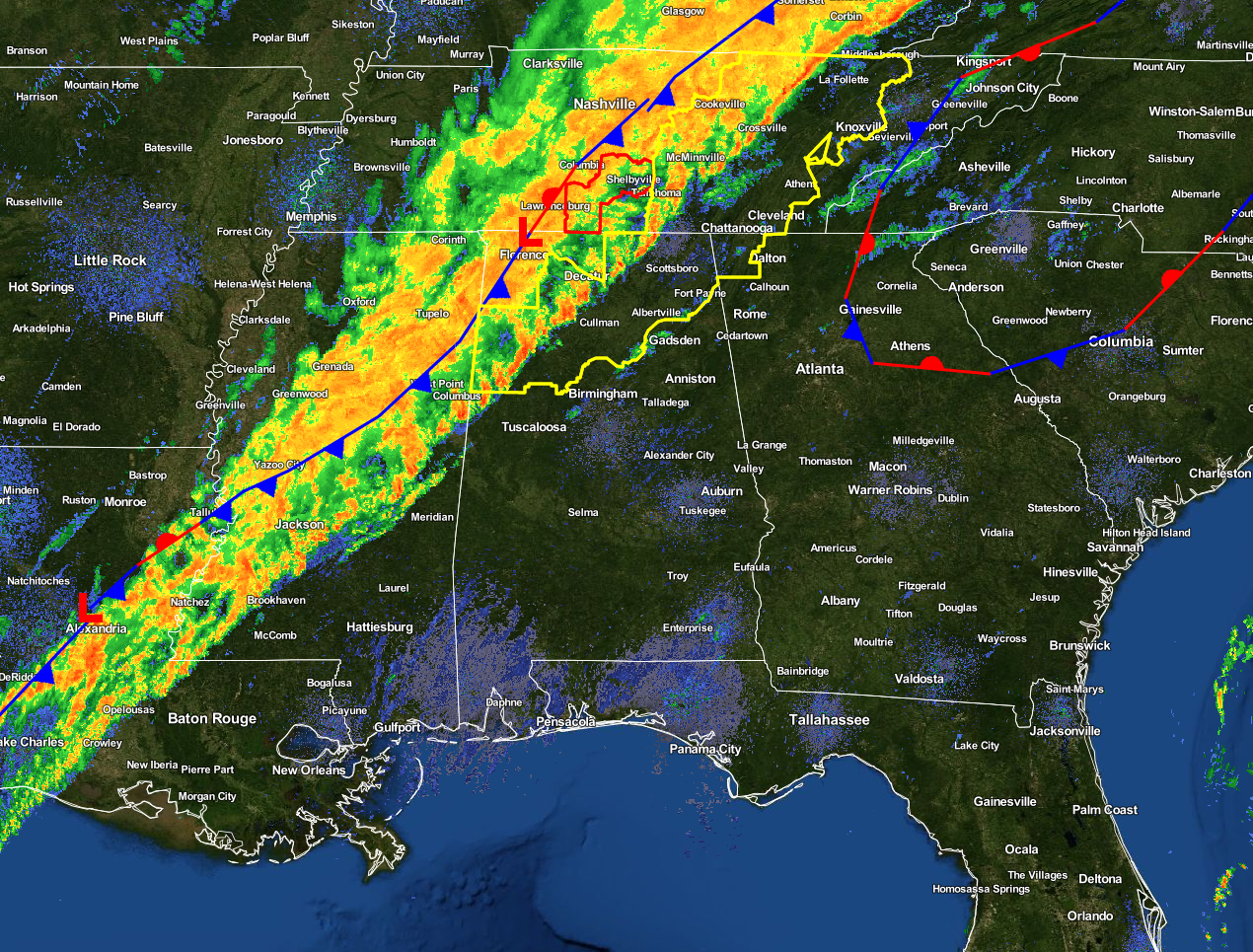
A Severe Thunderstorm Watch continues in effect for Fayette, Winston, Walker, Cullman, and Blount Counties in Central Alabama until 5:00 AM CST. A line of showers and a few strong thunderstorms continue to press through the northwestern parts of the area, with the strongest of the storms remaining up in the Tennessee Valley and across the state line in east-central Tennessee. The line should reach the Tuscaloosa area in the 3AM-4AM range, Birmingham 4AM-5AM range, and Anniston by the 5AM-6AM time range.
CAPE (surface instability) values continue to lower to 500 J/kg and less, along with decreasing Helicity (shear) values and Significant Tornado Parameter values nearly dissipating completely, as the line continues to get closer to the I-65 corridor. It has actually been over an hour since the last severe thunderstorm warning was issued. There might be a few storms that reach the significant weather advisory level for straight-line winds, but I believe the main threat for severe weather is over.
Latest discussion from the NWS Birmingham says that a split may happen in the line of rain into two separate lines, where a gap could form in-between both lines. The front line will continue along with the front, as the second line will lag behind. The back edge of the trailing line will have to be monitored for a brief period of light freezing rain. By noon, the threat of any freezing rain will have ended across the extreme northwestern parts of the area, which includes Marion and Winston Counties. Potential impacts look to be very low at this time with borderline temperatures, minimal precipitation, and soil temperatures well above freezing.
Damage reports are coming in from Mississippi, where a roof was blown off of a KFC in Booneville. Another report from Mississippi, pressure gradient winds brought down a tree through the roof of a house near Pine Ridge.
Category: Alabama's Weather, Current Warnings, Severe Weather
About the Author (Author Profile)
Scott Martin is an operational meteorologist, professional graphic artist, musician, husband, and father. Not only is Scott a member of the National Weather Association, but he is also the Central Alabama Chapter of the NWA president. Scott is also the co-founder of Racecast Weather, which provides forecasts for many racing series across the USA. He also supplies forecasts for the BassMaster Elite Series events including the BassMaster Classic.Subscribe
If you enjoyed this article, subscribe to receive more just like it.


