

Tennessee Hailers
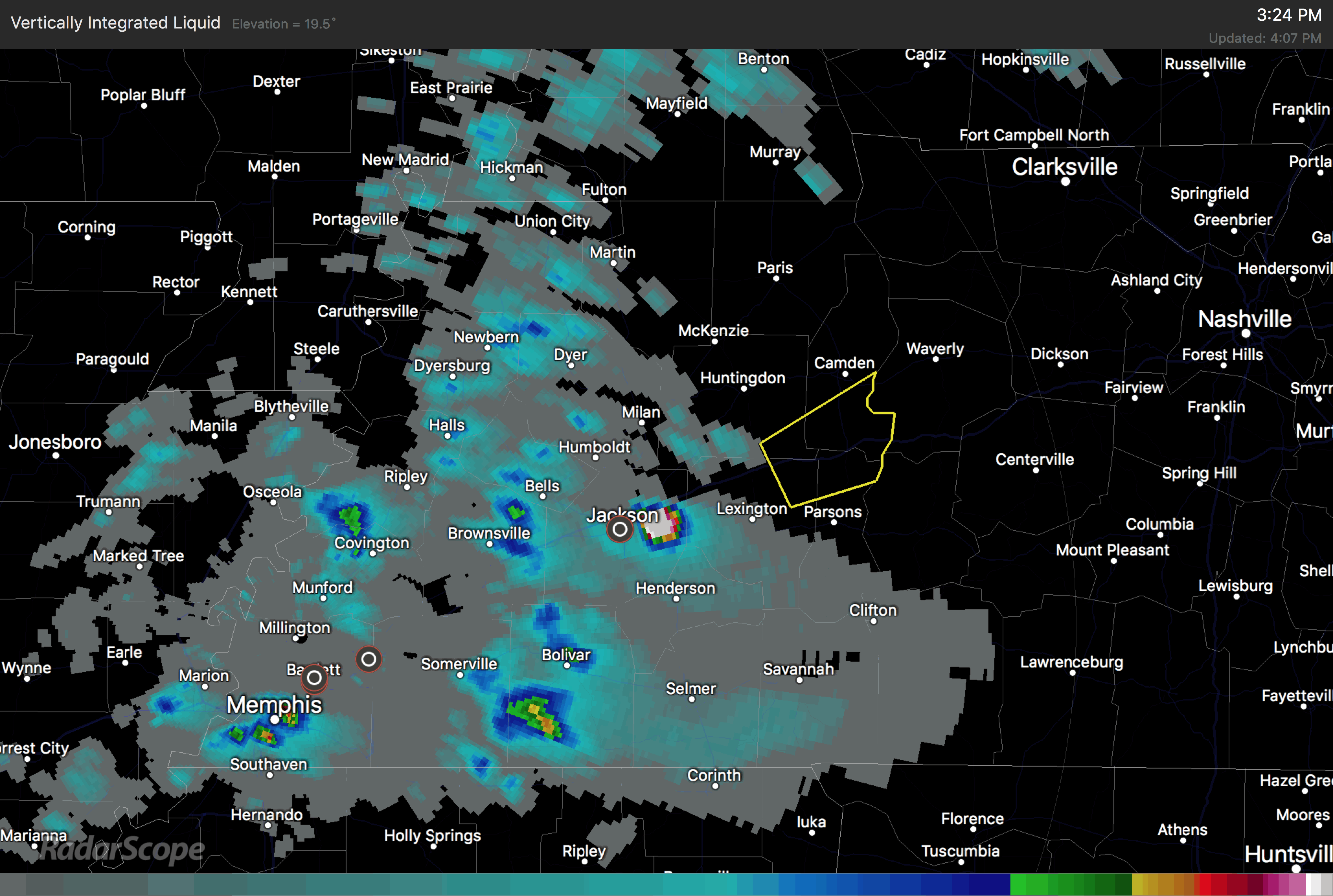
Thunderstorms over western Tennessee are putting out some pretty big hail. 1.75 inch hail was reported just east of Jackson TN at 3:24 p.m.
Here is a radar image of vertically integrated liquid, or VIL, which is a good indicator of large hail.
Cold temperatures aloft are resulting in the strong updrafts and hail. This tendency will continue into the evening and overnight hours as trough works southeastward toward us and storms continue to form out ahead of the main line.
The storms over Tennessee are elevated in nature, meaning that their source of instability is not near the surface. These storms don’t generally produce big severe weather, but can produce big hail.
Still no change in our other thinking. The warm front is working its way northward, extending from north of Meridian to near Montgomery at this hour. There are a few showers along the front, which will lift northward over the next few hours. South of it, the airmass is warm and moist and unstable. As it lifts over the rest of Central Alabama tonight the stage will be set for strong to severe thunderstorms.
Damaging winds and hail will be the main threat from the storms. There is an outside chance of an isolated tornado or two overnight.
We will have frequent updates throughout the night. Look for your next update on or before 7 p.m.
Category: Severe Weather
About the Author (Author Profile)
Bill Murray is the President of The Weather Factory. He is the site's official weather historian and a weekend forecaster. He also anchors the site's severe weather coverage. Bill Murray is the proud holder of National Weather Association Digital Seal #0001 @wxhistorianSubscribe
If you enjoyed this article, subscribe to receive more just like it.


