Heads Up Southwestern Jackson And Northern Marshall Counties
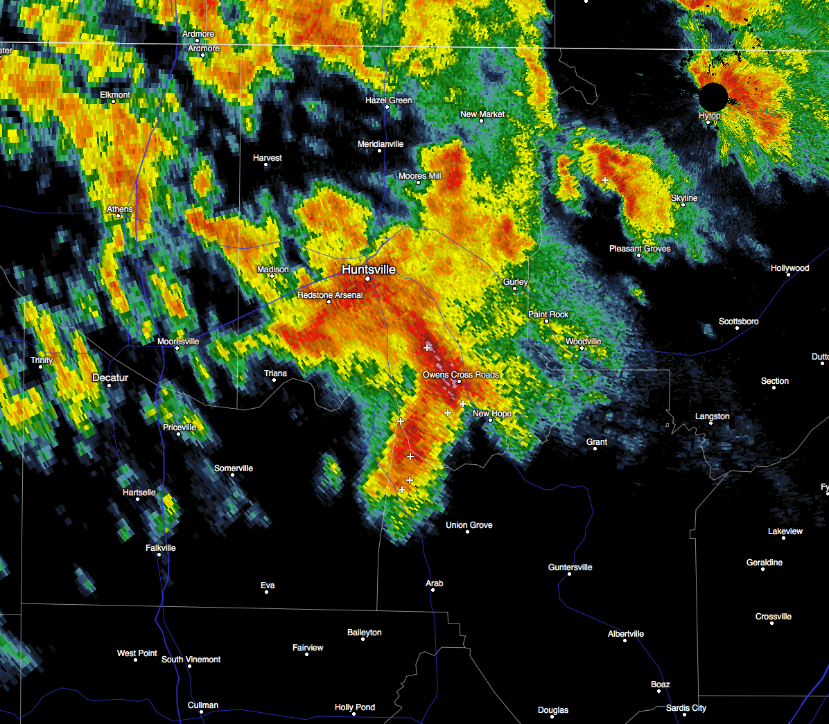
A Significant Weather Advisory has been issued by the NWS Huntsville forSouthwestern Jackson and Northern Marshall counties until 10:30 PM CST. At 9:58 PM CST, Doppler radar was tracking a strong thunderstorm over southeastern Huntsville, moving east at 50 mph. Penny size hail and winds in excess of 40 mph will be possible with this storm.
Locations impacted include Southern Huntsville, Scottsboro, Redstone Arsenal, Owens Cross Roads, Hollywood, Grant, Gurley, Section, Woodville and Pleasant Groves.
Frequent cloud to ground lightning is occurring with this storm. Lightning can strike several miles away from a thunderstorm. Seek a safe shelter inside a building or vehicle.
Category: Alabama's Weather, Severe Weather
About the Author (Author Profile)
Scott Martin is an operational meteorologist, professional graphic artist, musician, husband, and father. Not only is Scott a member of the National Weather Association, but he is also the Central Alabama Chapter of the NWA president. Scott is also the co-founder of Racecast Weather, which provides forecasts for many racing series across the USA. He also supplies forecasts for the BassMaster Elite Series events including the BassMaster Classic.Subscribe
If you enjoyed this article, subscribe to receive more just like it.


