An Update To Our Weather Situation at 10:15 PM CST
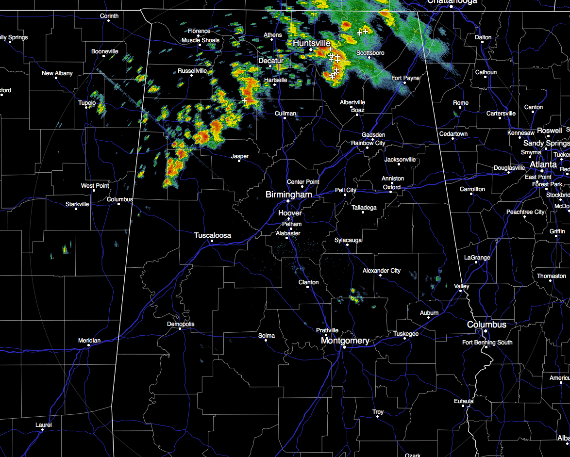
Currently across the Central Alabama area, the line of showers and storms that are pushing through the north and northwestern parts of the state have now made it into Marion, Winston, Lamar, and Fayette counties. These storms at the moment are not producing much lightning at all at the moment, and are staying well-behaved. The storms that are located over Madison, Limestone, and Morgan counties are currently strong, but not severe. Even with that said, wind gusts exceeding 40 MPH are possible.
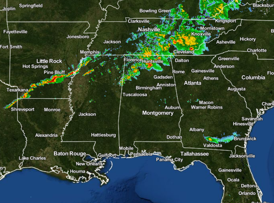
The latest look at the situation, a secondary line showers and thunderstorms have formed back to our west stretching from the extreme northwestern corner of Mississippi, back to the west-southwest through southern Arkansas, and ending in the northeastern corner of Texas. This will probably be the line of storms that our severe weather threat will be focused on.
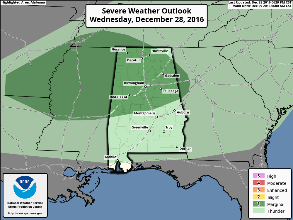
The Storm Prediction Center still has almost the entire northern half of Alabama in a “Marginal Risk” for severe storms throughout the remainder of the night and into the morning on Thursday. Damaging straight-line winds and small hail, and a brief spin-up tornado will be the main risks with tonight’s event.
The latest HRRR model run has the higher instability values confined to the southern parts of the area, with those only reaching 500 J/kg at around 1:00 AM. Helicity (shear) values are starting to look a little more impressive with larger areas of values in the 350-450 m2/s2 range. Along with those numbers, dewpoints will be in the low to mid 60s. So the ingredients will be there for marginal strong to severe storms, the question is “Will there be any severe development?”
I still the timing is the same as from my last update… From 10PM-3AM for the northwestern parts (east of a line from Tuscaloosa to Birmingham to Gadsden), midnight-5AM for the central and eastern parts (Anniston, Alexander City, Clanton, Selma, and Demopolis), and from 4AM-8AM for the southeastern parts (Montgomery, Troy, Eufaula, and Auburn).
Bill Murray and myself will keep you updated throughout the night and the early morning hour. Remember that we are also on Facebook and on Twitter.
Category: Alabama's Weather, Severe Weather
About the Author (Author Profile)
Scott Martin is an operational meteorologist, professional graphic artist, musician, husband, and father. Not only is Scott a member of the National Weather Association, but he is also the Central Alabama Chapter of the NWA president. Scott is also the co-founder of Racecast Weather, which provides forecasts for many racing series across the USA. He also supplies forecasts for the BassMaster Elite Series events including the BassMaster Classic.Subscribe
If you enjoyed this article, subscribe to receive more just like it.


