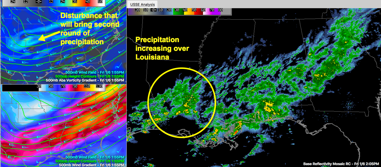
Second Wave of Precipitation Developing to the West Ahead of Upper Level Disturbance
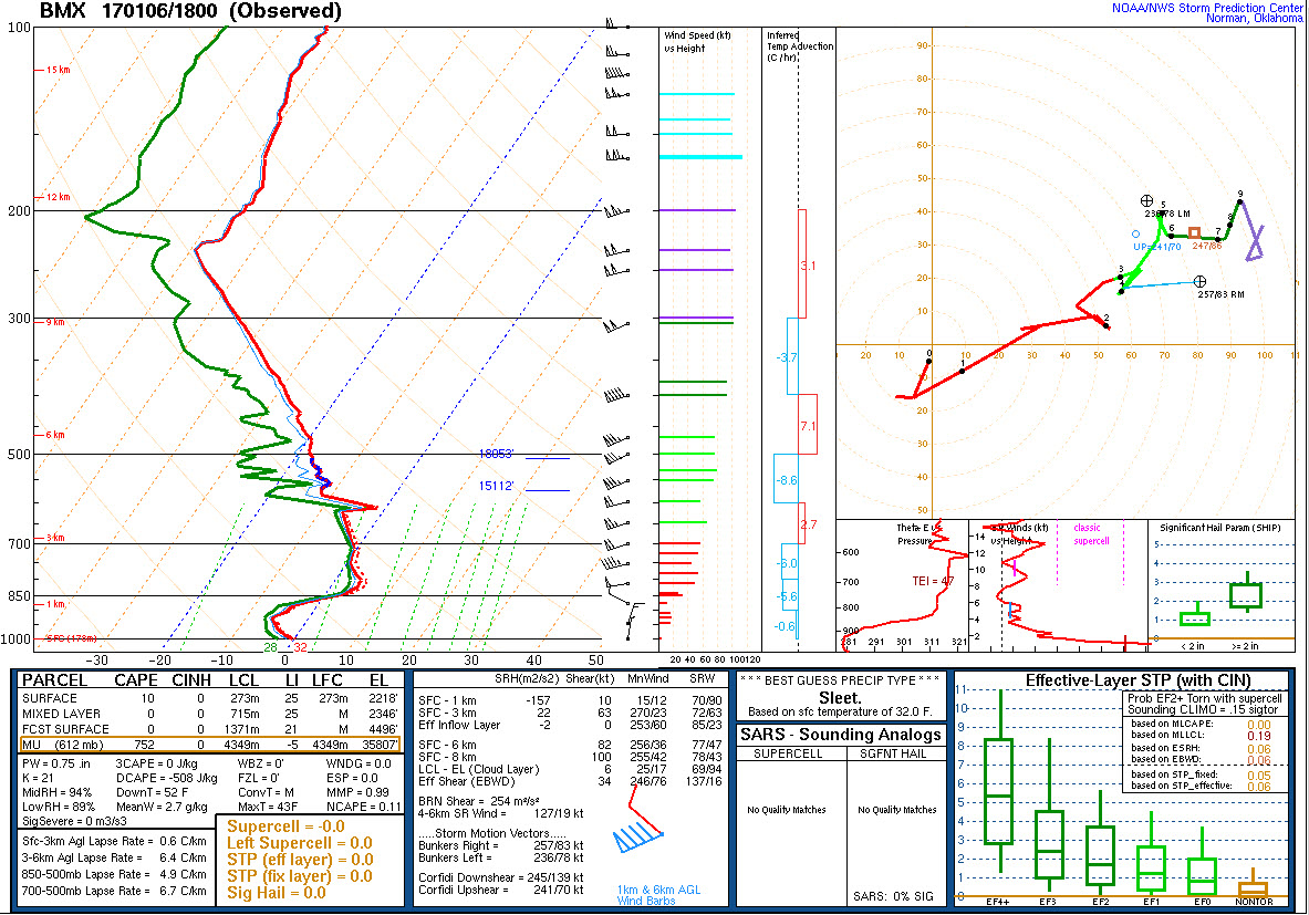
2:49 ADDED THE SKEW-T DIAGRAM AS REQUESTED BY A READER
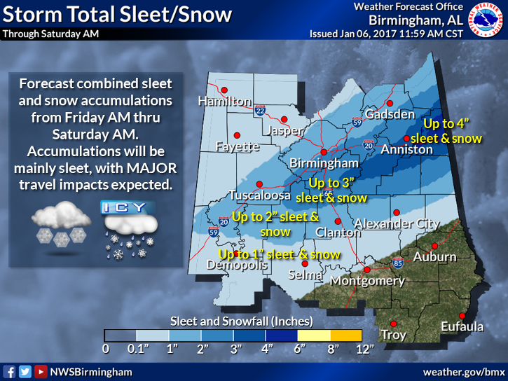
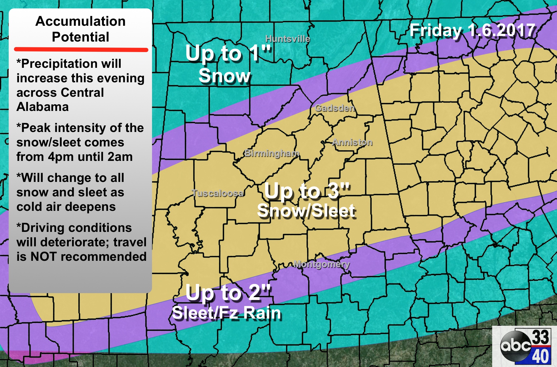
SNOW ACCUMULATION
The NWS has upped the snow and sleet accumulation forecast for parts of East Alabama to up to 4 inches. Here is their latest graphic.
ORIGINAL POST
Our thoughts and prayers are with the victims of the shooting at the Fort Lauderdale Airport and their families this afternoon.
Here is Alabama, a wintry mix has affected the central part of the state with a mix of ice pellets, freezing rain, rain and some snow. Snowfall accumulations have been light and mostly over northern portions of the area.
A layer of warm air aloft kept the precipitation limited to sleet and some freezing rain where surface temperatures were at or below freezing. Ice formed on exposed objects like signs, automobiles and decks. There were some icy patches on roads but no major traffic problems were reported. Traffic is moving freely now on Birmingham Metro roads and highways.
Precipitation is mainly south of I-20 now. Temperatures are right around freezing in the Tuscaloosa and Birmingham areas. From northern Jefferson County into the northern parts of the state, readings range down into the middle and upper 20s. It is now 25F at Muscle Shoals.
Some drying has resulted in a little bit of sunshine is breaking out just north of I-20. Where sunshine is coming out, readings are warming just a bit, like Columbus AFB in Mississippi where readings rose back into the middle 30s.
Big surface high centered over Kansas and Missouri. Northerly surface winds are behind cold front all the way into the Gulf of Mexico which has now cleared the Florida Panhandle. This colder air will continue to filter southward for the next several hours.
The noon special balloon release data is in from the national Weather Service Birmingham at the Shelby County Airport. Temperatures in the lowest 4000 feet are below freezing, but there is still a layer of warm air about 1500 feet deep at about 5000 feet. This is setting the stage for freezing rain until that layer cools. The special sounding from Jackson MS looks very similar.
Here is the Skew-T diagram of the sounding data:
To the west, precipitation is increasing over Central Louisiana. Precipitation is spreading back to the north and northeast across Central Mississippi. This is ahead of an upper-level disturbance swinging across Texas and Oklahoma at this time. This precipitation will spread across Central Alabama late this afternoon and this evening. It will fall as a mix of sleet and freezing rain with a band of snow forming along the northern fringe.
There could be a band of heavier snow tonight somewhere in the I-20 Corridor.
In Meridian, freezing rain is reported at the Naval Air Station. There is a media report from a family member that the precipitation at their location near Meridian is all snow.
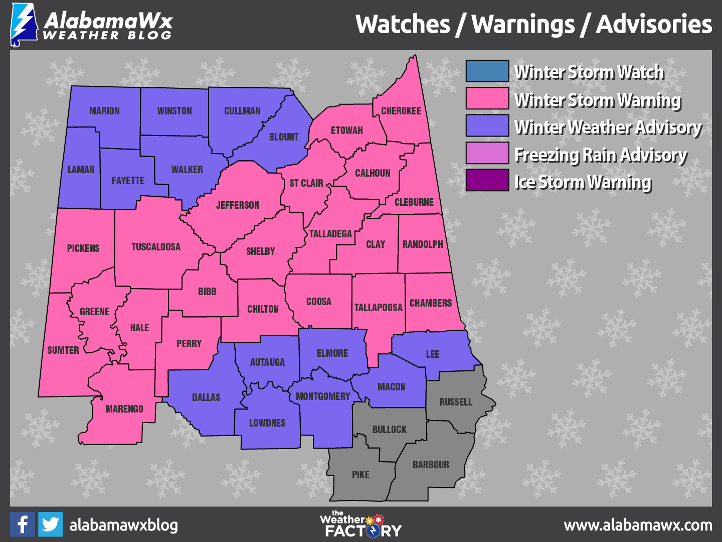
Here are the winter storm warning and winter weather advisories that are in effect:
Here is the expected accumulation map:
Roads which have water on them could develop ice overnight as well.
All travel is discouraged in the winter storm warning and winter weather advisory areas this afternoon and evening.
Category: Alabama's Weather
About the Author (Author Profile)
Bill Murray is the President of The Weather Factory. He is the site's official weather historian and a weekend forecaster. He also anchors the site's severe weather coverage. Bill Murray is the proud holder of National Weather Association Digital Seal #0001 @wxhistorianSubscribe
If you enjoyed this article, subscribe to receive more just like it.


