A Quick Winter Weather Update At 4PM
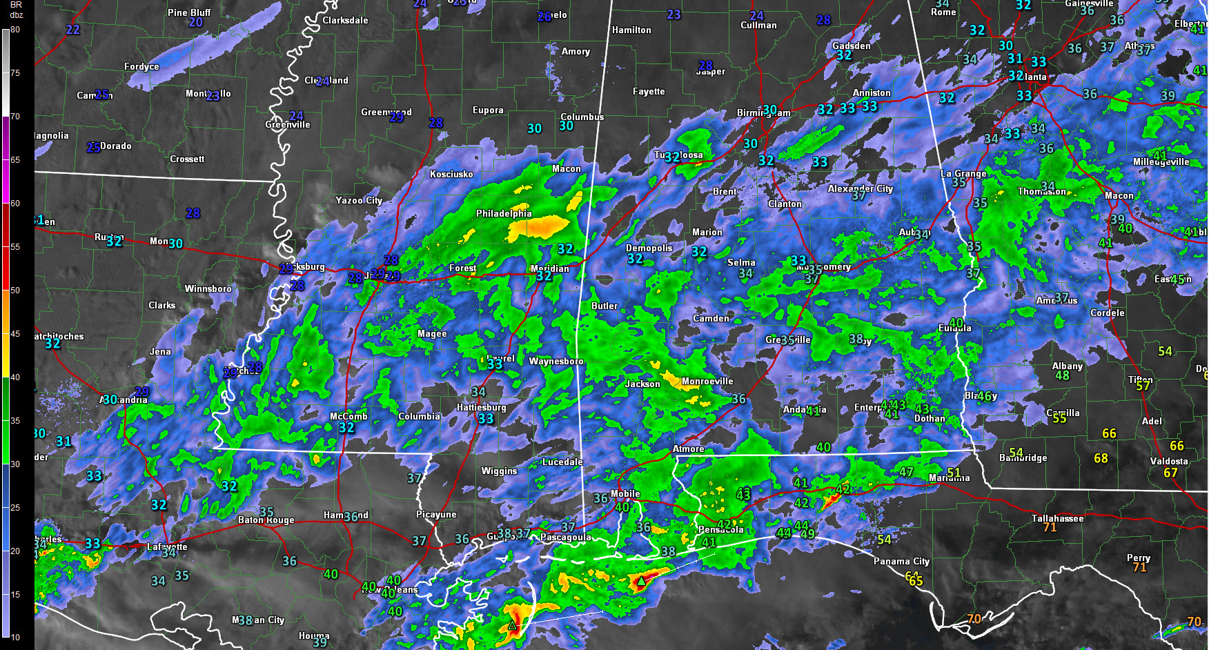
More moisture is moving into Central Alabama from southern Mississippi, and this is where our big show will be coming from. Latest projected soundings for the area has that nose of above freezing air that has been hovering around 5,000 feet above the surface eroding away. When that happens, any precipitation that falls will be either sleet or snow, or a mix of both.
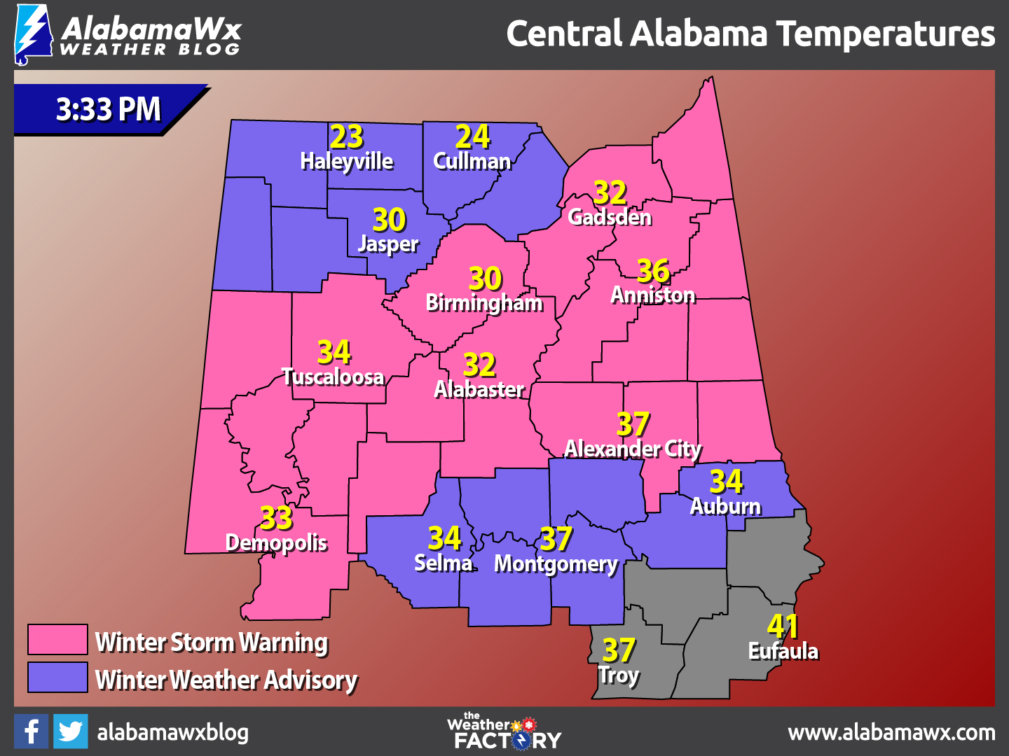
Temperatures at the 3:30 are ranging from the low 20s in the extreme northern parts of the area, to the upper 30s in the southern part. Eufaula is still the warmer spot in the area at 41 degrees, compared to a very cold Haleyville at 23 degrees.
The best odds for snow looks should be along I-20 from Pickens through Tuscaloosa and into Jefferson Counties. This will more than likely expand through St, Clair, Etowah, Calhoun and Cherokee Counties. There will be a large band of sleet that will form along and south of the snow band. South of that, it will transition to freezing rain and then to rain. The best odds of freezing rain will be from south of Clanton to near Montgomery.
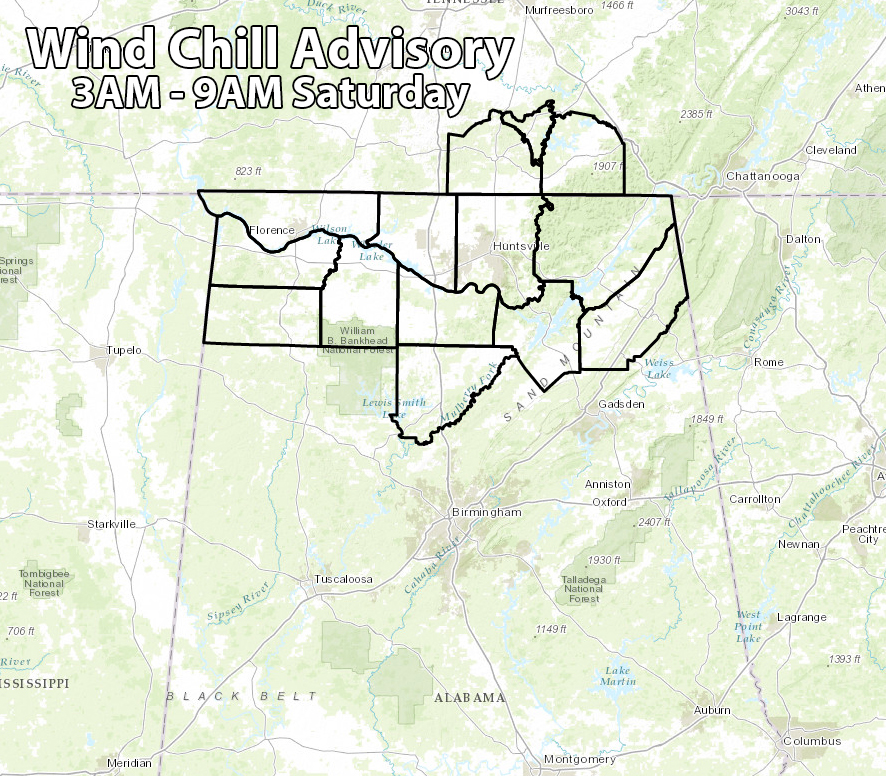
A wind chill advisory has been issued for the Tennessee Valley area of North Alabama from 3AM until 9AM for wind chills between -5 to 5 degrees.
Category: Alabama's Weather, Winter Weather
About the Author (Author Profile)
Scott Martin is an operational meteorologist, professional graphic artist, musician, husband, and father. Not only is Scott a member of the National Weather Association, but he is also the Central Alabama Chapter of the NWA president. Scott is also the co-founder of Racecast Weather, which provides forecasts for many racing series across the USA. He also supplies forecasts for the BassMaster Elite Series events including the BassMaster Classic.Subscribe
If you enjoyed this article, subscribe to receive more just like it.


