Several Stormy Periods Ahead
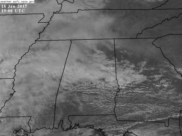
COOLER DAY: The sky is generally cloudy across North/Central Alabama this afternoon with temperatures in the mid 60s, about ten degrees cooler than yesterday, but still above average for mid to late January. Some communities up in the Tennessee Valley are holding in the 50s. Very little rain on radar.
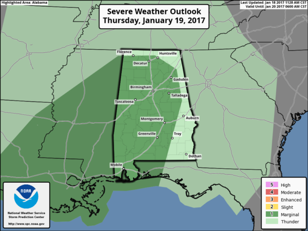
The surface front over Central Alabama will slowly move northward as a warm front tonight and tomorrow, and with an approaching upper trough the stage is set for some active weather. SPC maintains a “marginal” severe weather risk for much of the state tomorrow afternoon and tomorrow night…
New model data suggests rain will move into the state around the midday hours tomorrow, with a fairly large rain mass over the state through the evening and into tomorrow night. This should limit the available instability and the overall severe weather threat despite good dynamic forcing.
TIMING: The primary chance of strong to severe storms will come from about 4:00 tomorrow afternoon through 2:00 a.m. Friday.
THREATS: The main issues will come from gusty thunderstorm winds and small hail. A brief tornado is possible, not not likely.
RAIN: Rain amounts of around one inch are likely; probably not enough for significant flooding issues.
Just be sure you are in a position to hear severe weather warnings in case they are needed. Hopefully we will get away with just a good rain event and not too many problems.
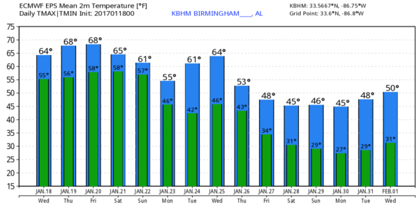
FRIDAY: Morning clouds will give way to a little afternoon sun, and temperatures should rise into the 70-75 degree range. Rain from the event tomorrow night should end during the pre-dawn hours Friday, with only isolated showers during the day.
MORE STORMS FOR THE WEEKEND: A complex storm system will impact Alabama over the weekend. Instability values will rise Saturday; surface based CAPE values could exceed 2,500 j/kg over Southwest Alabama, with values to 1,500 j/kg over the northern counties. While the main dynamics will be west of Alabama, with that much instability we could see a few strong to severe storms as early as Saturday afternoon. Seems like the higher severe weather coverage will come later Saturday night or Sunday as the big upper trough gets closer. This one will have strong wind fields, and it will need to be monitored closely in coming days.
But, understand it is simply too early to determine the timing and magnitude of the weekend severe weather threat. Once we get past the storms tomorrow night we will have a much better idea of what the atmosphere will look like Saturday and Sunday.
Additional rain amounts of 1-2 inches sure look likely over the weekend, bringing the storm totals to 3-4″ in spots across Alabama by Monday. Very beneficial for the drought stricken areas of North Alabama.
Just keep an eye on the blog for updates on the weekend situation over the next few days and we will be much more specific.
NEXT WEEK: Monday will be cloudy, windy, and much cooler with highs in the 50s and some lingering light rain at times. Then, late in the week, even colder air arrives with highs dropping into the 40s.
As always, watch me for the full weather story on ABC 33/40 News this evening at 4, 5, 6, and 10:00!
WEATHER BRAINS: Don’t forget you can listen to our weekly 90 minute netcast anytime on the web, or on iTunes. This is the show all about weather featuring many familiar voices, including our meteorologists here at ABC 33/40.
CONNECT: You can find me on all of the major social networks…
Facebook
Twitter
Google Plus
Instagram
Snapchat: spannwx
Look for the next Weather Xtreme video here by 7:00 a.m. tomorrow…
Category: Alabama's Weather
About the Author (Author Profile)
James Spann is one of the most recognized and trusted television meteorologists in the industry. He holds the AMS CCM designation and television seals from the AMS and NWA. He is a past winner of the Broadcast Meteorologist of the Year from both professional organizations.Subscribe
If you enjoyed this article, subscribe to receive more just like it.


