Tornado Warning Continues for Pike County Until 945 AM CST
UPDATE 930 AM
…A TORNADO WARNING REMAINS IN EFFECT UNTIL 945 AM CST FOR
SOUTHEASTERN PIKE COUNTY…
At 930 AM CST, a severe squall line capable of producing both
tornadoes and extensive straight line wind damage was located along a
line extending from near Boot Hill to near Ariton, moving east at 50
mph.
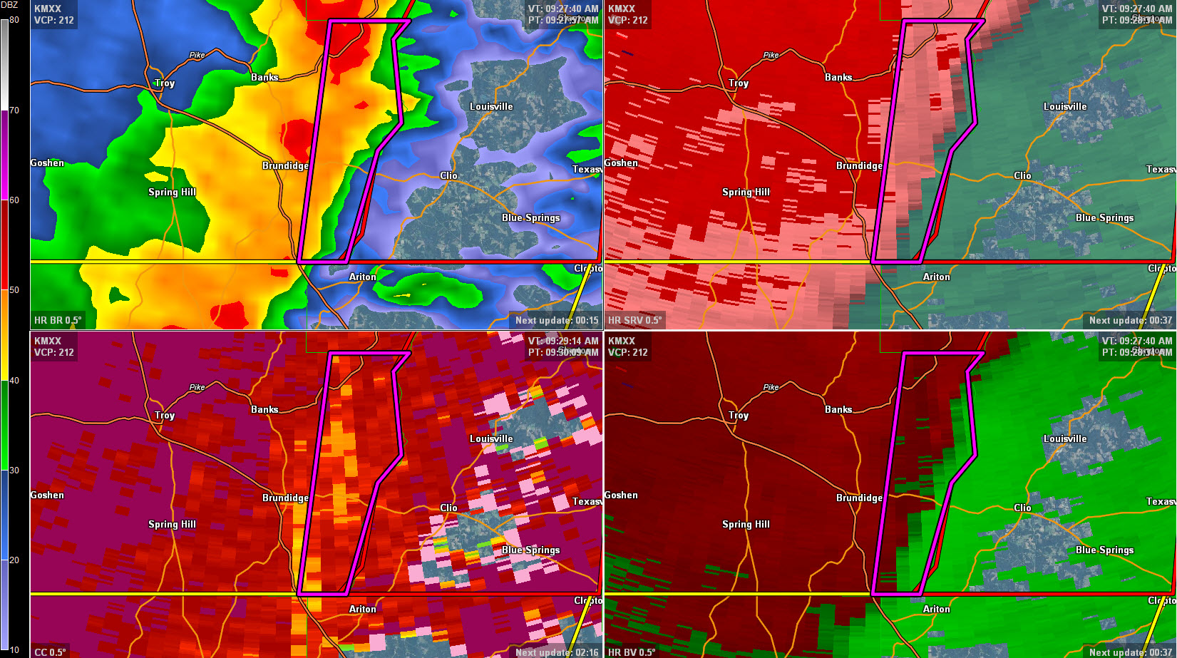
HAZARD…Tornado.
SOURCE…Radar indicated rotation.
IMPACT…Flying debris will be dangerous to those caught without
shelter. Mobile homes will be damaged or destroyed. Damage
to roofs, windows, and vehicles will occur. Tree damage is
likely.
Locations impacted include…
Tennille and Josie.
___________________________________________________________________
DAMAGE REPORT at 9:25
Trees were reported down on George Wallace Drive in Troy. Possible tornado.
___________________________________________________________________
CURRENT WARNING INFO
…A TORNADO WARNING REMAINS IN EFFECT UNTIL 945 AM CST FOR EASTERN
PIKE COUNTY…
At 921 AM CST, tornado producing storms were located along a line
extending from near Beans Crossroads to 7 miles south of Brundidge,
moving east at 60 mph.
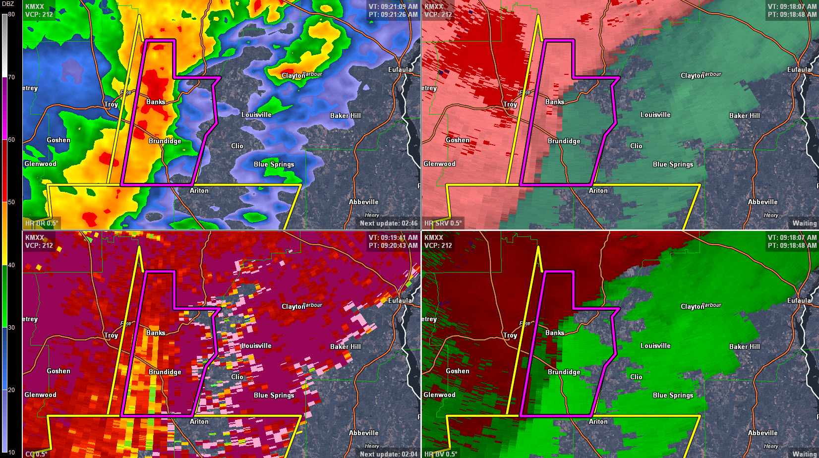
HAZARD…Damaging tornado.
SOURCE…Radar confirmed tornado.
IMPACT…Flying debris will be dangerous to those caught without
shelter. Mobile homes will be damaged or destroyed. Damage
to roofs, windows, and vehicles will occur. Tree damage is
likely.
Locations impacted include…
Troy, Brundidge, Banks, Linwood, Antioch, Brundidge Municipal
Airport, Josie, Sandfield, Tennille, Tarentum, Monticello and
Hamilton Crossroads.
Category: Alabama's Weather, Current Warnings, Severe Weather
About the Author (Author Profile)
Bill Murray is the President of The Weather Factory. He is the site's official weather historian and a weekend forecaster. He also anchors the site's severe weather coverage. Bill Murray is the proud holder of National Weather Association Digital Seal #0001 @wxhistorianSubscribe
If you enjoyed this article, subscribe to receive more just like it.


