Weather Xtreme Video for Sunday, January 29th
It’s my pleasure to sit in again for Brian this morning as he is at a storytelling festival.
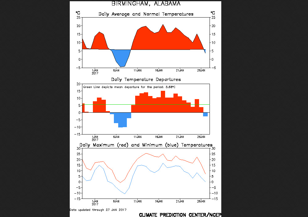
JANUARY NUMBERS: We’re starting to wind down January, so I thought we will take a sneak peek at how January is turning out from a climatological standpoint.
Projecting out to the end of the month with our forecasts, we will finish with an average high of 60.2, which is 6.4 degrees above the mean maximum temperature. The average low will end up around 43.9F, which is 10.1 degrees above the mean. The average temperature for the month will end up at 52.1F, which is 8.3F degrees above the 30 year average.
Here is the 30 day temperature series for Birmingham.
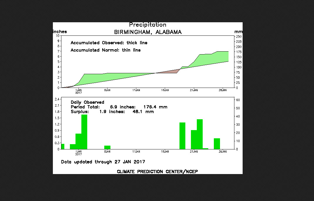
We will finish the month with 6.71 inches of rain, which is 1.87 inches above the 30 year average.
Here is the 30 day precipitation series for Birmingham.
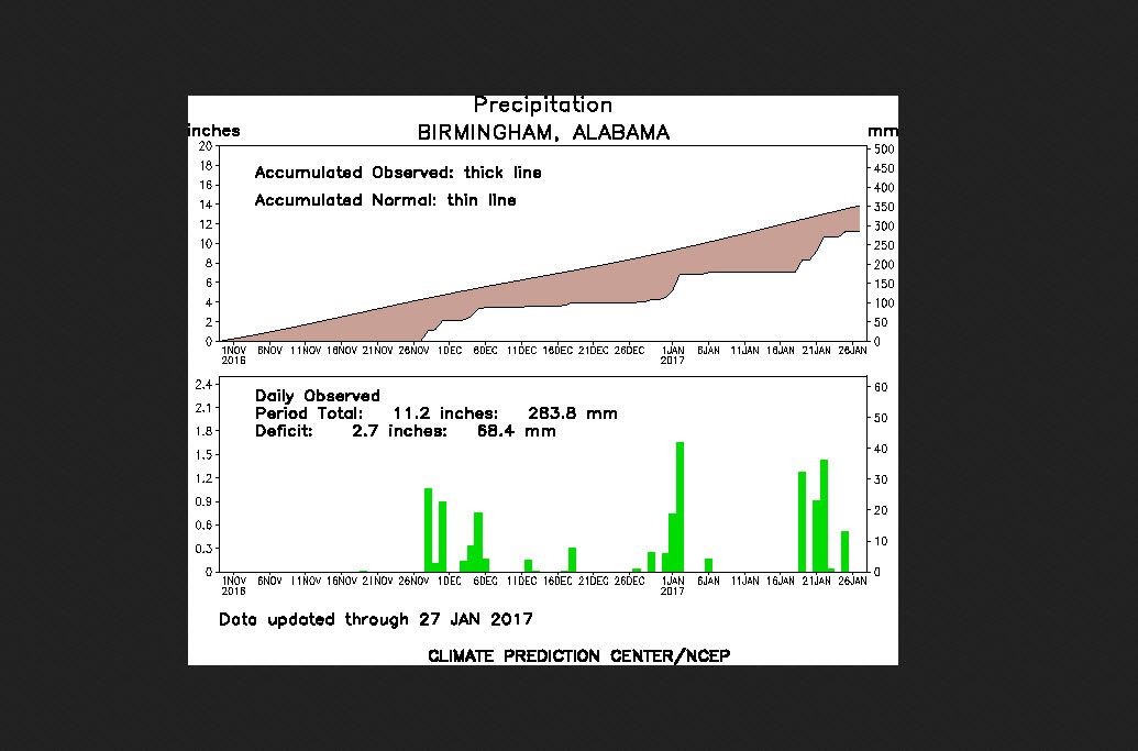
We have dented the drought recently, as evidenced by the 90 day precipitation series.
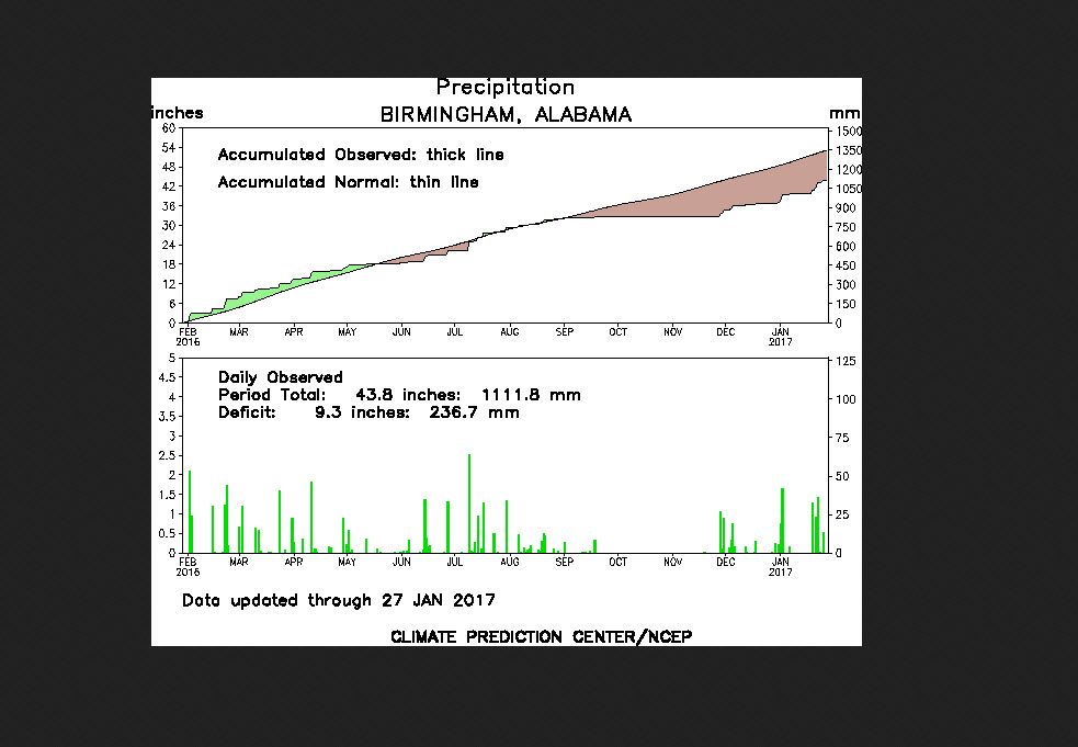
But we still have a long way to go, as evidenced by the 365 day precipitation series for Birmingham. But we certainly haven’t made up as much ground as we would have liked.
And I don’t really have good news. The WPC 7 day precipitation forecast shows zero rain for Central Alabama. And the longer range look from the GFS is not hopeful.
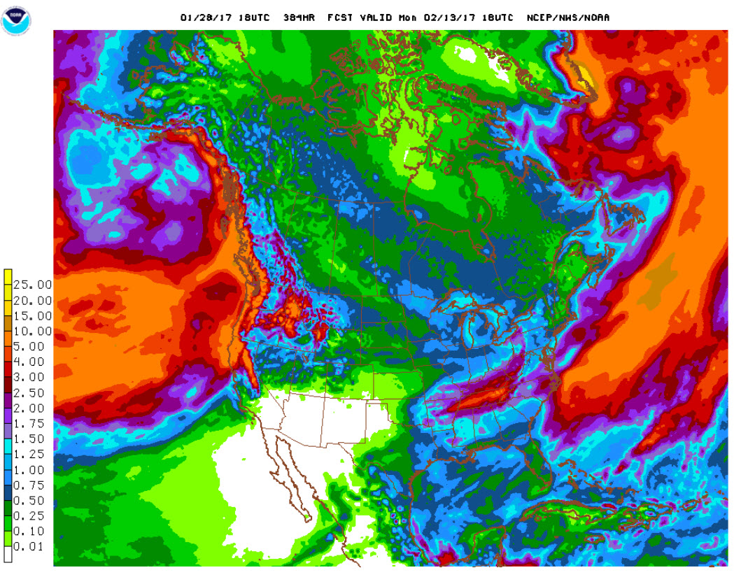
We will be lucky to squeeze out 1-1.25 inches of rain over the next 16 days.
Let’s break it down:
SUNDAY SHORTWAVE: An upper level disturbance is poised to spread across Alabama today, but it has almost nothing to work with in the way of moisture. Precipitable water values this morning are less than 0ne half inch, which is is not all that unusual for late January, but still too low to get excited about. You will notice an increase in cloudiness however, which will help temperatures stay 3-4 degrees less than those of yesterday, topping out between 48-55 degrees. Coldest northeast of course, and warmest around Demopolis. The I-20 Corridor should average between 50-53. Look for overnight lows to drop to near or just below freezing with decreasing cloudiness.
MONDAY STILL COOL: The upper level trough will still be pumping cold air into Alabama on Monday, keeping highs around 50-52F.
MIDWEEK MODERATION: You will start to notice moderation on Tuesday, as highs return to the lower 60s. 60s will be commonplace into the weekend.
END OF THE WEEK FRONT: A stubborn subtropical ridge of high pressure off the Southeast will grudgingly give way enough for a cold front to approach the area on Friday. As it approaches, it could trigger a few showers Friday evening across Central Alabama. But the lack of moisture should limit rain chances again and we will be lucky to get measurable rain at all. We could reach the upper 60s by Friday. That’s not bad at all!
SECOND PUSH: The front will get a little impetus from a passing shortwave by later in the day on Saturday, and by then, moisture levels will be higher as the ridge breaks down. The GFS is bullish on a solution that gives increasing chances of a soaking rain starting late Saturday afternoon and continuing through Sunday night. We will keep our fingers crossed. Temperatures will be trending down however after the front moves through, with 50s expected Sunday. Lows will be in the 40s from Wednesday through Sunday.
VOODOO COUNTRY: Two systems the week of February 6th will bring more wet weather, but it appears mainly to the south of us. Can’t get too excited about that, yet.
BIRMINGHAM’S SECOND BIGGEST SNOW: Snow started at 7:46 a.m. on Wednesday morning, January 29, 1936. 24 hours later, eleven inches of the white stuff would be on the ground. It would be the Magic City’s greatest snowfall until 1993. More about the 1936 snow in a special weather history post later today.
WEATHERBRAINS: Fascinating conversation with Tim Marshall last week. Check out the show at www.WeatherBrains.com. You can listen to the audio podcast on iTunes.
Category: Alabama's Weather
About the Author (Author Profile)
Bill Murray is the President of The Weather Factory. He is the site's official weather historian and a weekend forecaster. He also anchors the site's severe weather coverage. Bill Murray is the proud holder of National Weather Association Digital Seal #0001 @wxhistorianSubscribe
If you enjoyed this article, subscribe to receive more just like it.


