Rain/Storms Stabilizing Airmass Over Central and North Alabama; Severe Threat Diminishing for Us
The severe threat for North and North Central Alabama has diminished thaks to the rain and storms that are moving across the area.
The leading edge of the storms extends from Gadsden to Moody to Alabaster to Brent to Marion and back into Southwest Alabama.
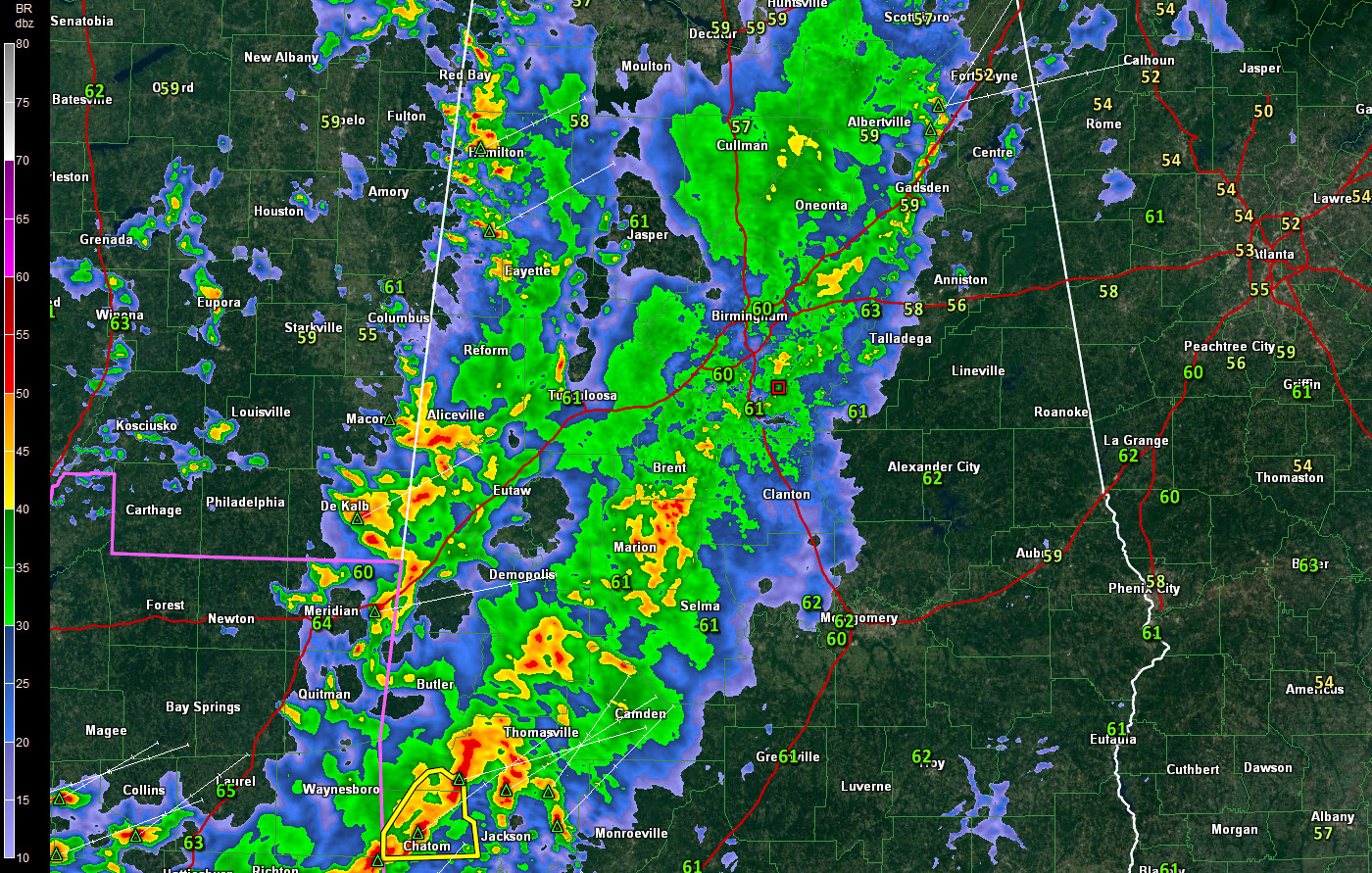
The storms are strongest south of Brent into the Marion area. These storms will affect much of Chilton County within the hour. Further southwest, severe thunderstorm warnings are in effect for Choctaw and Washington Counties.
Behind this line, there is a 45 mile wide band of rain.
Right behind that, another line of storms is along the Alabama/Mississippi border. These storms will produce lightning and heavy rain as well as gusty winds.
They will be approaching the Tuscaloosa area between now and 11:20. Tuscaloosa will have lots of lightning and heavy rain but no severe weather.
They are currently affecting Hamilton and will move into Carbon Hill and Jasper within the next 30 minutes.
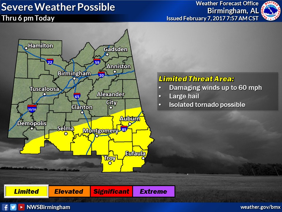
The severe weather threat has diminished for areas north of a line from Uniontown to Dadeville to Lafayette. Southeast of that line, in the highlighted area, there is still a limited threat of severe weather this afternoon.
We will be watching that swarm of supercells over Louisiana that has produced a significant tornado from Pnchatoula to near Madisonville over the past hour. These storms will remain over southern Alabama and may morph into a big damaging wind threat for that part of the state.
We will continue with frequent updates throughout the afternoon. There will be another severe threat tomorrow as the main cold front approaches. There may be sufficient heating during the day to erode what should be a strong capping inversion over Central Alabama.
Category: Alabama's Weather
About the Author (Author Profile)
Bill Murray is the President of The Weather Factory. He is the site's official weather historian and a weekend forecaster. He also anchors the site's severe weather coverage. Bill Murray is the proud holder of National Weather Association Digital Seal #0001 @wxhistorianSubscribe
If you enjoyed this article, subscribe to receive more just like it.


