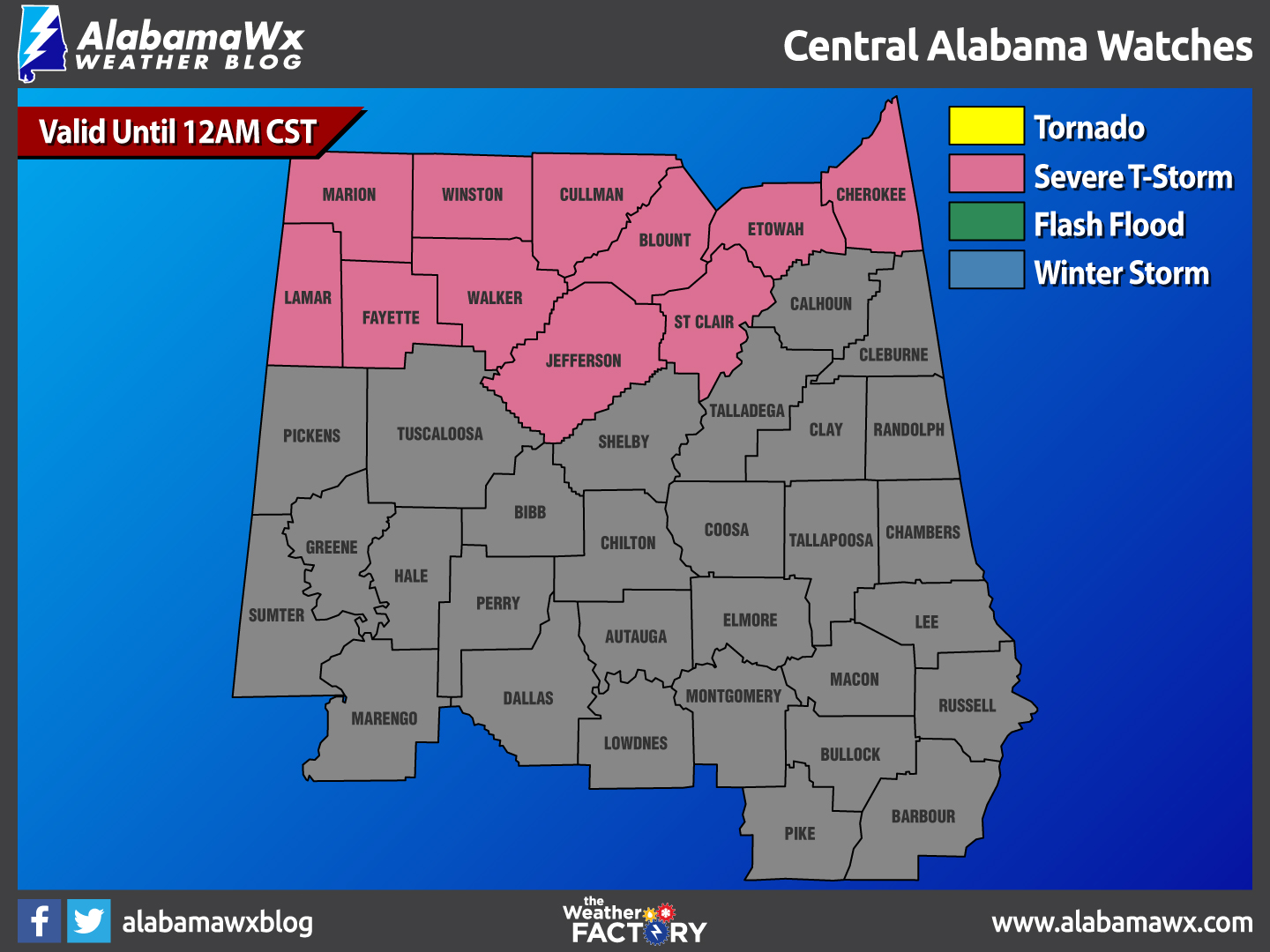
New Severe Thunderstorm Watch for North and North Central Alabama
Current Status:
Severe Storm Watch #0031 has been Issued for the following counties: Blount, Cherokee, Colbert, Cullman, DeKalb, Etowah, Fayette, Franklin, Franklin, Jackson, Jefferson, Lamar, Lauderdale, Lawrence, Limestone, Lincoln, Madison, Marion, Marshall, Moore, Morgan, St. Clair, Walker, Winston
Convection is developing now across Central Tennessee ahead of a cold front. It will push into North Alabama over the next couple of hours.
Watch History:
Wednesday, 4:54pm
Watch Issued for the following counties: Colbert, Cullman, DeKalb, Franklin, Jackson, Lauderdale, Lawrence, Limestone, Lincoln, Madison, Marshall, Moore, Morgan
Wednesday, 4:53pm
Watch Issued for the following counties: Blount, Cherokee, Etowah, Fayette, Jefferson, Lamar, Marion, St. Clair, Walker, Winston
Category: Alabama's Weather
About the Author (Author Profile)
Bill Murray is the President of The Weather Factory. He is the site's official weather historian and a weekend forecaster. He also anchors the site's severe weather coverage. Bill Murray is the proud holder of National Weather Association Digital Seal #0001 @wxhistorianSubscribe
If you enjoyed this article, subscribe to receive more just like it.


