Nasty Storms Pushing East and Southeast, New Warning Includes Tuscaloosa
The storm dropping into Tuscaloosa from the northwest shows strong signs of high winds. Doppler radar velocities are over 95 mph at 4000 feet, which could easily reach the ground as 65-70 mph winds. There is also the potential for one inch hail.
There is some broad rotation as well in this very organized storm. A pronounced notch is also evident.
The good news is that the worst part may remain north of the City of Tuscaloosa. But residents in northern and eastern Tuscaloosa County need to be in a safe place as it approaches.
ORIGINAL POST
Time to breathe.
We have been testing the new warnings automatically to the blog process tonight and have been extremely pleased. The time from issuance by the NWS to receipt by our system to update on the blog is taking less than 5 seconds.
This has been a perfect practice outbreak. Just enugh warnings, far enough apart, with plenty of cancels and continuations.
But back the weather:
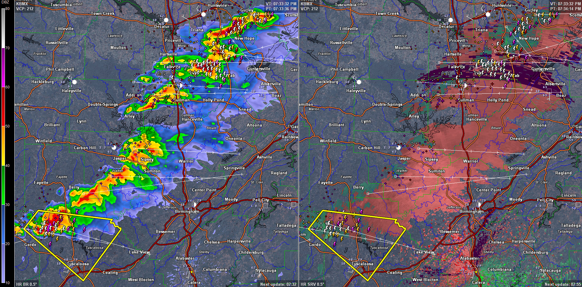
A nasty little swarm of thunderstorms extends from Gurley in Madison County to east of Somerville to east of Falkville to west of Cullman to Jasper, Parish, Oakman and into northwestern Tuscaloosa County near Moore’s Bridge.
There is a little broad rotation on the storm in northwestern Tuscalosa County, but no signs of a tornado.
The NWS just issued a severe thunderstorm warning for extreme eastern Pickens and much of Tuscaloosa County. It includes Tuscaloosa, Northport and the University of Alabama as well as Coker. Hail to one inch and 60 mph winds are possible with this storm.
Storms will begin affecting western part of the Birmingham Metro between now and 815 p.m.
Category: Archived Warnings
About the Author (Author Profile)
Bill Murray is the President of The Weather Factory. He is the site's official weather historian and a weekend forecaster. He also anchors the site's severe weather coverage. Bill Murray is the proud holder of National Weather Association Digital Seal #0001 @wxhistorianSubscribe
If you enjoyed this article, subscribe to receive more just like it.


