The GOES-16 Kerfuffle
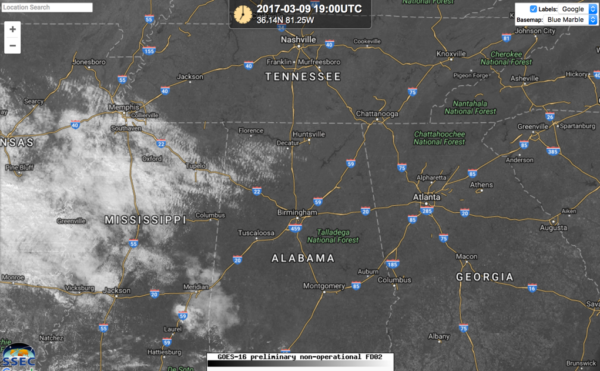
For over six years, meteorologists have been salivating at the promise of data from the new GOES satellite, which represents a quantum leap in temporal resolution and specialized product for weather forecasting. We all held our breath when the satellite was launched into space on November 19th last year from Cape Canaveral. We have been oohing and ahhing over the data that has been shared with us over the past few weeks from the SSEC Real Earth site.
Then last night, the spigot was shut off.
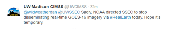
This raised a kerfuffle among broadcast meteorologists who were dismayed that the data went away.
Our very own Satellite Sheldon shed some light on the disappearance of the data this afternoon:
I know you are all desiring to use the new GOES-16 data…now is the time to learn all you want and if you are like I was in my NESDIS analysis career, you want to use it for hazardous weather, even if it has not been declared operational. Use it, tell me about your uses so we can all learn, but be careful it has not been totally tested yet, so have patience in that regard.
See https://www.nesdis.noaa.gov/GOES-16 for latest clarification on using GOES-16. And especially the words “”NOAA’s GOES-16 satellite has not been declared operational and its data are preliminary and undergoing testing.” I know from experience when we in NESDIS had to do a careful analysis and testing when a new generation of satellites was brought onboard in the early 80’s, 90’s and now that you could use the data, but scientists were still testing and calibrating, so it was not an official data source till declared operational.
So keep that in mind when using the data between now and fall. I know you want to use it as quickly as possible, but try to learn how to use it for different weather events during the lucky periods you get to see the data…and not just the IR, VIS and Water Vapor, but some of the other goodies, like RGB and smoke and dust products and lightning mapper, to name a few.
The data started flowing again this afternoon.
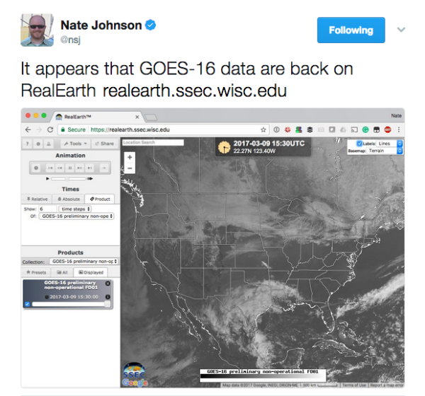
Back to enjoying it!
Sheldon couldn’t miss an opportunity to weigh in on the coming snows for the Mid-Atlantic. He may have nearly a foot in his backyard in coming days.
That storm that a few days was expected to give snow to the East Coast over the weekend, may still do but further south…watch out NC and southern VA and the moisture is about to move into the Pacific NW. Any other snow events next week would probably come from other disturbances still in the Eastern Pacific Ocean…see https://www.ssd.noaa.gov/goes/west/nepac/flash-ft.html.
Category: ALL POSTS, Met 101/Weather History
About the Author (Author Profile)
Bill Murray is the President of The Weather Factory. He is the site's official weather historian and a weekend forecaster. He also anchors the site's severe weather coverage. Bill Murray is the proud holder of National Weather Association Digital Seal #0001 @wxhistorianSubscribe
If you enjoyed this article, subscribe to receive more just like it.


