1:15 a.m. Update on the Alabama Severe Weather Situation
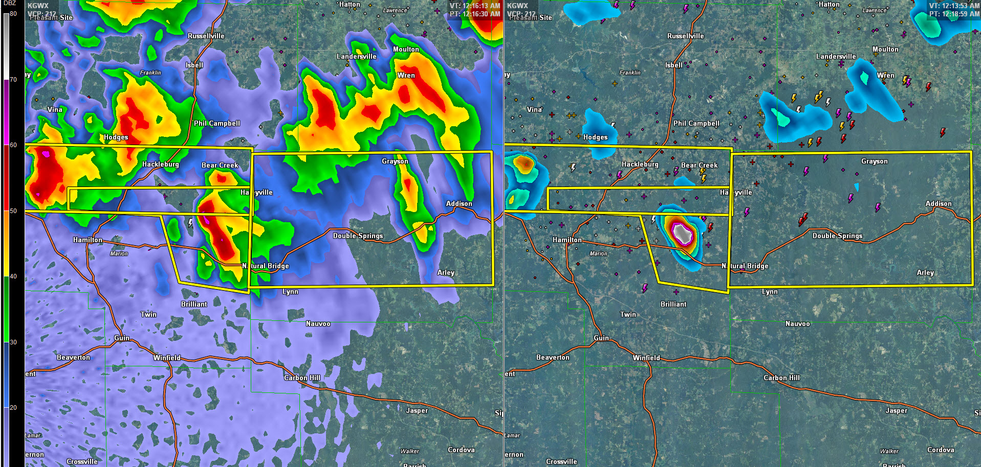
Our line of intense thunderstorms continues to drive southward tonight.
At 1:15 a.m., it extends across Franklin, northern Marion, Winston, Morgan, Cullman, Marshall and DeKalb Counties.
1 inch hail was reported just south of Huntsville at 12:45 a.m.
Just after 12:15 a.m., power lines were reported down just east Ardmore. A tree was down that was apparently blocking a medical vehicle in the area.
These are the only two severe weather reports in the past hour across North Alabama.
Two warnings are in effect right now, but the activity seems to be calming down. The storms will continue to slowly weaken as they push south. There will reach the Birmingham area before 3 a.m.
A severe thunderstorm watch continues until 4 a.m.
Category: Alabama's Weather, ALL POSTS
About the Author (Author Profile)
Bill Murray is the President of The Weather Factory. He is the site's official weather historian and a weekend forecaster. He also anchors the site's severe weather coverage. Bill Murray is the proud holder of National Weather Association Digital Seal #0001 @wxhistorianSubscribe
If you enjoyed this article, subscribe to receive more just like it.


