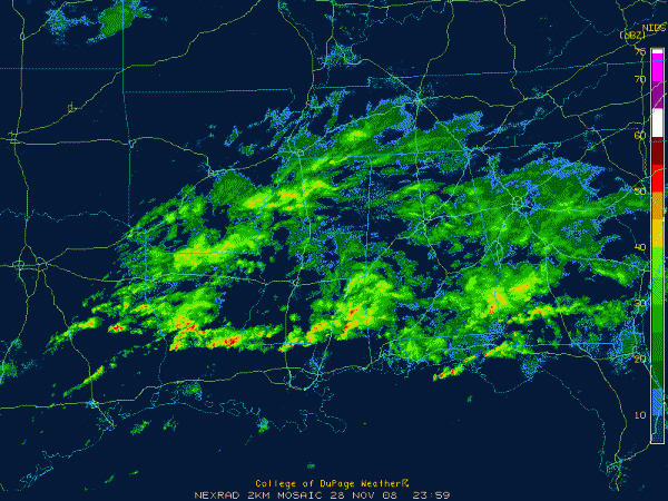
Quick Alabama Update…6:00 p.m.
Fog and light rain covers much of Central Alabama at this hour. Visibilities have dropped to between 2 and 3 miles in most locations. Gadsden was down to 1/4 mile at 5 p.m.
Rainfall amounts are light so far…
….0.08 at Hueytown
….0.20 at Marion
….0.10 at Pleasant Grove
….0.20 at Marion
….0.20 at Coker
A quasi-stationary boundary bisects the state. A surface trough extends back into Central Louisiana. An approaching upper trough is transporting moist air northward into southern Louisiana and Mississippi. Moisture overrunning the boundary is producing the widespread light to moderate rain over northern and central sections of Alabama. Back over Louisiana into southern Mississippi, instabilities are approaching 1000 j/kg. Severe storms are possible from central Louisiana into southwestern Mississippi, where shear is sufficient to produce rotating thunderstorms.
Showers will continue to increase through the night over Central Alabama. There could be a couple of elevated storms, but most of the storms should stay to the south. A surface low was developnig near Alexandria, Louisiana. It will move northeast overnight. Hopefully the storms to the south won’t act to cut off the moisture flow into Central Alabama.
Rain should start ending from the west early tomorrow. We believe most of the rain will be gone by gametime in Tuscaloosa, but can’t be certain. Prepare accordingly. There could be a little light rain or drizzle into the afternoon.
Colder air will begin flowing into Alabama on Sunday. A few snow flurries or snow showers could be possible. With surface temperatures above freezing, accumulations are not expected. Monday will be a cold and raw day. Look for another front WEdnesday night, which will be accompanied by decent moisture, so hopefully we will squeeze out another half inch of rain. Another wet weather system looks possible for the weekend.
Category: Uncategorized


