

Severe Thunderstorm Warning Continues For Parts Of Colbert And Lauderdale Counties Until 2:45PM

…A SEVERE THUNDERSTORM WARNING REMAINS IN EFFECT UNTIL 245 PM CDT FOR SOUTHWESTERN LAUDERDALE AND WESTERN COLBERT COUNTIES… At 229 PM CDT, a severe thunderstorm was located near Cherokee, or 11 miles east of Tishomingo State Park, moving northeast at 35 mph.
HAZARD…60 mph wind gusts and quarter size hail.
SOURCE…Radar indicated.
IMPACT…Hail damage to vehicles is expected. Expect wind damage to roofs, siding, and trees. Locations impacted include… Florence, Sheffield, Tuscumbia, Cherokee, Malone, Posey Loop, Allsboro, Wright, Red Rock and Pride Landing.
Severe Thunderstorm Warning Canceled For Parts Of Franklin County
Mar 27th @ 2:17 pm
…THE SEVERE THUNDERSTORM WARNING FOR NORTHWESTERN FRANKLIN COUNTY IS CANCELLED… The severe thunderstorm which prompted the warning has moved out of the warned area. Therefore, the warning has been cancelled. A severe thunderstorm watch remains in effect until 900 PM CDT for northwestern Alabama.
Severe Thunderstorm Warning Continues For Parts Of Colbert, Franklin, And Lauderdale Counties Until 2:45PM
Mar 27th @ 2:17 pm
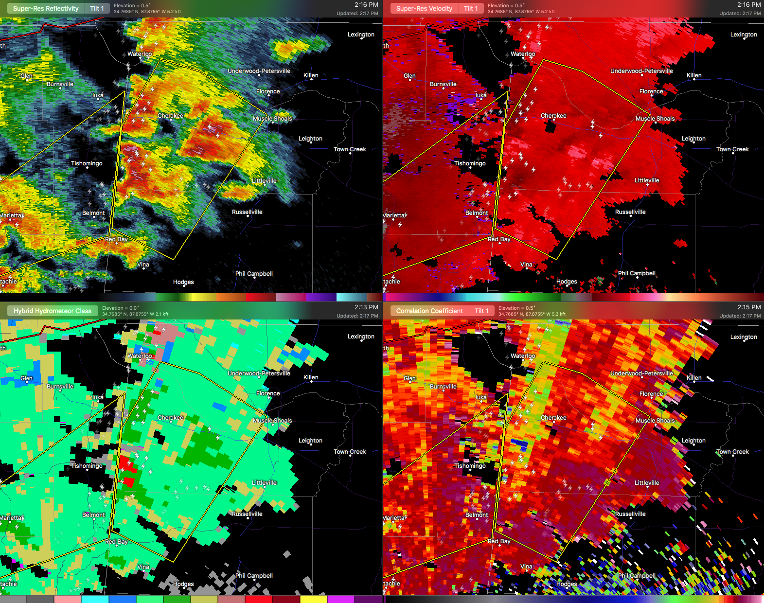

…A SEVERE THUNDERSTORM WARNING REMAINS IN EFFECT UNTIL 245 PM CDT FOR SOUTHWESTERN LAUDERDALE…WESTERN COLBERT AND NORTHWESTERN FRANKLIN COUNTIES… At 216 PM CDT, a severe thunderstorm was located near Tishomingo State Park, moving northeast at 30 mph. Another severe thunderstorm was located near Posey Loop moving northeast at 30 mph.
HAZARD…60 mph wind gusts and quarter size hail.
SOURCE…Radar indicated.
IMPACT…Hail damage to vehicles is expected. Expect wind damage to roofs, siding, and trees. Locations impacted include… Florence, Sheffield, Tuscumbia, Cherokee, Malone, Posey Loop, Allsboro, Wright, Red Rock and Pride Landing.
Category: ALL POSTS, Archived Warnings
About the Author (Author Profile)
Subscribe
If you enjoyed this article, subscribe to receive more just like it.


