Two Severe Weather Threats In The Days Ahead
MUST BE SPRING IN ALABAMA: The “wave train” will continue to push deep mid latitude upper troughs across the southern U.S. this week, bringing two opportunities for severe thunderstorms.
TOMORROW: The first event is tomorrow; SPC has much of the state in an “enhanced risk” of severe weather…
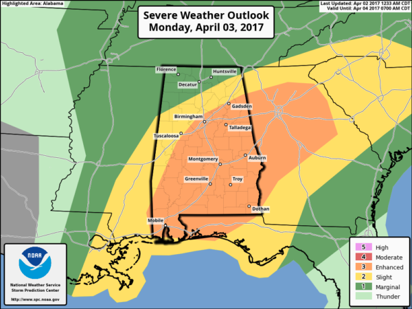
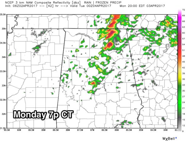
A batch of rain and storms will pass through the state tomorrow morning between 6:00 and 12:00 noon. Instability values will be less than impressive, but there will be good upper forcing/upward motion, and some of the morning storms could produce hail and strong gusty winds. An isolated tornado or two is possible… the highest tornado potential should be over the southern half of the state where instability values will be a little higher.
LATE AFTERNOON REDEVELOPMENT? Additional storms could form late tomorrow afternoon over North Alabama ahead of a cold front in a moist, unstable environment, but this is very conditional. If storms do happen to develop, they could become severe with a tornado threat. But, they will be very scattered in nature.
It all depends on the state of the atmosphere after the morning storms. Bottom line is that tomorrow will be an active weather day and everyone will need to pay attention to any watches and warnings that are issued.
WEDNESDAY: After a break Tuesday, another setup for severe storms arrives Wednesday. SPC has much of the state in a severe weather risk in their “Day 4” outlook…
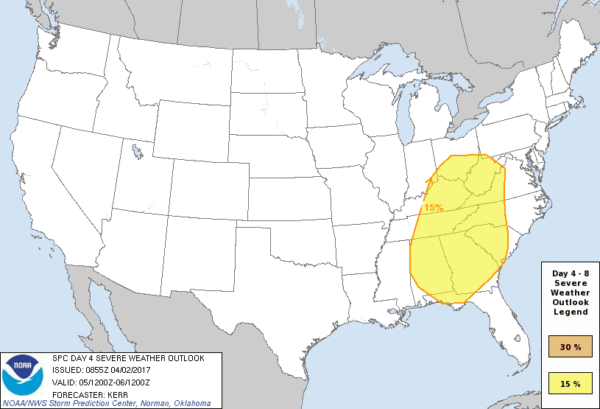
Long time readers know I will say we have to get through tomorrow’s event before we can really have high confidence on Wednesday, but it is clear we could see a much more substantial setup as forecast instability values are the highest so far this year by Wednesday afternoon/evening…
Coming during the peak of the daytime heating process and with extremely high instability values, all modes of severe storms will be possible Wednesday with potential for strong tornadoes. But, again, let’s get through tomorrow before we go “all in”. Just be aware of the potential.
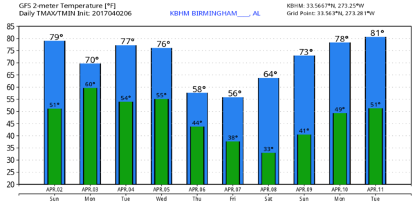
APRIL COLD SNAP: And… after Wednesday’s event much colder air returns… a good chance we drop into the 30s Friday and Saturday morning with some frost potential. You know my advice… don’t plant until April 15…
BE READY: Be sure you have a way of getting warnings; a NOAA Weather Radio is the baseline, and a good smart phone app is the other tier. Identify the safe place in your home, and be sure everyone knows where it is. And, in that safe place have helmets for everyone, along with hard sole shoes and preferably a portable airhorn in case you need help.
Be sure you have the ABC 33/40 app on your phone so you can watch our live severe weather coverage, if needed:
As always, we will be watching and look for frequent updates here.
Category: Alabama's Weather, ALL POSTS
About the Author (Author Profile)
James Spann is one of the most recognized and trusted television meteorologists in the industry. He holds the AMS CCM designation and television seals from the AMS and NWA. He is a past winner of the Broadcast Meteorologist of the Year from both professional organizations.Subscribe
If you enjoyed this article, subscribe to receive more just like it.


