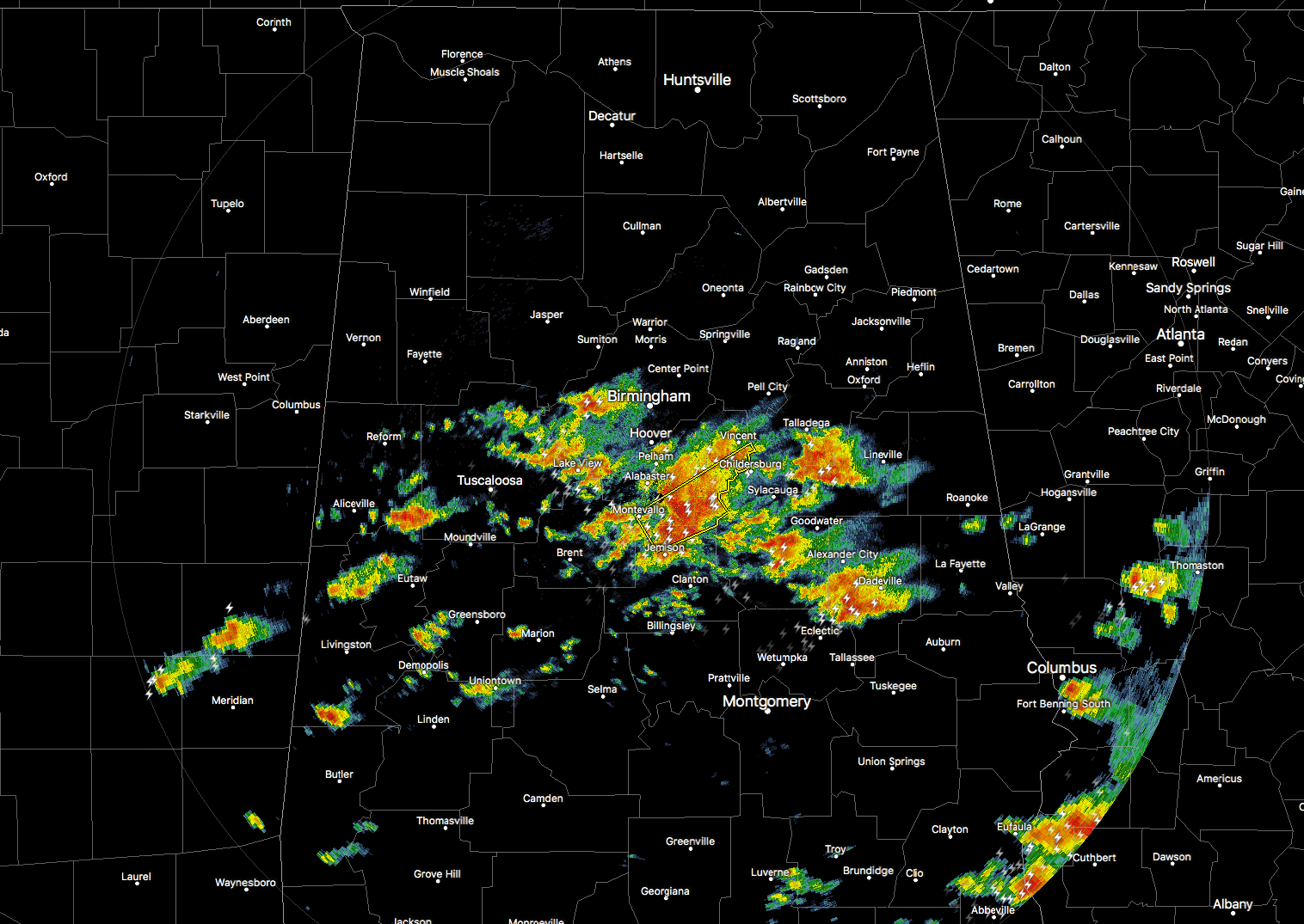
The Alabama Weather Situation At 5:20AM
RADAR CHECK
Storms are continuing to push to the northeast along the warm front that is currently over the central parts of Alabama. We only have one severe thunderstorm warning in effect for parts of Shelby and Chilton counties until 5:45AM. Penny-size hail has been reported with this storm as it is passing over the NWS Birmingham office at the Shelby County Airport.
A BRIEF UPDATE FOR TODAY
This round of strong to severe storms that are aligned with a warm front will continue to move northeastward through Central Alabama, and should be north of the area by 11AM. The main threat with these storms will be from large hail up to the size of baseballs, and damaging winds.
To the south of the front, isolated cells will develop and move to the northeast through the late morning and afternoon hours, and could impact all of Central Alabama. All modes of severe weather will be possible… damaging straight-line thunderstorm winds, large hail up to baseball size, and destructive long-track tornadoes. All of Central Alabama is in the threat for these, but the greatest threat area will be east of a line from Warrior to West Blocton to Uniontown.
A cold front will move through the area later this afternoon and evening, and more storms are expected to develop along and ahead of this line. All modes of severe weather will be possible with these storms as well.
Be vigilant today… keep your smartphones charged and have your NOAA Weather Radios close by. Be sure to stay updated through the day on our severe weather situation. Your safe place should be ready now. James Spann will have his morning Weather Xtreme post up soon.
Category: ALL POSTS


