The Alabama Weather Situation At 7:20AM
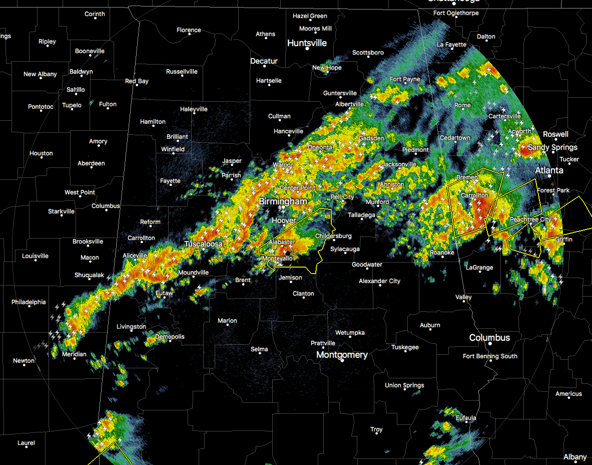
RADAR CHECK
A line of strong to severe thunderstorms is continuing to make its way northeastward through the northern parts of Central Alabama. We only have one current Severe Thunderstorm Warning in effect for Shelby County until 8:15AM. This line of storms is continuing to move northward with an associated warm front. Dewpoints are continuing to increase greatly to the south of the front, now into the lower 70s in the southern parts of the state to the south of Montgomery.
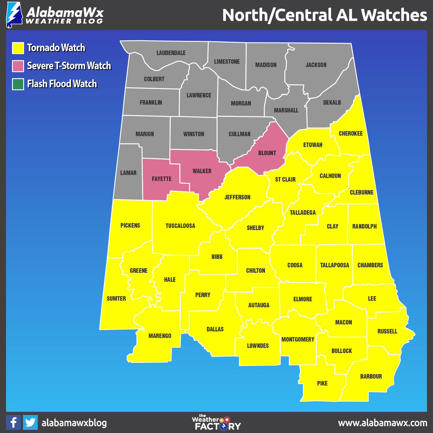
A Tornado Watch has just been issued for much of Central Alabama, including the metropolitan areas of Tuscaloosa and Birmingham.
A BRIEF UPDATE FOR TODAY
This round of strong to severe storms that are aligned with a warm front will continue to move northeastward through Central Alabama, and should be north of the area by 11AM. The main threat with these storms will be from large hail up to the size of baseballs, and damaging winds.
To the south of the front, isolated cells will develop and move to the northeast through the late morning and afternoon hours, and could impact all of Central Alabama. All modes of severe weather will be possible… damaging straight-line thunderstorm winds, large hail up to baseball size, and destructive long-track tornadoes. All of Central Alabama is in the threat for these, but the greatest threat area will be east of a line from Warrior to West Blocton to Uniontown.
A cold front will move through the area later this afternoon and evening, and more storms are expected to develop along and ahead of this line. All modes of severe weather will be possible with these storms as well.
Be vigilant today… keep your smartphones charged and have your NOAA Weather Radios close by. Be sure to stay updated through the day on our severe weather situation. Your safe place should be ready now.
Category: ALL POSTS
About the Author (Author Profile)
Scott Martin is an operational meteorologist, professional graphic artist, musician, husband, and father. Not only is Scott a member of the National Weather Association, but he is also the Central Alabama Chapter of the NWA president. Scott is also the co-founder of Racecast Weather, which provides forecasts for many racing series across the USA. He also supplies forecasts for the BassMaster Elite Series events including the BassMaster Classic.Subscribe
If you enjoyed this article, subscribe to receive more just like it.


