Tornado Warning Expired For Parts Of Barbour And Bullock Counties
…THE TORNADO WARNING FOR SOUTHEASTERN BULLOCK AND NORTHWESTERN
BARBOUR COUNTIES HAS EXPIRED…
The storm which prompted the warning has weakened below severe
limits, and has exited the warned area. Therefore, the warning has
been allowed to expire.
To report severe weather, contact your nearest law enforcement
agency. They will relay your report to the National Weather Service
Birmingham.
Tornado Warning Issued For Parts Of Barbour And Bullock Counties Until 12:45PM
Apr 27th @ 12:04 pm

The National Weather Service in Birmingham has issued a
* Tornado Warning for…
Southeastern Bullock County in southeastern Alabama…
Northwestern Barbour County in southeastern Alabama…
* Until 1245 PM CDT
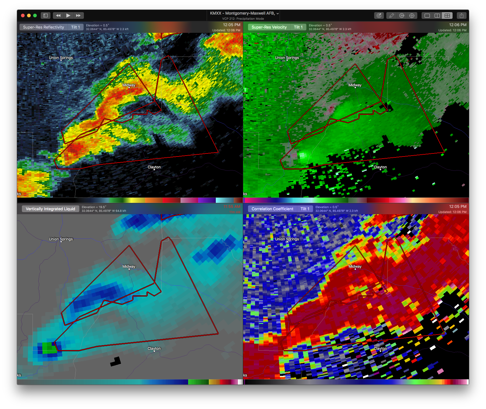
* At 1203 PM CDT, a severe thunderstorm capable of producing a tornado was located near Boot Hill, or 13 miles northeast of
Brundidge, moving northeast at 30 mph.
HAZARD…Tornado and quarter size hail.
SOURCE…Radar indicated rotation.
IMPACT…Flying debris will be dangerous to those caught without shelter. Mobile homes will be damaged or destroyed.
Damage to roofs, windows, and vehicles will occur. Tree damage is likely.
* Locations impacted include…
Clayton, Comer, Barbour County Public Lake Dam, Tanyard and Mount
Andrew.
Category: ALL POSTS, Archived Warnings
About the Author (Author Profile)
Subscribe
If you enjoyed this article, subscribe to receive more just like it.


