Strong Storm Approaching Multiple Locations in Central Alabama
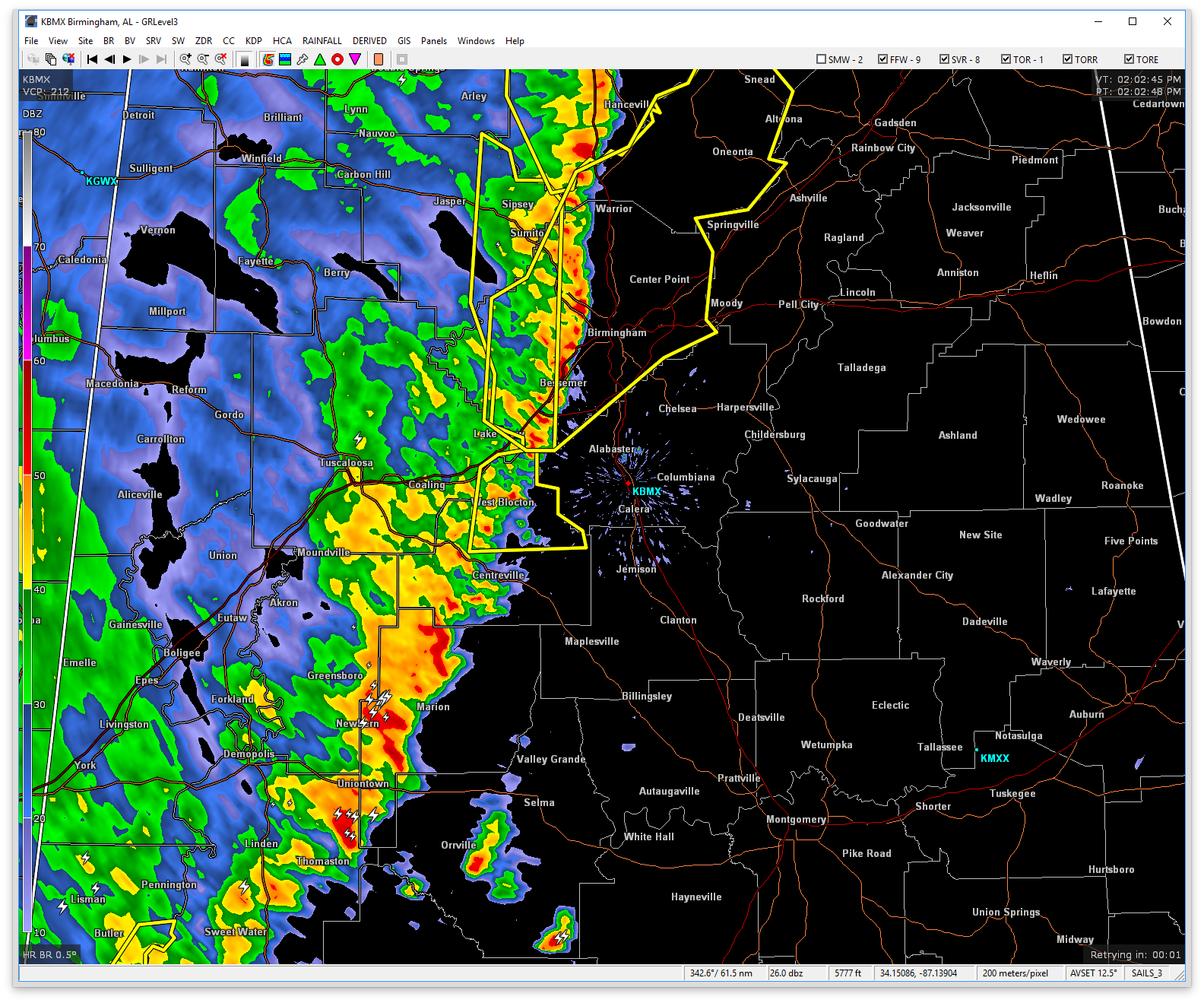
At 201 PM CDT, Doppler radar was tracking strong thunderstorms along a line extending from Eoline to near Dixons Mill. Movement was east northeast at 45 mph. Winds in excess of 40 mph will be possible with these storms.
A SIGNIFICANT WEATHER ADVISORY has been issued for portions of Chilton, Hale, Autauga, Bibb, Marengo, Dallas, and Perry counties until 3:00PM.
Locations impacted include…
Selma, Calera, Clanton, Brent, Valley Grande, Marion, Centreville, Jemison, Linden, Uniontown, Selmont-West Selmont, Thorsby, Maplesville, Thomaston, Sweet Water, Orrville, Newbern, Faunsdale, Dayton and Gap Of The Mountain.
These storms may intensify, so be certain to monitor local radio stations and available television stations for additional information and possible warnings from the National Weather Service.
Category: ALL POSTS
About the Author (Author Profile)
Scott Martin is an operational meteorologist, professional graphic artist, musician, husband, and father. Not only is Scott a member of the National Weather Association, but he is also the Central Alabama Chapter of the NWA president. Scott is also the co-founder of Racecast Weather, which provides forecasts for many racing series across the USA. He also supplies forecasts for the BassMaster Elite Series events including the BassMaster Classic.Subscribe
If you enjoyed this article, subscribe to receive more just like it.


