Tornado Warning Expired For Parts Of Cullman And Morgan Counties
…THE TORNADO WARNING FOR NORTH CENTRAL CULLMAN AND SOUTHEASTERN
MORGAN COUNTIES WILL EXPIRE AT 230 PM CDT…
The storm which prompted the warning has weakened below severe
limits, and no longer appears capable of producing a tornado.
Therefore the warning will be allowed to expire.
Remember, a Severe Thunderstorm Warning still remains in effect for
much of Morgan and Cullman Counties until 3 PM CDT.
A tornado watch remains in effect until 700 PM CDT for north central
and northwestern Alabama. A tornado watch also remains in effect
until 700 PM CDT for north central and northeastern Alabama.
Tornado Warning Continues For Parts Of Cullman And Morgan Counties Until 2:30PM
Apr 30th @ 2:09 pm

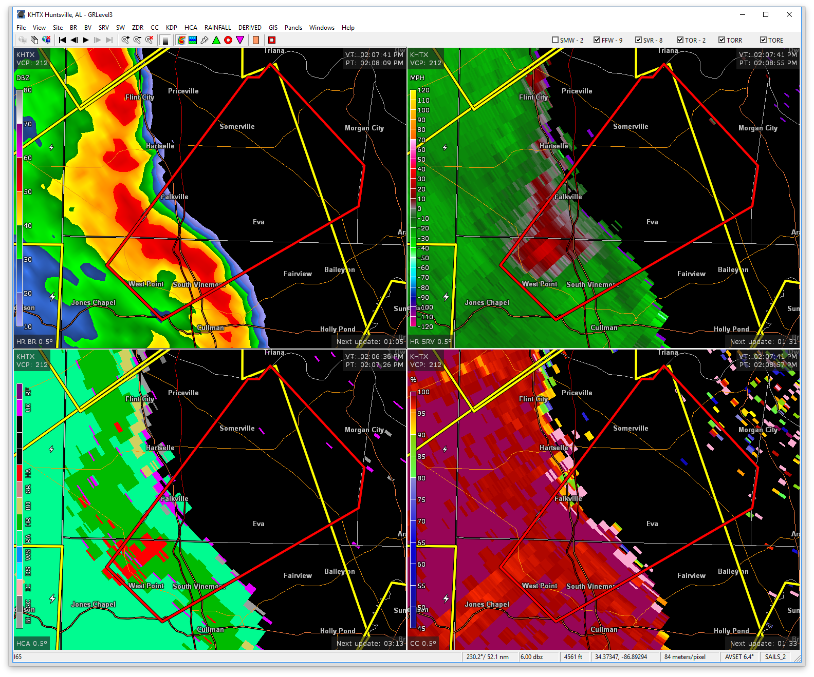
…A TORNADO WARNING REMAINS IN EFFECT UNTIL 230 PM CDT FOR NORTH CENTRAL CULLMAN AND SOUTHEASTERN MORGAN COUNTIES… At 216 PM CDT, a severe thunderstorm capable of producing a tornado was located near Lacon, near Interstate 65 Exit 318, moving northeast at 35 mph.
HAZARD…Tornado.
SOURCE…Radar indicated rotation.
IMPACT…Flying debris will be dangerous to those caught without shelter. Mobile homes will be damaged or destroyed. Damage to roofs, windows, and vehicles will occur. Tree damage is likely. Locations impacted include… Falkville, Vinemont, Somerville, Eva, Valhermoso Springs, Cole Springs, Lacon and Florette.
Tornado Warning Issued For Parts Of Cullman And Morgan Counties Until 2:30PM
Apr 30th @ 2:09 pm

The National Weather Service in Huntsville Alabama has issued a
* Tornado Warning for…
North central Cullman County in north central Alabama…
Southeastern Morgan County in north central Alabama…
* Until 230 PM CDT
* At 208 PM CDT, a severe thunderstorm capable of producing a tornado was located 2 miles west of Vinemont, or 8 miles northwest of Cullman, moving northeast at 40 mph.
HAZARD…Tornado.
SOURCE…Radar indicated rotation.
IMPACT…Flying debris will be dangerous to those caught without shelter. Mobile homes will be damaged or destroyed.
Damage to roofs, windows, and vehicles will occur. Tree damage is likely.
* This tornadic thunderstorm will remain over mainly rural areas of north central Cullman and southeastern Morgan Counties, including the following locations: Valhermoso Springs, Cole Springs, Battleground, Eva and Lacon.
Category: ALL POSTS, Archived Warnings
About the Author (Author Profile)
Subscribe
If you enjoyed this article, subscribe to receive more just like it.


