Picture Perfect Weather At Midday Across Central Alabama
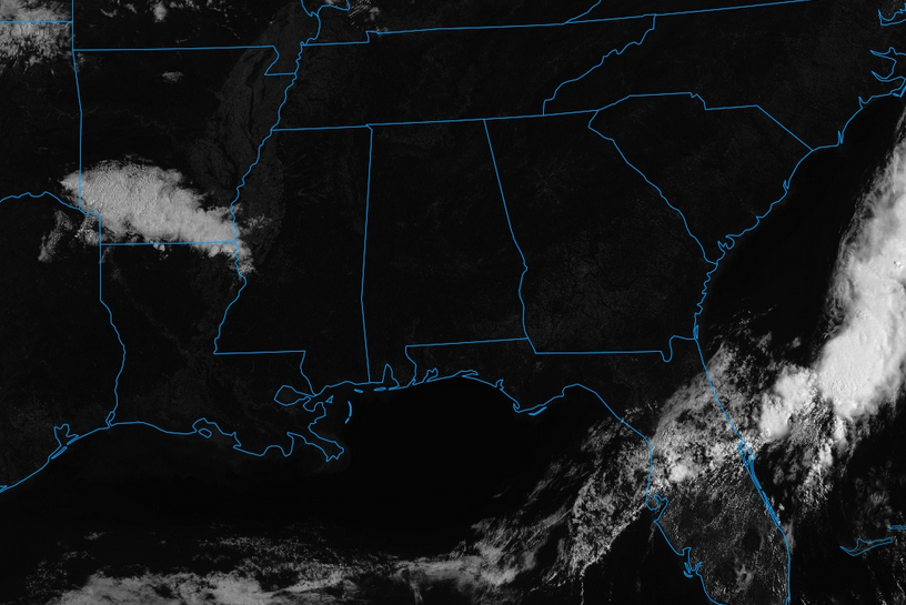
GOES-16 Visible Satellite Imagery (experimental, non-operational)
Just an absolutely beautiful day across Central Alabama as we are starting to approach the noon hour. Skies across the area are completely clear, allowing for maximum sunshine to reach the surface. And , of course, with maximum sunshine, that also means no rain at all anywhere near the area. The closest shower activity to us at this point is well back to the west over the south-central parts of Arkansas.
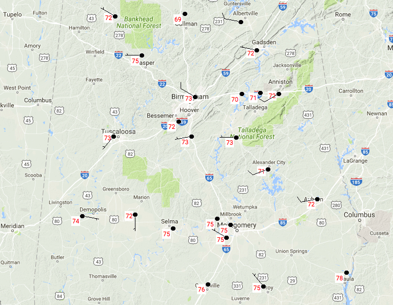
Temperatures at 11:12AM are currently running in the 70s across the area, with mostly lower to mid 70s north of the I-20 corridor, and mid to upper 70s to the south of that. The cool spot at this time is Cullman at 69 degrees, while the warm spot is currently Eufaula at 78 degrees.
For the remainder of the day today, no clouds will be able to take away the sunshine at all. Skies will be clear throughout the afternoon and into the evening hours tonight. Afternoon highs will be in the lower to mid 80s across the area. Winds will be light for the most part, out of the west to northwest at 5-10 MPH. Overnight lows will fall into the 50s throughout the area, under clear skies.
On Wednesday, we’ll have an approaching trough that will bring in an increase in cloud cover and the risk for rain, especially for the late evening and into the overnight hours. The daytime hours on Wednesday will be warm under mostly clear to sunny skies. Afternoon highs will be in the lower to mid 80s.
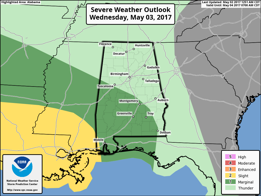
For the evening hours, it appears that we’ll have a high shear/low CAPE setup in the atmosphere over the southern 2/3rds of Central Alabama. SPC has an area defined in a marginal risk for severe storms on Wednesday evening through Thursday morning, roughly south of a line from near Tuscaloosa to just north of Montgomery to Dothan. A line of storms will move into the western counties after 8PM and transverse across the area during the overnight and into the late morning hours on Thursday. The main threat will be from damaging wind gusts, but a few brief spin-up tornadoes are possible.
Remember, we are still in the peak of our severe weather season, and every system bears watching. While the overall threat looks low, we still need to keep our eye on this. At this time of the year when it comes to thunderstorms, you have to “expect the unexpected.”
BEACH FORECAST
From the shores of Fort Morgan to the sands of Panama City Beach, click here to see what the forecast holds on our Beach Forecast Center page. Save Up To 25% on Spring Break Beach Vacations on the Alabama Gulf Coast with Brett/Robinson! The Beach Forecast is partially underwritten by the support of Brett/Robinson Vacation Rentals in Gulf Shores and Orange Beach. Click here to see Brett/Robinson’s best beach offers now!
ON THIS DAY IN WEATHER HISTORY – May 2, 1929
Virginia’s worst tornado disaster occurred. Six tornadoes, two of which were west of the Blue Mountains, killed 22 people. Twelve children and a teacher were killed at Rye Cove, in Scott County. Four schools were destroyed by the storms.
WEATHERBRAINS
Don’t forget you can listen to the weekly 90 minute netcast anytime on the web, or on iTunes. This is the show all about weather featuring many familiar voices, including meteorologists at ABC 33/40. Shows are usually produced on Monday evenings starting at 8:30 CDT… you can watch it live here.
ADVERTISE WITH US
Deliver your message to a highly engaged audience by advertising on the AlabamaWX.com website. Over 4 million pages views just since April 1st! Don’t miss out! We can customize a creative, flexible and affordable package that will suit your organization’s needs. We would love to work with you. Contact Bill Murray at (205) 687-0782 for more information.
Category: Alabama's Weather, ALL POSTS
About the Author (Author Profile)
Scott Martin is an operational meteorologist, professional graphic artist, musician, husband, and father. Not only is Scott a member of the National Weather Association, but he is also the Central Alabama Chapter of the NWA president. Scott is also the co-founder of Racecast Weather, which provides forecasts for many racing series across the USA. He also supplies forecasts for the BassMaster Elite Series events including the BassMaster Classic.Subscribe
If you enjoyed this article, subscribe to receive more just like it.


