

A Quick Update On Central Alabama’s Weather Situation At 4:45PM
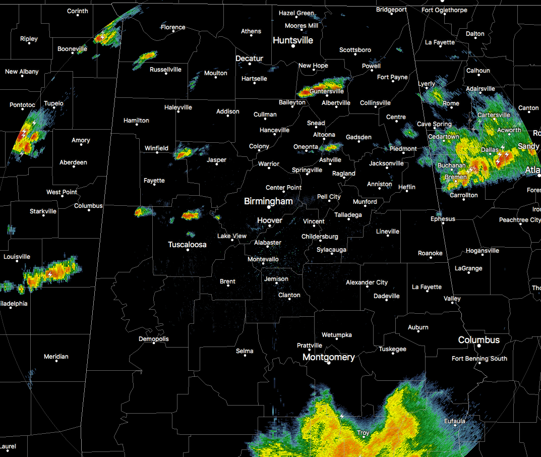
Radar is relatively quiet across much of Central Alabama at this point, with the few exceptions of a few isolated showers out there. Down to the south in Pike and Barbour counties, a good soaking rain is currently falling. As far as any strong storms at this point, there are none across Central Alabama at this point.
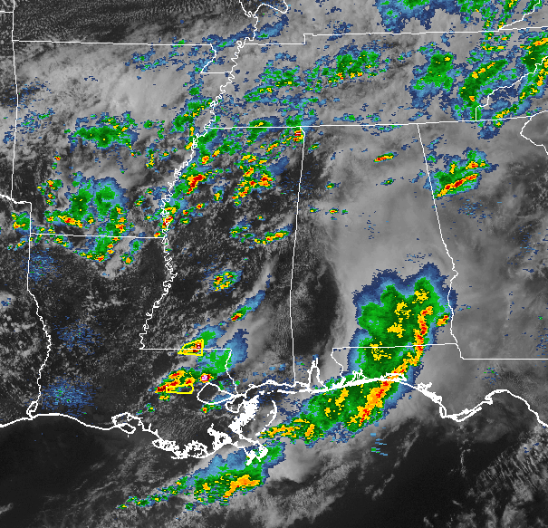
As you can see, back to our west in Mississippi and down in Louisiana, more showers and thunderstorms have formed and a few severe thunderstorm warnings have been issued for a few counties. These will continue to move to the east and push into the state later this evening and into tonight.
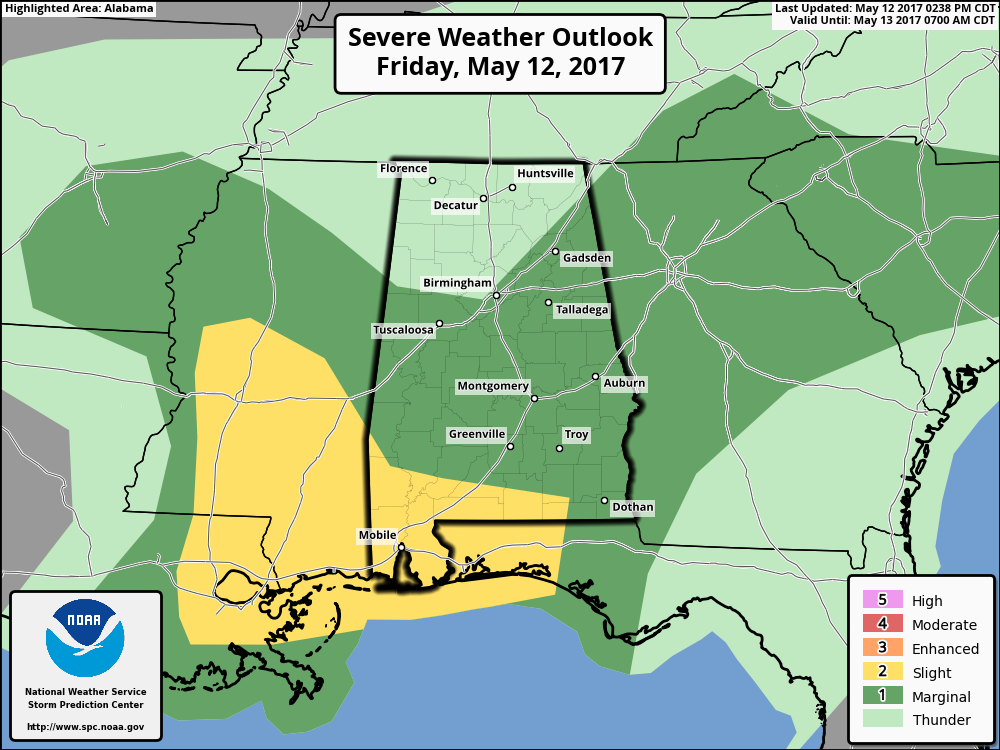
SPC maintains a Marginal Risk for severe storms for most of Central Alabama. Some of the heavier storms could produce small hail and strong gusty winds… and the good news is that there is no meaningful tornado threat over the Alabama. We could have additional rain amounts of 1/2 inch, and rain will come to an end from west to east soon after midnight tonight.
Category: Alabama's Weather, ALL POSTS
About the Author (Author Profile)
Scott Martin is an operational meteorologist, professional graphic artist, musician, husband, and father. Not only is Scott a member of the National Weather Association, but he is also the Central Alabama Chapter of the NWA president. Scott is also the co-founder of Racecast Weather, which provides forecasts for many racing series across the USA. He also supplies forecasts for the BassMaster Elite Series events including the BassMaster Classic.Subscribe
If you enjoyed this article, subscribe to receive more just like it.


