

Strong Storms Affecting Calhoun, Cleburne, & Cherokee Counties
SIGNIFICANT WEATHER ADVISORY FOR EAST CENTRAL CALHOUN, NORTHEASTERN CLEBURNE, AND SOUTHEASTERN CHEROKEE COUNTIES UNTIL 11:45AM CDT
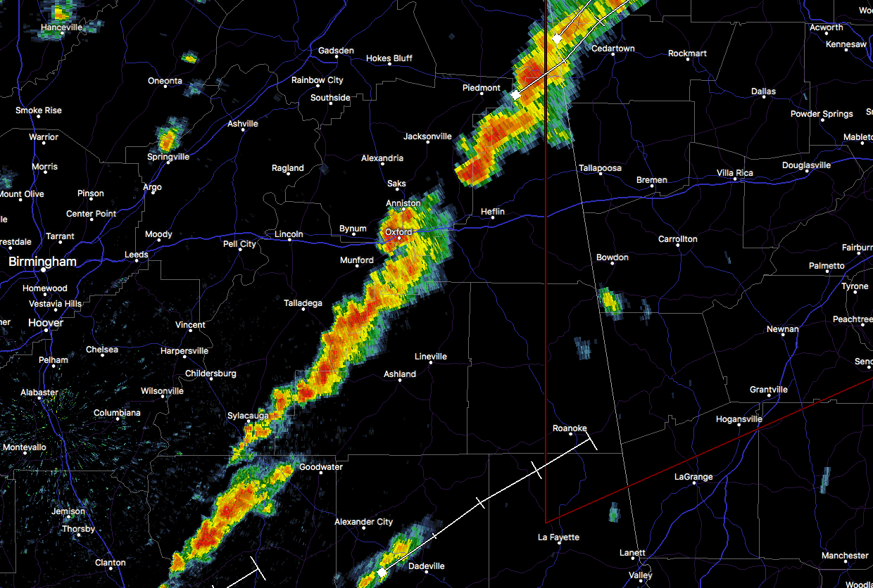
At 11:16 AM CDT, Doppler radar was tracking strong thunderstorms along a line extending from near Pleasant Gap to 6 miles northwest of Heflin. Movement was northeast at 25 mph. Winds in excess of 40 mph will be possible with these storms.
Locations impacted include…
Mars Hills, Oak Level, Sweetwater Lake, Borden Springs, Liberty Hill and Coleman Lake And Campground.
Torrential rainfall is also occurring with these storms, and may lead to localized flooding. Do not drive your vehicle through flooded roadways.
Category: Alabama's Weather, ALL POSTS
About the Author (Author Profile)
Scott Martin is an operational meteorologist, professional graphic artist, musician, husband, and father. Not only is Scott a member of the National Weather Association, but he is also the Central Alabama Chapter of the NWA president. Scott is also the co-founder of Racecast Weather, which provides forecasts for many racing series across the USA. He also supplies forecasts for the BassMaster Elite Series events including the BassMaster Classic.Subscribe
If you enjoyed this article, subscribe to receive more just like it.


