

Midday Check On Central Alabama’s Weather Situation
RADAR CHECK
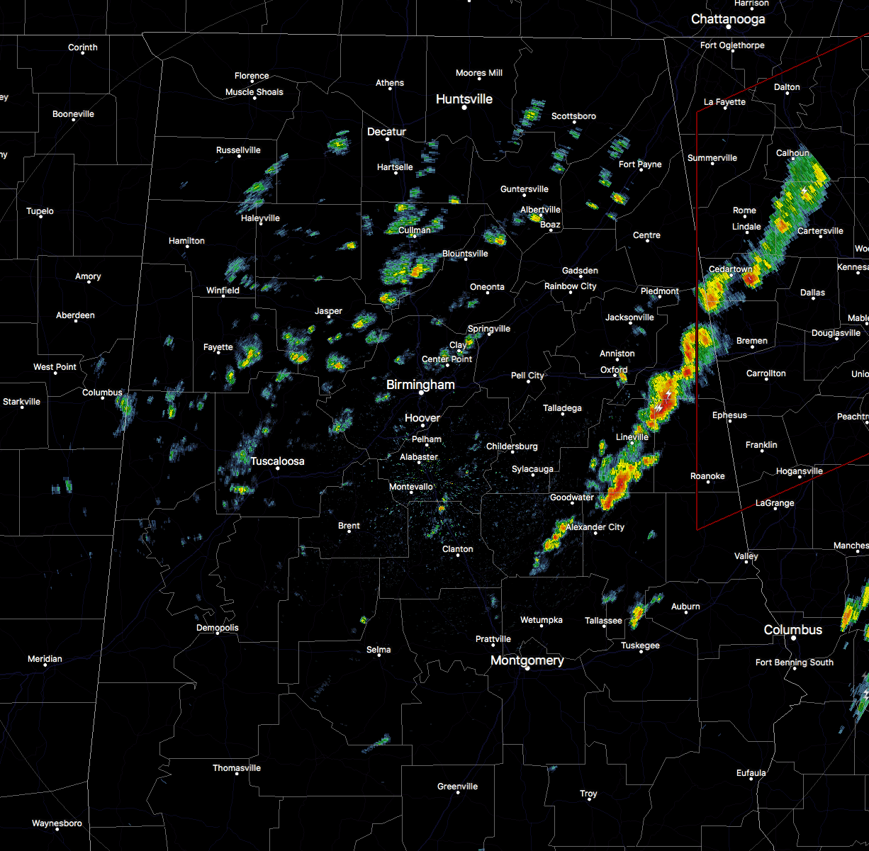
Currently at the midday hour across Central Alabama, we still have the line of storms associated with a shortwave continuing to slowly push through the eastern parts of the area. A few of these storms are strong, especially in portions of Cleburne and Clay counties. The cells in the line are moving to the northeast at 25 MPH, while the line is slowly progressing eastward.
For the rest of Central Alabama, we have breaks in the clouds throughout the area, but we also have widely scattered showers throughout as well, especially north of the I-20 corridor.
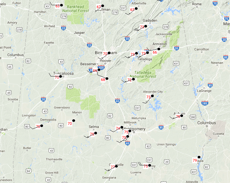
Temperatures at this time are in the 60s and 70s throughout the area. Birmingham is currently at 70 degrees at 11:54AM, with Haleyville as the cool spot at 63 degrees, and Eufaula as the warm spot at 79 degrees.
REMAINDER OF THE DAY
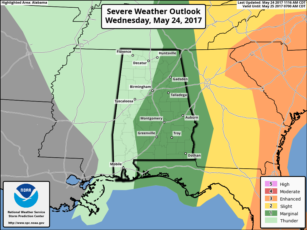
After this first line of storms pushes out of the state, we’ll have scattered to numerous showers and thunderstorms develop and move through along with the upper low as it pushes through. The Marginal Risk for severe storms has been extended a little westward and now includes the Birmingham metropolitan area. More than likely, the storms that develop this afternoon and evening will be general thunderstorms, but one or two could be strong. The main threat would be from damaging wind gusts, but the better dynamics will be east of the state keeping the severe threat really low. Afternoon highs are expected to be in the 70s, with one or two locations in the extreme southeastern corner of the area hitting 80 degrees. Lows tonight will be in the lower to mid 50s.
A WAY BETTER DAY ON THURSDAY
Drier air will make a triumphant return to Central Alabama, and so will the sunshine. Skies will be mostly sunny and temperatures will be relatively cool for late may, with highs reaching the mid to upper 70s across the area.
The SEC Baseball Tournament returns to the Hoover Met this week, May 23–28. Come see some of the best college players in the country as they compete for the championship. Also, for the first time ever, you can take advantage of the Hoover Metropolitan Complex which will feature a free, indoor Fan Fest – ferris wheel, sports bar and much more! Tickets start at only $9!
BEACHBOUND: For a detailed look at the weather from Fort Morgan over to Panama City Beach, Click here to see the Beach Forecast Center page. The Beach Forecast is partially underwritten by the support of Brett/Robinson Vacation Rentals in Gulf Shores and Orange Beach. Click here to see Brett/Robinson’s best beach offers now!
ON THIS DAY IN WEATHER HISTORY – 1989
Thunderstorms developing ahead of a cold front produced severe weather across the Upper Midwest through the day and night. Thunderstorms spawned 30 tornadoes, and there were 158 reports of large hail and damaging winds. A strong (F-3) tornado caused five million dollars damage at Corning, IA, and a powerful (F-4) tornado caused five million dollars damage at Traer, IA. Thunderstorm winds gusting to 88 mph killed one person and injured five others at Stephensville, WI.
Category: Alabama's Weather, ALL POSTS
About the Author (Author Profile)
Scott Martin is an operational meteorologist, professional graphic artist, musician, husband, and father. Not only is Scott a member of the National Weather Association, but he is also the Central Alabama Chapter of the NWA president. Scott is also the co-founder of Racecast Weather, which provides forecasts for many racing series across the USA. He also supplies forecasts for the BassMaster Elite Series events including the BassMaster Classic.Subscribe
If you enjoyed this article, subscribe to receive more just like it.


