A Quick Check Of Central Alabama’s Weather At 10:55AM
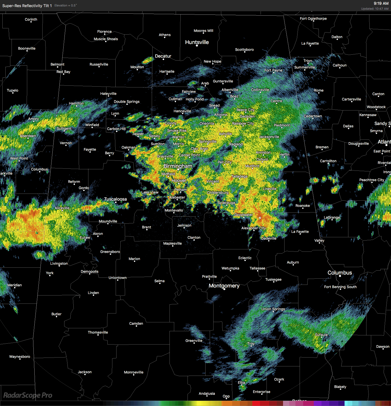
At this time, we are dealing with rainfall that continues to fall pretty much over the same areas in Central Alabama, especially over parts of Jefferson, Blount, and Walker counties.
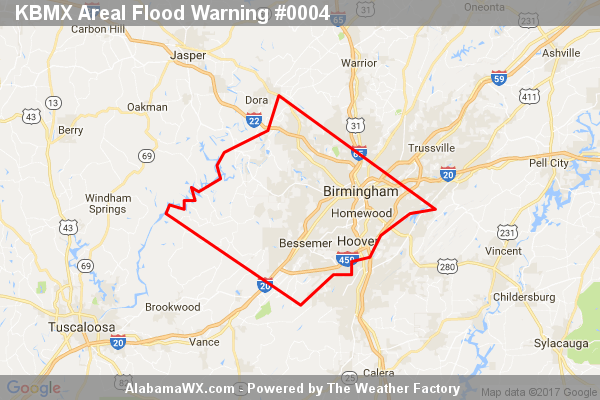
There continues to be an Areal Flood Warning until 11:15AM for the central Parts of Jefferson County, including the Birmingham metropolitan area, Bessemer, Homewood, Hoover, Hueytown, Fairfield, Fultondale, Pleasant Grove, Tarrant, Midfield, Adamsville, Brighton, Lipscomb, Graysville, Sylvan Springs, Brookside and Mulga.
We have several reports of flooding already… one report (NWS Chat) of a ditch overflowing and flooding a resident’s home. Several reports of flooding in Vestavia Hills by Pizitz Middle School in via Twitter. Another report on Twitter shows Patton Creek is close to overflowing Southland Drive. Another report in from John Talbot stating significant road flooding on Rocky Ridge Road and Dolly Ridge Road.
The good news is the intensity of the rainfall is starting to let up, but rain is still falling in these areas. Please do not travel in these locations until we get the all clear on these roads. Do not cross a flooded roadway at all… Turn Around, Don’t Drown!
Fortunately, a cold front will be working its way southward through the area today, and we’ll have sunny and dry conditions to finish out the work week.
Category: Alabama's Weather, ALL POSTS
About the Author (Author Profile)
Scott Martin is an operational meteorologist, professional graphic artist, musician, husband, and father. Not only is Scott a member of the National Weather Association, but he is also the Central Alabama Chapter of the NWA president. Scott is also the co-founder of Racecast Weather, which provides forecasts for many racing series across the USA. He also supplies forecasts for the BassMaster Elite Series events including the BassMaster Classic.Subscribe
If you enjoyed this article, subscribe to receive more just like it.


