

A Quick Check Of Central Alabama’s Weather at 12:50PM
RADAR CHECK
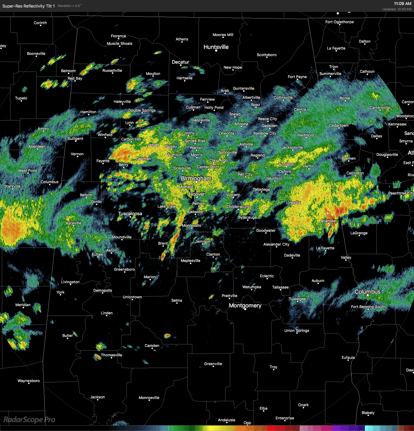
The shower activity is really starting to dissipate some in the middle of Central Alabama as we approach the 1 o’clock hour, and allowing any flood waters to recede from where they were just a couple of hours ago. The main focus of the shower activity has shifted to near the state line on the east and west side of the states, with several scattered thunderstorms developing over the southern parts of the area. Precipitable water values are near 2.00 inches over Central Alabama, so if your are caught under a shower, expect plenty of rainfall that could possibly lead to localized flash flooding.
TEMPERATURE CHECK
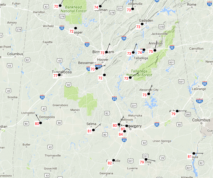
Temperatures at 12:45PM are in the lower to mid 70s in the northern parts of the area, thanks in part to the thick cloud cover and rainfall that has occurred or continues to fall. In the southern parts of the area, temperatures are mostly in the upper 70s to the lower 80s. Montgomery is up to 84 degrees at this time, making it the warm spot in the area.
FOR THE REST OF THE TODAY
Rainfall will slowly push southward as a cold front will begin to move through the area later this afternoon and evening hours. As this happens, the rain will start to end starting in the northern parts and moving south. Afternoon highs will be held back due to the rain and clouds, only making it into the mid to upper 70s for the northern half of Central Alabama, and into the upper 70s to the mid 80s in the south. Rainfall should end for nearly everyone in Central Alabama by midnight tonight, with the exception of the extreme southeastern parts of the area. Lows will be in the 60s.
A MUCH BETTER DAY ON WEDNESDAY
The cold front will have pushed all of the way through the area, and drier continental air will replace the warm muggy airmass that was in place. A few lingering showers may be hanging tough in the southeastern corner of the area, but those will quickly push out during the morning. Skies will be mostly sunny and highs will be in the lower to mid 80s.
A LOOK AT THE TROPICS
All remains quiet and no tropical storms are expected to form within the next 5 days in the Atlantic or Gulf of Mexico.
HEADING TO THE BEACH
After today, it will begin to dry out and skies will clear for Wednesday through the day on Sunday. Click here to see the AlabamaWx Beach Forecast Center page.
The Beach Forecast is partially underwritten by the support of Brett/Robinson Vacation Rentals in Gulf Shores and Orange Beach. Click here to see Brett/Robinson’s Own Your Summer specials now!
WEATHERBRAINS
Don’t forget you can listen to our weekly 90 minute netcast anytime on the web, or on iTunes. This is the show all about weather featuring many familiar voices, including our meteorologists here at ABC 33/40. We will produce this week’s episode tonight at 8:30… you can watch it live here.
Category: Alabama's Weather, ALL POSTS
About the Author (Author Profile)
Scott Martin is an operational meteorologist, professional graphic artist, musician, husband, and father. Not only is Scott a member of the National Weather Association, but he is also the Central Alabama Chapter of the NWA president. Scott is also the co-founder of Racecast Weather, which provides forecasts for many racing series across the USA. He also supplies forecasts for the BassMaster Elite Series events including the BassMaster Classic.Subscribe
If you enjoyed this article, subscribe to receive more just like it.


