Midday Check On Our Weather, And What Does Tomorrow Hold For Central Alabama
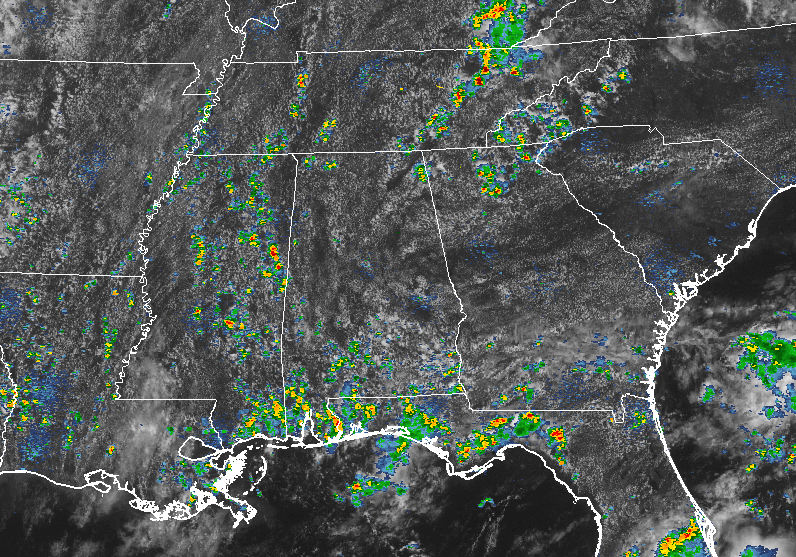
It is relatively quiet across much of Central Alabama during the midday hour, with a mix of sun and clouds and only some scattered shower activity in the extreme southern portions of the area. There is one shower that has popped up on the county lines of Lamar and Pickens counties. Much of the action close to home is occurring over the surrounding states, especially in the panhandle of Florida and the northeastern parts of Tennessee. There are scattered showers throughout the southeastern states, but those have the most active.
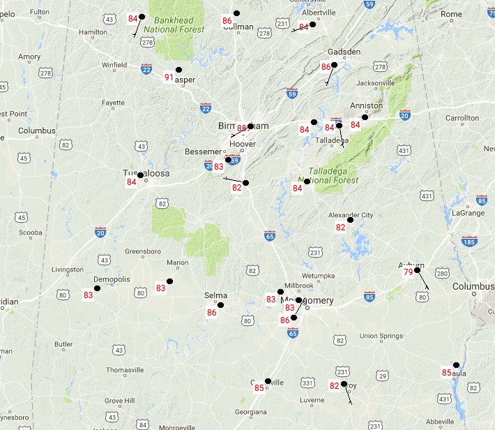
TEMPERATURES AT MIDDAY
At 12:44 PM, temperatures are in the mid to upper 80s across much of Central Alabama. Birmingham is the warmest location at 88 degrees, while the cool spot is Auburn at 79 degrees.
FOR THE REST OF THE DAY
Well continue to have a mix of sun and clouds with a standard summertime risk of isolated to scattered showers and thunderstorms. It will be hot and muggy out there, with highs reaching the upper 80s to the lower 90s throughout the area. Much of the shower activity will diminish for tonight, but a few could linger on into the late night to the overnight hours. Otherwise, skies will be mostly clear to partly cloudy, and lows will be in the upper 60s to the lower 70s. Some patchy fog is possible especially where rainfall occurs during the late afternoon through the evening hours.
THURSDAY’S WEATHER
We’ll have a mix of sun and clouds once again throughout much of the day in Central Alabama, with the standard summertime risk of scattered showers and storms. Afternoon highs will be in the mid to upper 90s, with a few locations hitting 90 degrees.
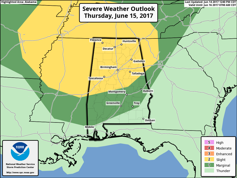
For tomorrow evening, we will have a Slight Risk for severe storms for a little over the northern half of the state, with nearly the remainder of the state in a Marginal Risk.
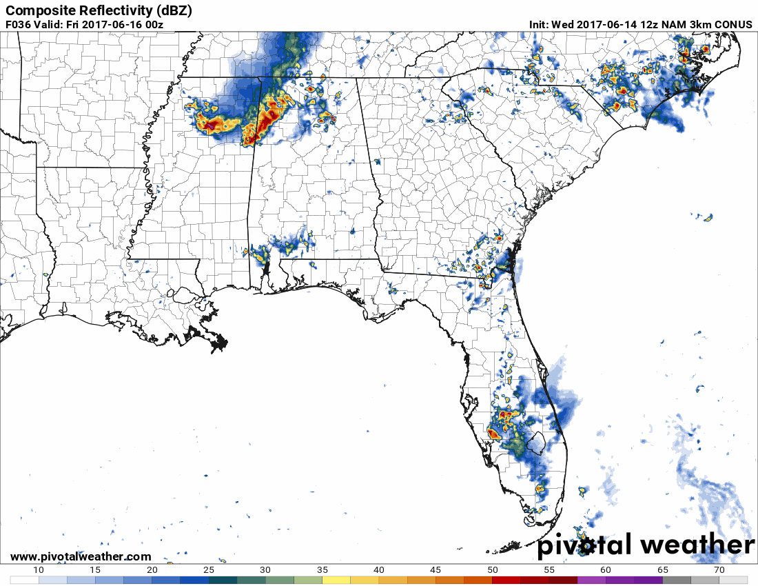
The culprit will be a MCS that is expected to form at some point during the day and will enter the state around the 4PM-6PM time frame and progress southeastward into Central Alabama by 9PM-11PM. There is no tornado threat with this event, but strong to damaging straight-line thunderstorm winds will be possible. Good new is that it should be on a weakening trend as it reaches Central Alabama, but we do need to stay aware of the situation throughout the evening. It looks like it will fizzle out well before sunrise, but more scattered storms are expected to move through afterwords. Overnight lows will be in the upper 60s to the mid 70s.
HEADING TO THE BEACH
For a detailed look at the weather from Fort Morgan over to Panama City Beach, click here to see the AlabamaWx Beach Forecast Center page. The Beach Forecast is partially underwritten by the support of Brett/Robinson Vacation Rentals in Gulf Shores and Orange Beach. Click here to see Brett/Robinson’s Own Your Summer specials now!
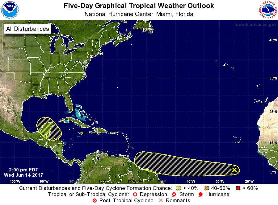
TROPICAL UPDATE
We currently have two areas to keep our eyes on throughout the next several days… Number 1 is a tropical wave is located several hundred miles south of the Cabo Verde Islands, but development of this system, if any, is expected to be slow to occur during the next several days while the wave moves westward near 20 MPH. Number two is the possibility of abroad area of low pressure to form over the northwestern Caribbean Sea and adjacent land areas by the weekend. Some gradual development of this system is possible thereafter while it moves slowly northwestward toward the southwestern Gulf of Mexico.
TODAY IN WEATHER HISTORY
June 14, 1989 – Thunderstorms developing ahead of a cold front produced severe weather from the Central Gulf States to the Middle Atlantic Coast Region during the day and into the night. There were 62 reports of large hail and damaging winds. Thunderstorm winds caused 28 million dollars damage in Montgomery County MD.
WEATHERBRAINS
It was a great show this week with Lans Rothfusz from the National Severe Storms Laboratory talking about progress on the new severe weather warning paradigm called FACETS. Lans also updated us on Warn on Forecast. Check out the show at www.WeatherBrains.com. You can also subscribe on iTunes.
Category: Alabama's Weather, ALL POSTS
About the Author (Author Profile)
Scott Martin is an operational meteorologist, professional graphic artist, musician, husband, and father. Not only is Scott a member of the National Weather Association, but he is also the Central Alabama Chapter of the NWA president. Scott is also the co-founder of Racecast Weather, which provides forecasts for many racing series across the USA. He also supplies forecasts for the BassMaster Elite Series events including the BassMaster Classic.Subscribe
If you enjoyed this article, subscribe to receive more just like it.


