

A Quick Look At Our Weather Situation At 10:00AM
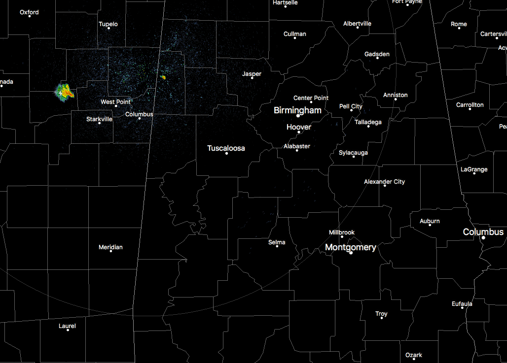
At this point across Central Alabama, the radar is pretty quiet across the area, with the exception of a few isolated showers showing up in Lamar County. These are pushing to the east-southeast. There is another small thunderstorm that is back over the corners of Calhoun, Chickasaw, and Wester counties, but that is about it close to home.
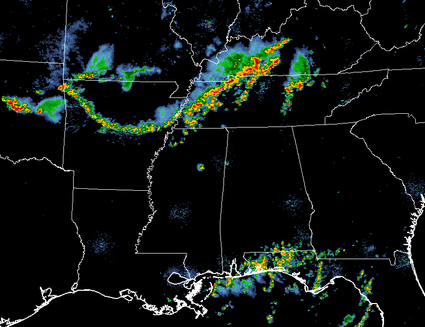
The main focus of thunderstorm activity is currently a line that originates in Central Kentucky and stretches back to the southwest through Western Tennessee and into Arkansas. I believe this is where our threat for strong to severe storms will come from later today… if it holds together.
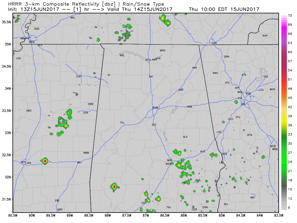
The latest run of the HRRR is showing that the line will break apart, but scattered to numerous showers and storms will start to form around 10AM-12PM time frame and continue to form during the afternoon and evening hours. More storms will form along the boundary that is left over from the line of storms, and we will have active storms through midnight tonight.
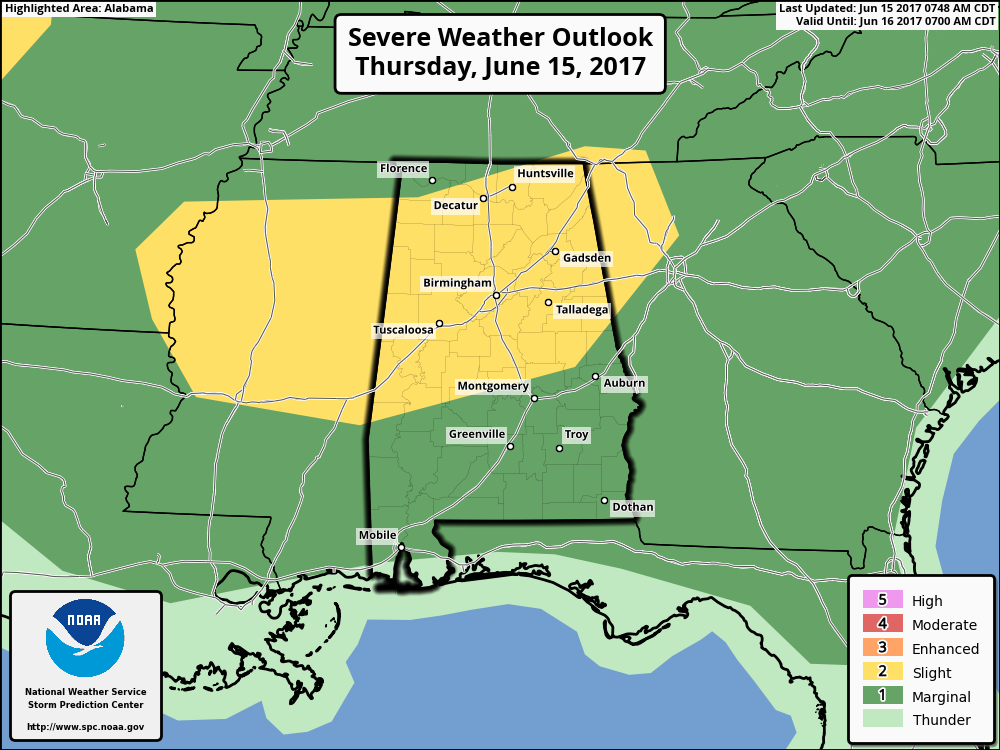
SPC has the entire state under some risk of severe storms today and through tonight, with the northern half of the state in a Slight Risk, and the remainder of the state in a Marginal Risk. There will be no tornado threat with today’s storms, but the main threat will be from damaging straight-line thunderstorm winds.
With that being said, straight-line winds can do as much damage as a tornado, so please stay weather aware throughout the day. If a Severe Thunderstorm Warning is issued for your location, take it seriously. We’ll have updates on the blog throughout the day.
Category: Alabama's Weather, ALL POSTS
About the Author (Author Profile)
Scott Martin is an operational meteorologist, professional graphic artist, musician, husband, and father. Not only is Scott a member of the National Weather Association, but he is also the Central Alabama Chapter of the NWA president. Scott is also the co-founder of Racecast Weather, which provides forecasts for many racing series across the USA. He also supplies forecasts for the BassMaster Elite Series events including the BassMaster Classic.Subscribe
If you enjoyed this article, subscribe to receive more just like it.


