Tornado Warning for Jefferson County Has Been Cancelled
Severe Weather Statement
National Weather Service Birmingham AL
130 PM CDT THU JUN 22 2017
ALC073-221840-
/O.CAN.KBMX.TO.W.0039.000000T0000Z-170622T1900Z/
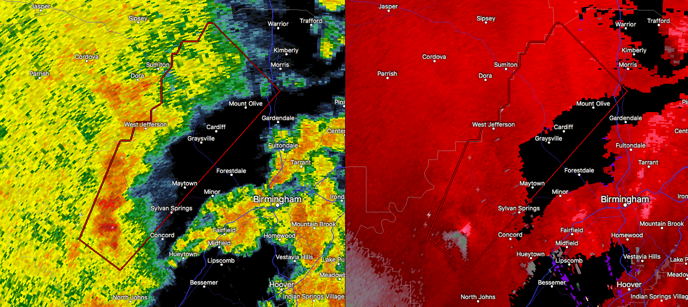
Jefferson AL-
130 PM CDT THU JUN 22 2017
…THE TORNADO WARNING FOR NORTHWESTERN JEFFERSON COUNTY IS
CANCELLED…
The storm which prompted the warning has weakened below severe
limits, and no longer appears capable of producing a tornado.
Therefore the warning has been cancelled.
A tornado watch remains in effect until 1000 PM CDT for Alabama.
LAT…LON 3371 8681 3346 8710 3350 8717 3363 8712
3363 8710 3366 8709 3366 8706 3368 8706
3369 8704 3373 8704 3375 8702 3377 8702
3377 8701 3379 8700 3379 8697 3382 8695
3382 8694
TIME…MOT…LOC 1828Z 211DEG 20KT 3353 8710
BULLETIN – EAS ACTIVATION REQUESTED
Tornado Warning
National Weather Service Birmingham AL
120 PM CDT THU JUN 22 2017
The National Weather Service in Birmingham has issued a
* Tornado Warning for…
Central Jefferson County in Alabama…
* Until 200 PM CDT
* At 120 PM CDT, a severe thunderstorm capable of producing a tornado
was located over Oak Grove, or 8 miles west of Hueytown, moving
northeast at 25 mph.
HAZARD…Tornado.
SOURCE…Radar indicated rotation.
IMPACT…Flying debris will be dangerous to those caught without
shelter. Mobile homes will be damaged or destroyed.
Damage to roofs, windows, and vehicles will occur. Tree
damage is likely.
* Locations impacted include…
Birmingham, Gardendale, Adamsville, Graysville, Sylvan Springs,
Brookside, Mulga, Maytown, West Jefferson, Cardiff, Forestdale,
Sayre, Rock Creek, Birmingport, Miller Steam Plant and Partridge
Crossroads.
PRECAUTIONARY/PREPAREDNESS ACTIONS…
TAKE COVER NOW! Move to a basement or an interior room on the lowest
floor of a sturdy building. Avoid windows. If you are outdoors, in a
mobile home, or in a vehicle, move to the closest substantial shelter
and protect yourself from flying debris.
&&
LAT…LON 3371 8681 3342 8712 3347 8720 3363 8712
3363 8710 3366 8709 3366 8706 3368 8706
3369 8704 3373 8704 3375 8702 3377 8702
3377 8701 3379 8700 3379 8697 3382 8695
3382 8694
TIME…MOT…LOC 1820Z 211DEG 20KT 3348 8713
TORNADO…RADAR INDICATED
HAIL…<.75IN
Category: Archived Warnings
About the Author (Author Profile)
Scott Martin is an operational meteorologist, professional graphic artist, musician, husband, and father. Not only is Scott a member of the National Weather Association, but he is also the Central Alabama Chapter of the NWA president. Scott is also the co-founder of Racecast Weather, which provides forecasts for many racing series across the USA. He also supplies forecasts for the BassMaster Elite Series events including the BassMaster Classic.Subscribe
If you enjoyed this article, subscribe to receive more just like it.


